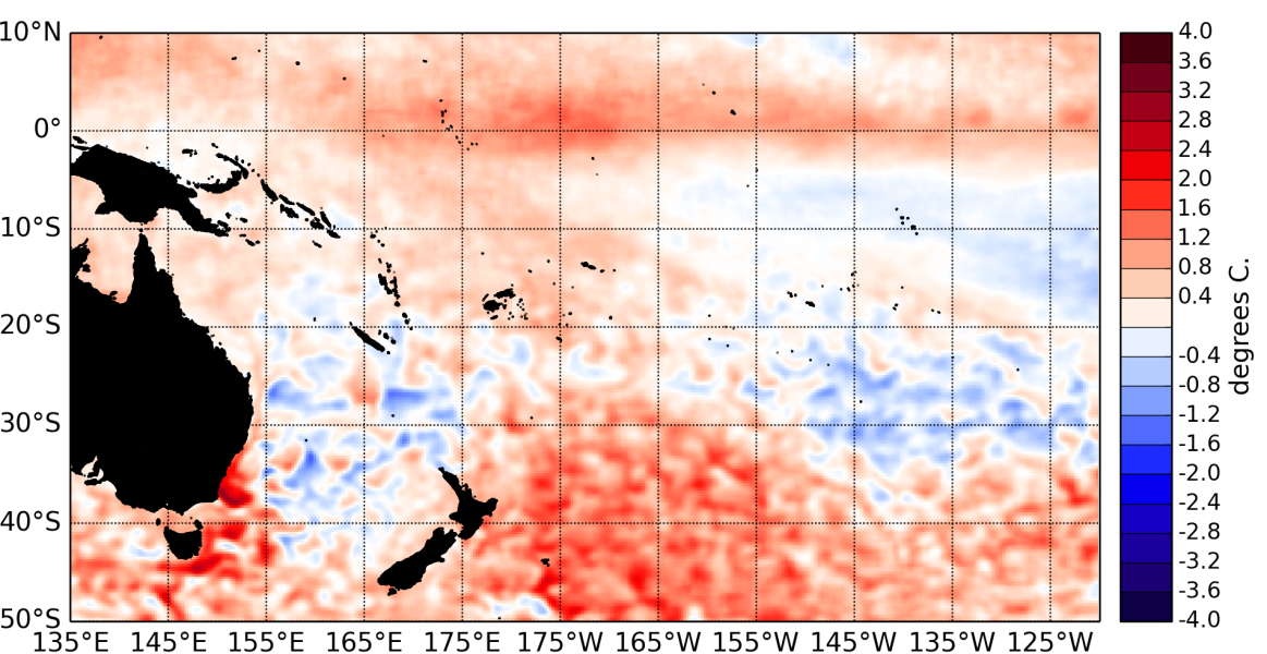
The tropical Pacific Ocean was borderline between neutral and El Niño conditions in May 2014. Above normal sea surface temperatures warmed further in the eastern Pacific and persisted around the International dateline.
The latest monthly values for all NINO indices are now at or already above conventional El Niño thresholds: 0.49°C for NINO3.4, 0.72°C for NINO3, and 0.74°C for NINO4
Warm anomalies in the subsurface ocean still exceed +5°C east of about 110°W at about 50m depth. Ocean heat content anomalies still reach about +2°C locally over the same region but have weakened slightly from last month.
The Intertropical Convergence Zone (ITCZ) was not very coherent spatially, overall it was weaker than normal in the western equatorial Pacific and the maritime continent and associated with reduced rainfall. The South Pacific Convergence Zone (SPCZ) was shifted towards the Equator and assumed a more zonal orientation in May 2014.
The atmosphere as a whole has yet to respond to the oceanic anomalies. The Southern Oscillation Index (SOI) is positive (+0.4) for May 2014, and the latest value for the TRMM ENSO index for the 30 days to 4 June is –0.51 (on the La Niña side of neutral).
The Madden – Julian Oscillation (MJO) was active in the central Indian ocean in the last 2 weeks of May. The MJO forecasts indicate that increased convective activity is likely to stay confined into the maritime continent over the next two weeks, without propagating into the western Pacific.
The consensus forecast from IRI / CPC indicates that El Niño is the most likely outcome (59 % chance) over the June – August 2014 period. Chances for El Niño increases over the following seasons to reach 72% in November – February 2014/15. Uncertainty remains about the strength of the event if it does fully develop.

