Undersea New Zealand map
Caption
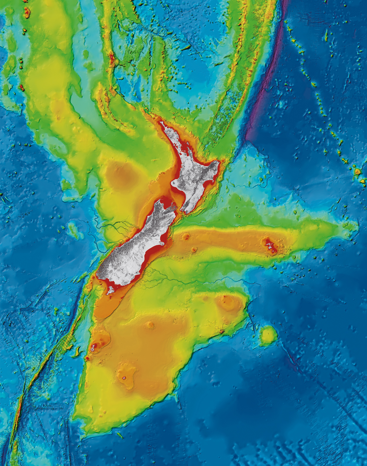
Undersea New Zealand, a high resolution image of the complex and diverse marine realm around New Zealand.
Undersea New Zealand provides a unique insight into the shape of the seafloor within one of the world's most extensive deepwater jurisdictions. New Zealand straddles an active plate margin, creating a highly complex and diverse seascape of submarine trenches, underwater volcanoes, active submarine canyons and quiescent broad plateaux.
Photo credit NIWA
Copyright 2012 NIWA
Data Source for Map:
All data used in the compilation is held at the National Institute of Water and Atmospheric Research (NIWA). Bathymetry is compiled from multibeam and single-beam data sourced from surveys by NIWA and Land Information New Zealand (LINZ), as well as international surveys by vessels from United States of America, France, Germany, Australia and Japan. In addition, scientific community data are sourced from the National Geophysical Data Center (United States), General Bathymetric Chart of the Oceans (GEBCO_08 Grid, version 20120927) and the Australian bathymetry and topography grid (June 2009).
Onshore representation derived from LINZ topographic and the Ministry for the Environment LCDB II digital datasets.
Other information about this item:
https://www.niwa.co.nz/our-science/oceans/common-questions/all/seafloor-...
https://www.niwa.co.nz/our-services/instruments/instruments/em300