-
Climate and weather
Information about climate and weather and links to climate-related websites. -
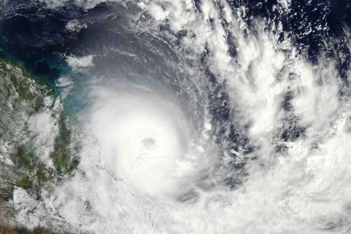
Storms and cyclones
Education ResourceCommon questions about storms and cyclones in New Zealand. -
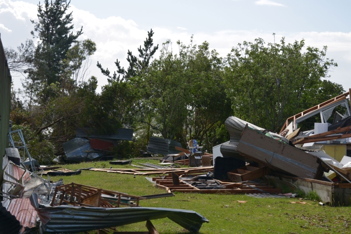
Extreme weather - winds and tornadoes
Education ResourceDue to its position in the 'Roaring Forties', a belt of strong winds in the Southern Hemisphere which generally occur between the latitudes of 40 and 49 degrees, as well as its small size, New Zealand is a windy country. -
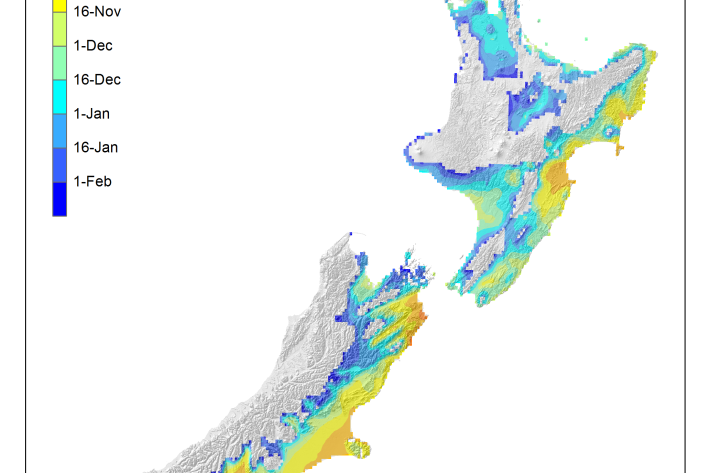
Average soil moisture deficit onset and termination maps
Maps of the average first and last dates of soil moisture deficit are shown here. -

Extreme weather - heavy rainfall
Education ResourceHeavy rainfall is one of the most frequent and widespread severe weather hazards to affect New Zealand. -
Hotspot Watch Updates
This weekly update helps assess likelihood of extremely dry weather preceding a drought. -
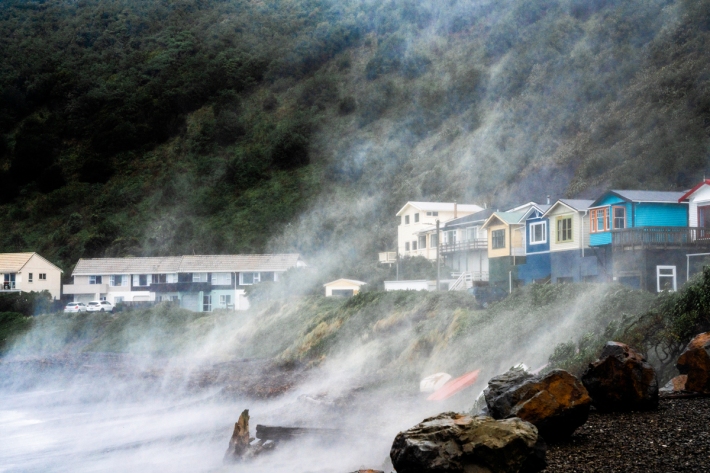
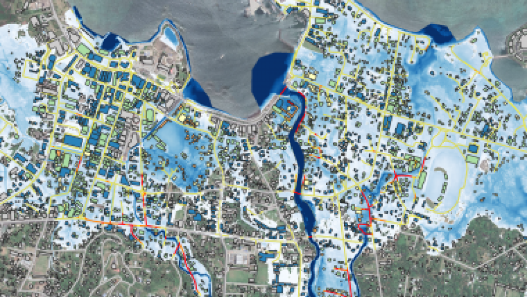
Coastal storm inundation
Education ResourceNew Zealand has low-lying coastal areas that are vulnerable to inundation (flooding) by the sea. -
Flooding - how does it happen?
Education ResourceUnderstanding what happens above and below ground during a flooding event, and how it is different from normal rainfall conditions -
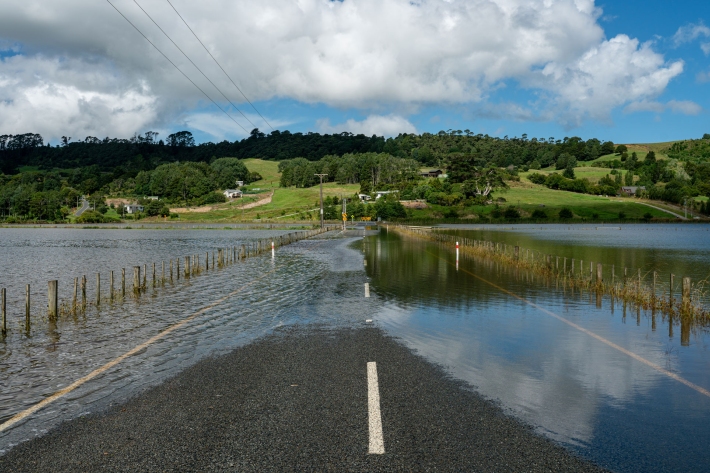
Floods
Education ResourceRiver floods occur when water spills from a river channel onto land that is normally dry, and are one of New Zealand's costliest natural hazards. -
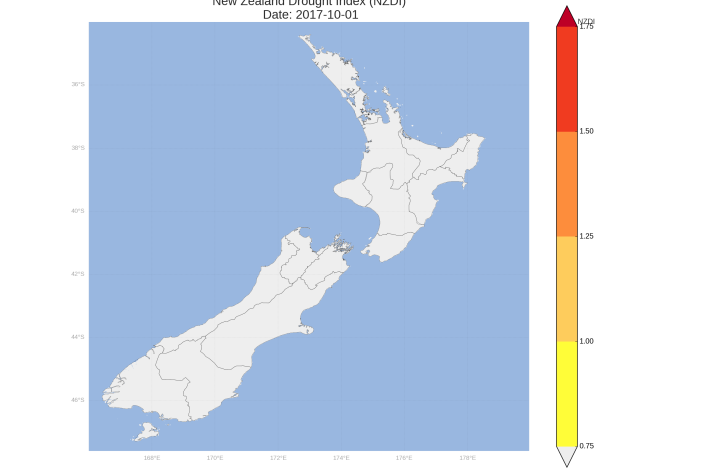
New Zealand Drought Monitor
ServiceThe New Zealand Drought Monitor is a system for keeping track of drought conditions across New Zealand based on a standardised climate index. -
Tornadoes in New Zealand - FAQs
Education ResourceSome commonly-asked questions about tornadoes in New Zealand. -
Kiribati plans for climate change