-

Category F - Barrier enclosed lagoons or drowned valleys
Similar in some respects to Category E estuaries, these have shallow basins and narrow mouths, usually formed by a spit or sand barrier. However, Category F estuaries have complex shorelines and numerous arms leading off a main basin. -
Category E - Tidal lagoons or barrier enclosed lagoons
Shallow, circular to slightly elongated basins with simple shorelines and extensive intertidal area. -
Category D - Coastal embayments
Shallow, circular or slightly elongated basins with simple shorelines and wide entrances that are open to the ocean. -
Category C - Tidal river lagoons
These occur where the mouth of a main river channel connects to shallow lagoons. -
Category B - Tidal river mouths
Elongated basins of simple shape and several to ten metres depth. -
Category A - Coastal lakes
Very shallow basins (several metres depth). They are often elongated and run parallel to the shore. -
What are you eating? NZ scientists reclassify nori – the seaweed used to make sushi
News article06 November 2012 -
Scientists discover freshwater flows affect polar oceanic microbes
News article31 October 2012 -
First sighting of volcano responsible for undersea eruption
News article29 October 2012 -
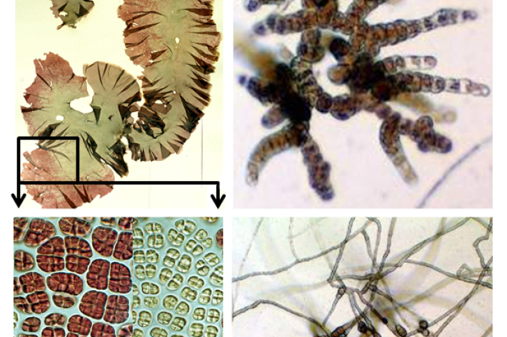
Reclassifying karengo (nori)
Research ProjectThe seaweed known colloquially as nori in Japanese - used for making sushi - or karengo in Maori has been reclassified by an international team of scientists including NIWA's Dr Wendy Nelson. -
NIWA’s Kaharoa sets sail to deploy robots across the Pacific Ocean
News article12 October 2012