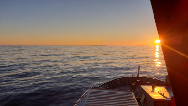
Tue 19th Jan: 14:00 Altered course southwards to commence passage through the ice bridge into the Ross Sea, encountered moderate sea ice by 20:00 which slowed our passage, wiggled Tangaroa through ice overnight at reduced speed.
Wed 20th: Finally cleared the ice bridge by 08:00 and making good passage westwards to Cape Adare. A single ice band forced us south for several hours then passage resumed towards the Cape.
Thu 21st: Passage to Adare continues, eta 14:00 today. Arrived at the 1st mooring retrieval site off Cape Adare this afternoon and commenced the release and retrieval of three moorings in this vicinity. These moorings were all recovered successfully although all three had lost their uppermost beacon buoys.
Fri 22nd: Sighted the Antarctic continent this morning for the first time, just south of Hanson’s Peak on Cape Adare. Numerous sightings of minke whales today while target identification mid-water trawls were being made on krill and fish layers beneath Tangaroa. A calibration of the ship’s sounders was undertaken to prove that all were fully operational and a test of some new technological ship identification, alert systems was also tested. Mooring deployment resumed with the first replacement mooring deployed, ranged for position fixing just prior to the calibration of the echo sounders.
Sat 23rd: Mesopelagic trawl was damaged this morning, broken headline. Crew spent several hours changing over the trawl in sub-zero temperature and a wind chill factor that lowered the temperature considerably. Strong southerlies curtailed most operations today but late this afternoon Cape Hallett came into view at over 60 miles distance. Stunning scenery, after many voyages to this realm I still feel privileged to be part of it.
Part of our operational requirements to operate in the Antarctic treaty area is that no poultry products of any nature are released into the environment. This is to protect the birdlife from any possible introduction of pathogens or viruses.
To ensure this is undertaken when poultry products are served from the galley our bird waste bin is deployed and all poultry waste is collected and stowed in the food freezer at -23C until our return to Wellington for disposal ashore.
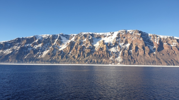
Sun 24th: Stunning scenery at the Downshire Cliffs as the sun rose and set several times as we slowly swathe mapped out a safe navigational area into 140 metres alongside these almost 2000m high cliffs. At 4.0 miles off the coast it seems so much closer due to the clarity of air down here. Twice we successfully ran the DTIS camera along the 150m contour line to record the fauna on the seafloor at this depth. It clearly indicated the re-introduction on the seabed of the sponges and fauna after the mass extinction from an iceberg, when it wipes the slate (seabed) clean on grounding through the area. Run off to 30 miles clear of the coast and deployed 2 moorings this afternoon, then returned back to the Downshire Cliffs area to resume more multibeam transects. Heavy fog on our approach to the coast reduced our speed.
Mon 25th: Fog had lifted by the time we had got to our previous multibeam transits. Deployed our“Remote Operated Vehicle in 150m depth but found the current was too strong for safe operations and this was aborted. Completed another 4 multibeam transects to extend our navigable area closer to the cliffs, now to within a mile and 120m depth range off the coastline. Another 2 DTIS transects completed along the 120m contour. Again we were treated to spectacular scenery in the low sun and 2000m high cliffs on our port side.
After the DTIS runs were completed we proceeded eastwards to clear the bird sanctuary protection requirements and commenced water sampling and bongo net tows. Prior to mid-day, sampling in the area was complete and Tangaroa proceeded south south east to mooring position R2. Arrived at 16:00 and multi-beam transects commenced to prove the mooring site and search for evidence of a lost Italian mooring here.
Tue 26th: Several mid-water trawls on targets at various depths to identify the species this morning while multi-beaming the R1, R2 and R3 sites and proving the loss of the Italian mooring. The evidence is clear in the multi-beam tracks of severe gouging on the seabed. Huge bergs have swept through this area cleaning off all in their path down to the sea floor of 500 metres depth. Water sampling at 08:00. Three moorings deployed in 500m depth at stations R1, R2 and R3 this afternoon/evening. Cape Hallett is 40 miles west of our position, should be there tomorrow morning.


