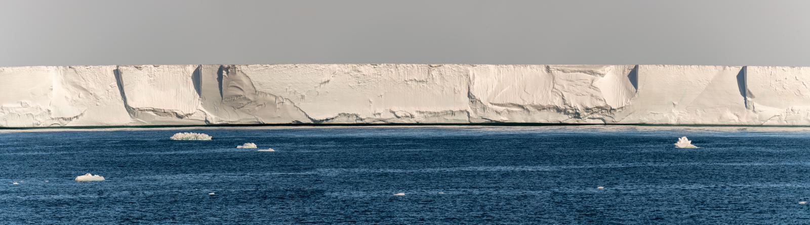
The last update ended up with us sailing south after dropping off BGC-Argo profiling drifters. In 1841, when James Clark Ross and his ships Erebus and Terror, sailed much the same route into what we now call the Ross Sea, he encountered the largest icebergs ever seen, the southern-most volcano and whales everywhere. These were things that, whilst remarkable, were at least known. What was literally off the charts was “the Barrier” - a 40 m high wall of ice that stretched so far east they went back to Hobart for winter before trying to find the other end.
By looking at the tabular bergs calving from the shelf they figured out that the barrier must be floating and probably several hundred metres thick. What they couldn’t know though, was that it stretched back 800 km further south and held back a large part of the polar plateau – they’d found the largest ice shelf on the planet. The Ross Ice Shelf is a slab of ice with an area comparable to Spain and is wedged into a 750 km wide gap between Ross Island and the West Antarctic coast.
Around a decade ago, NIWA colleague Dr Craig Stewart determined that the shelf around Ross Island was melting quite fast compared to the rest of the shelf. He had spent many summer seasons dropping off radar packages on the ice surface that could map ice melt on the underside. His data made it clear that warm water was sneaking into the ice shelf cavity along the eastern end of Ross Island - a place called Cape Crozier.
Cape Crozier is the location where three members of Scott’s final expedition spent a winter looking for Emperor Penguin eggs prior to the ill-fated attempt on the South Pole the following summer. Our interest was a little more oceanic – we need to know what’s forcing warm water into the cavity and will it accelerate if the oceans warm? And if warm water is going in – where is the balancing meltwater coming out?
The ocean off Cape Crozier is where the Ross Sea Polynya forms every year. A polynya occurs when very cold winds blow off the Antarctic continent, making new sea ice but then immediately blowing the ice away. The new ice oozes out all the salt originally in the seawater so water beneath a polynya is cold, salty and oxygenated. It eventually goes on to refresh the entire ocean.
Back in 2018 when we were planning the first phase of the Antarctic Science Platform (ASP), we developed a concept to run a large ocean campaign to sample the Ross polynya in a programme dubbed RISIPE (Ross Ice Shelf Integrated Polynya Experiment). However, there wasn’t an obvious vessel (at the time we thought sea ice and distance would put it beyond Tangaroa’s operational limits) – and then Covid arrived putting plans on hold. It looked like we’d have to drop the whole idea.
However, in mid-2023 the ASP leadership - Professors Ian Hawes (Waikato) and Nancy Bertler (VUW/GNS) - developed an ambitious plan to fund a joint New Zealand – Italian voyage aboard the Italian ice breaker the Laura Bassi. So, this time last year, twelve of us, along with 25 Italian researchers, finally got to work in the region, and put some of the original RISIPE plan into action.
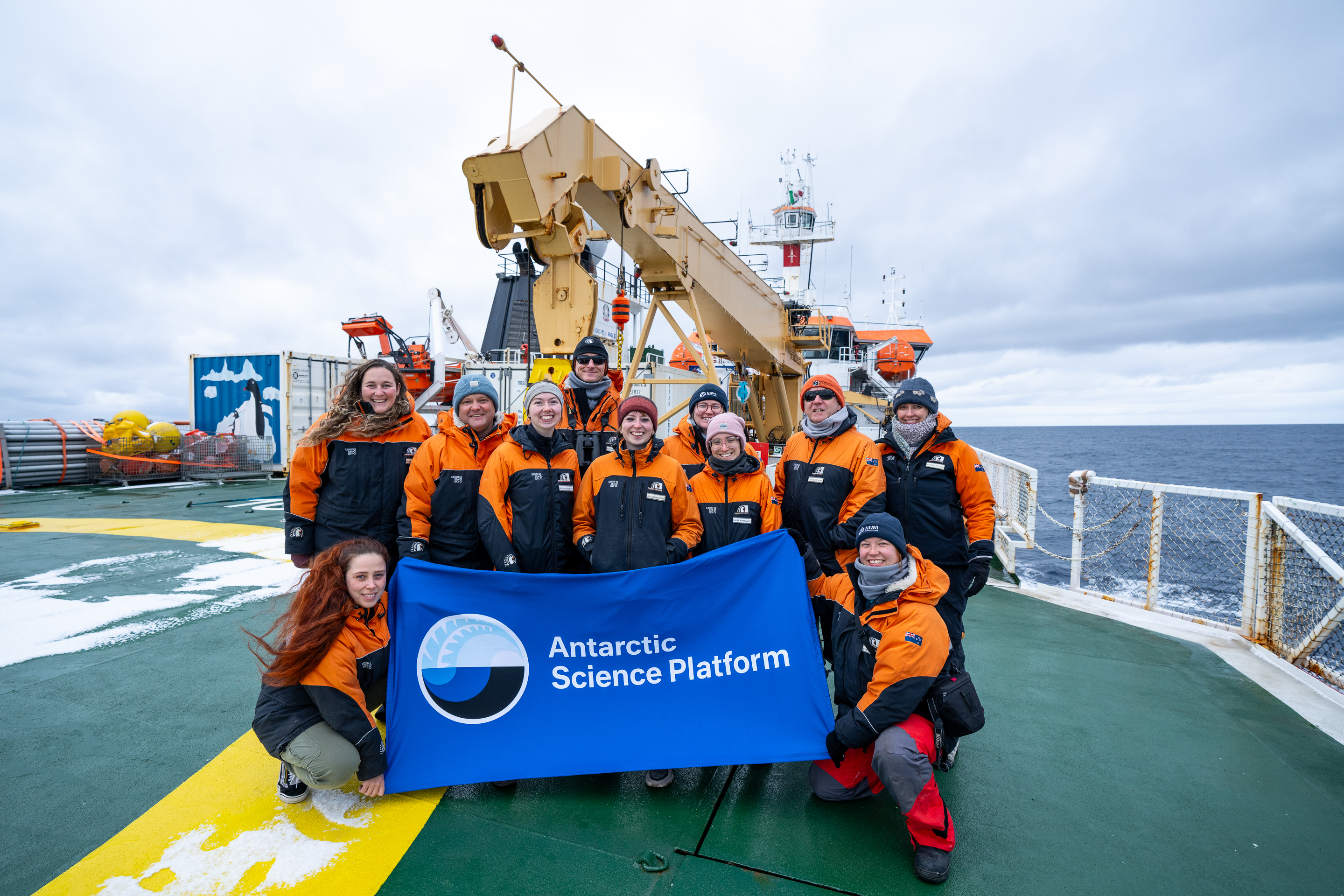
Despite the exceedingly short 2023 timeline we managed to scramble and put together four hydrographic moorings from the NIWA ocean moorings equipment pool. Then, thanks to the ASP-supported Laura Bassi expedition, we dropped them off in the ocean right in the critical zone near Cape Crozier. This year we are back to collect them, now aboard RV Tangaroa. In contrast to earlier Tangaroa voyages to the Ross Sea, ACTUATE includes a big loop down to the ice shelf front - inspired by the voyage design from our Italian colleagues. From an Antarctic research perspective, this growth in oceanographic work reflects the importance of the Southern Ocean described in MFAT’s strategy document described in an earlier update.
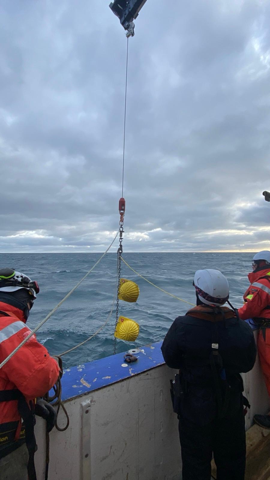
Tangaroa isn’t an icebreaker able to break through sea ice, so we have to select the right conditions. Fortunately, things have been great (so far), so almost effortlessly we’ve taken the ship to its farthest south – and got our RISIPE moorings back.
“Mooring” is a little misleading as usually for oceanographic moorings there is nothing floating on the surface – it’s all below, suspended by floats from a bottom weight. As Tangaroa came up to each mooring location, NIWA’s Henk van Rossem would switch on an acoustic sonar modem to talk to the submerged equipment. Upon establishing contact he’d send a “release” signal, and the gear would drop a ballast weight and float up to the surface - at which point we’d be on hand to get the expensive gear, and even more importantly, the data, back aboard. Henk leads the deployments of the large DART tsunami warning buoys spread around the Pacific Ocean, so he is well used to getting complex gear in and out of the ocean.
Perhaps most satisfyingly of all, one of the moorings that we got back had been set up to sample almost to the surface. This is in order to capture the interplay between meltwater and warm surface waters - and crucially of course it is where sea ice forms. We’d taken quite a risk with this, as any equipment at depths less than 300 m might get torn apart by one of the many ice bergs mooching around nearby. But we got away with it!
The data from this initial RISIPE campaign are going to be hugely influential in how the ASP plans the next stage of work looking at how this large ice shelf is going to evolve with a warming ocean. With the instruments safely on board we headed west to the north coast of Ross Island for the last stop on our southern loop.
Craig Stevens (co Voyage lead with Denise Fernandez).