It has been a summer to remember, but not in a good way.
February 2023 will go down as the month that Aotearoa New Zealand experienced one of its worst weather disasters.
On 13-14 February, Cyclone Gabrielle caused historic extreme rainfall and river flooding, catastrophic wind damage, and substantial storm surges across the North Island. Unfortunately, this culminated in widespread destruction and loss-of-life, with a long and costly recovery ahead.
Rainfall
February rainfall was nothing short of exceptional:
- Parts of the North Island received at least 400% of their normal February rainfall:
- Napier had its 3rd wettest month since records began, receiving over 600% its normal (and 45% of its annual normal)
- The highest 1-day rainfall was 316 mm, recorded at Tūtira (Hawke’s Bay) on 13 February
- However, in parts of the South Island, rainfall was below (50-79%) or even well below normal (<50%), as was seen in Fiordland
Summer rainfall was also noteworthy:
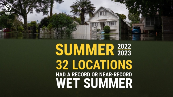
- 2nd wettest summer on record for the North Island
- The Auckland region received over 5.5 times its normal summer rainfall and 63% of the entire annual normal
- It was the wettest summer on record for several major centres, including Napier, Auckland, Whangārei, Gisborne, and Tauranga
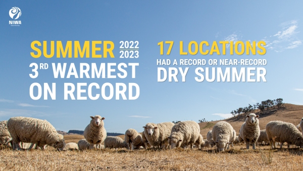
- 5th driest summer on record for the South Island
- Meteorological drought developed in Otago during February, with many areas recording less than half of their normal summer rainfall
Pressure
Extreme low-pressure readings speak to Cyclone Gabrielle’s power:
- 14 February saw air pressure dip to 968 hPa at Whitianga in the Coromandel Peninsula - the second lowest daily minimum value observed in the North Island since 1960
Soil moisture
This was a tale of two halves:
- At the end of February, soil moisture levels were well above normal across most of the North Island and in parts of Marlborough and Canterbury
- Soil moisture levels in the northern West Coast, western Tasman, the Mackenzie Basin, and Southland were below normal
Wind
Cyclone Gabrielle brough destructive winds:
- 18 locations observed a record or near-record high summer wind gust
- The highest wind gust was 150 km/h, observed at Mokohinau Islands on 12 February
Temperatures
It was not only wet, but warm:
February:
- The nationwide average temperature in February 2023 was 18.5°C, 1.1°C above the 1991-2020 February average
- Temperatures in the West Coast were particularly noteworthy, being the warmest February on record for Greymouth, Westport, and Arapito
- Greymouth recorded seven days with a daily maximum temperature above 25˚C (between 1972-2000, Greymouth only had six total February days when the temperature exceeded 25˚C!)
- The highest temperature was 35.6°C, observed at Middlemarch (Otago) on 4 February
Summer:
- It was the 3rd warmest summer on record
- 65 locations experienced record or near-record warm minimum temperatures
Marine heatwave
New Zealand’s waters are also part of the picture:
- Summer sea surface temperatures were record breaking (since at least 1982) in the west of the South Island
- In the north and east of the South Island, summer sea surface temperatures were 2nd highest on record
Sunshine
The sunniest four locations so far in 2023 are:
- Central Otago (562.6 hours)
- West Coast (548.6 hours)
- Mackenzie Basin (545.4 hours)
- Queenstown Lakes District (526.7 hours)
- Sunny in the west! The sunshine hours in Hokitika were twice as much as those in Dannevirke and Dargaville
The ‘why’ behind the weather
- Typical of La Niña summers, higher-than-normal air pressure was observed to the east and south of New Zealand, with lower-than-normal air pressure to the north and west
- This resulted in more easterly and northeasterly winds than usual, drawing in warm and humid air from the tropics and sub-tropics.
- This partly explains why persistently wet and cloudy weather was experienced in northern and eastern parts of both Islands, with sunnier and drier conditions in the west and south of both islands.
- Exacerbating the warmth, humidity, and moisture availability to passing low pressure systems was a protracted marine heatwave (MHW) that peaked during January and rivalled the MHWs of 2017-2018 and 2021-2022
- Climate change: a warmer atmosphere can hold more water vapour, which leads to heavier rainfall totals – NIWA scientists are contributing to an attribution study on the influence that climate change had on Gabrielle. More details will become available soon


