This project ran from 2016-2019 - please see PARTneR-2 and PARTneR-2+ for the next stages of the work.
Working with Pacific communities to predict, plan and prepare for the harm caused by disasters, using RiskScape, a software programme which estimates impacts and losses from natural hazards.
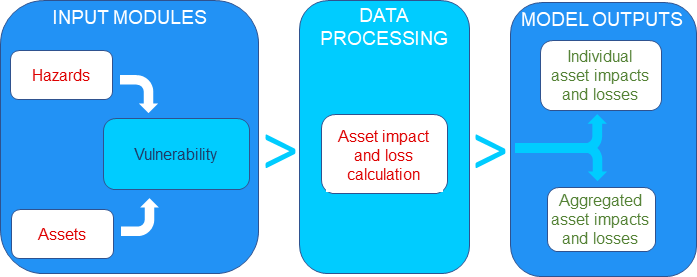
What is RiskScape?
What would happen to your home in a cyclone or volcanic eruption? If you knew this ahead of time, what could you do to reduce the impact before it occurred?
Developed by NIWA and GNS Science to help people understand the impacts of a natural hazard event, RiskScape is a free software programme which performs a complex calculation simply and quickly without needing specialist modelling knowledge - think of it as a giant calculator. PARTneR is working with Samoa and Vanuatu to tailor RiskScape to their needs and to model the effects to estimate impacts such as damages, human losses, economic costs, and displacement times. Governments can better avoid, prepare for, or respond to future disasters by using RiskScape.
Learn more about risk tools More about RiskScape
About PARTneR
PARTneR engages with Pacific countries to understand how information about the risk of hazards can be used to make better decisions.
Supporting natural disaster strategies to reduce the risks of, and respond to, natural disasters
We implement mechanisms that enable Pacific Island Countries (PICs) to generate new knowledge and better plan in accordance with the Sendai Framework 2015 – 2030 and the aligned Framework for Resilient Development in the Pacific 2017 – 2030.
Collecting information on natural hazards
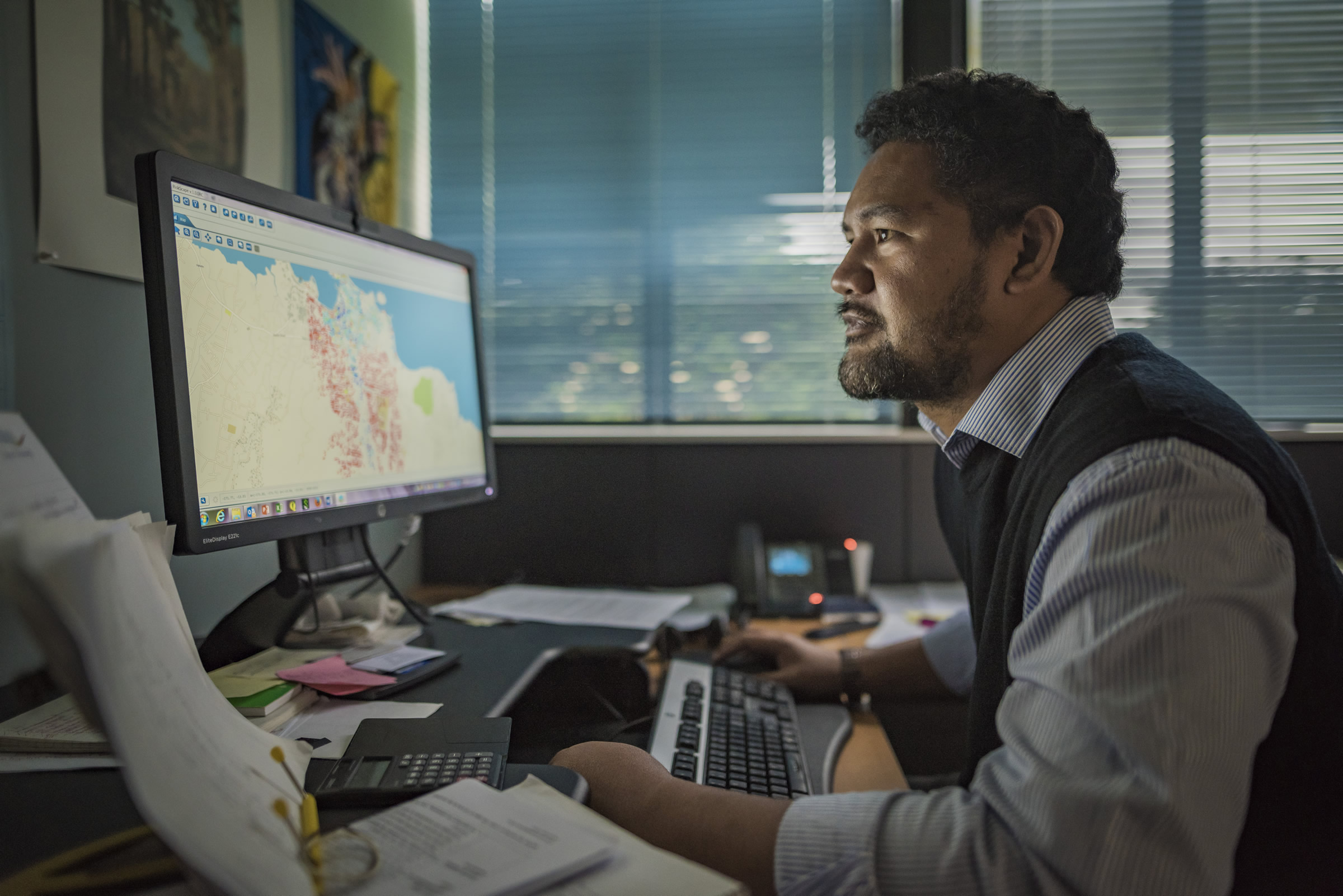
PARTneR collects information on natural hazards, assets and their vulnerability to better understand the effects of that hazard on people, communities and buildings. We then work with countries to integrate the information into RiskScape and to run the programme to model the likely impact of a hazard event.

The landslide case study in Samoa is being used by the Samoa Government to demonstrate the potential impacts of a landslide on Mount Vaea. The Planning and Urban Management Agency (PUMA) will use this information to inform land use development.
Translating hazard data into usable information to suport short and long-term decision-making
The tropical cyclone case study in Vanuatu will produce hazard maps of Lenakel Municipality (on the island of Tanna), indicating areas at risk of coastal inundation from cyclone-related flooding. The Town Council is using this information for planning and zoning purposes.
PARTneR tailors RiskScape to reduce the risks of disasters and better inform disaster response.
Listening to the needs of our partners
We understand their priorities and focus on the results we want to achieve.
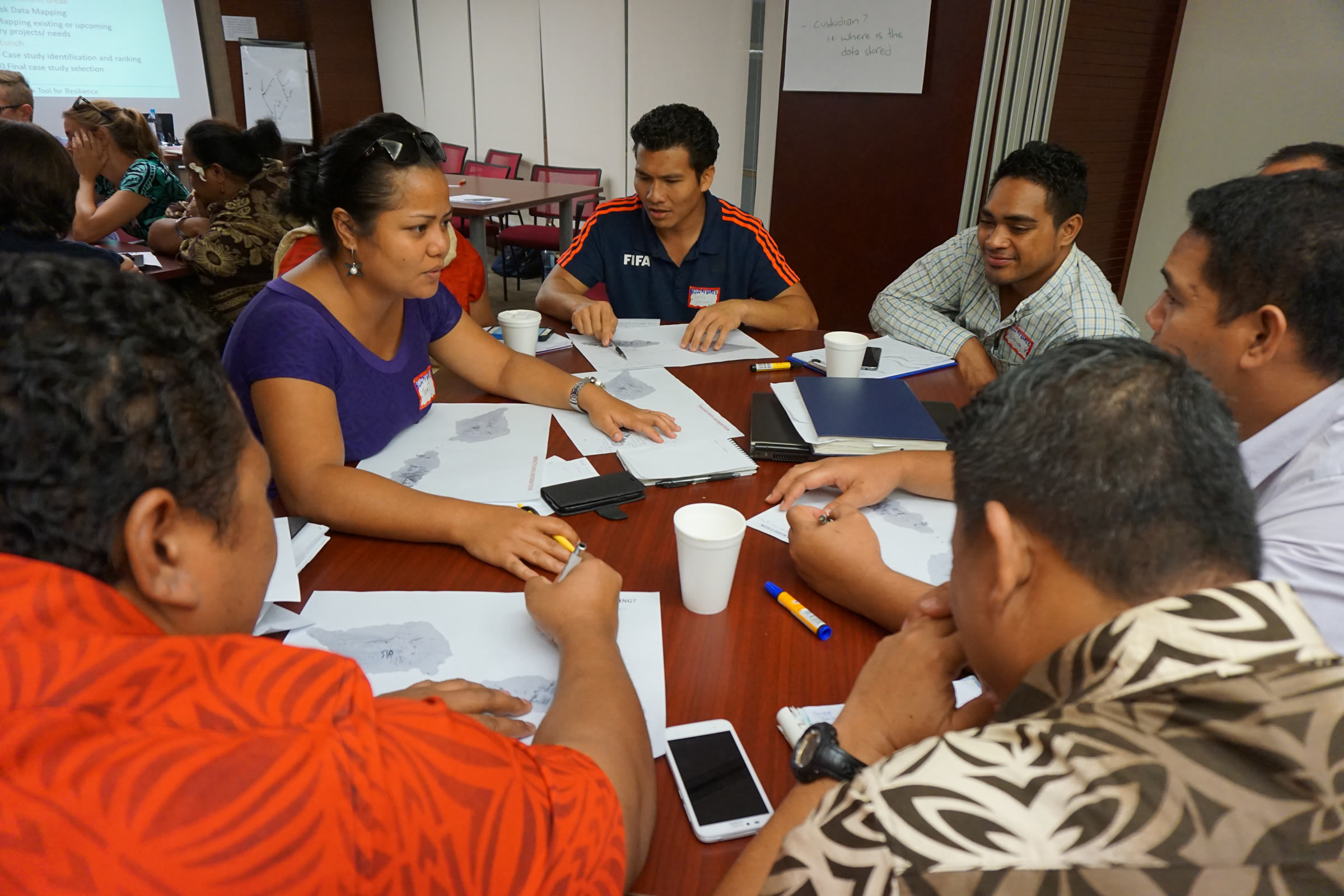
Pacific island countries are challenged to efficiently access disaster-related information so that they can plan to reduce the effect of future disasters and/or respond to them. Recognising this, PARTneR has worked with Samoa and Vanuatu to collect, archive, manage and disseminate accurate information on disasters. Through partnership with the Pacific Community, this has contributed to the establishment of GeoNode servers in Samoa and Vanuatu which store accurate information on previous disasters, impact maps and models of disaster impacts. Government agencies can now access the information readily to plan a better response. PARTneR has supported this work by training national staff to update and manage the stored information, as well as to establish Memoranda of Understanding to encourage better information sharing across government departments.
Sharing a common vision with its partners
PARTneR builds the capacity of government agencies such as the Samoa and Vanuatu National Disaster Management Offices (NDMOs) to use risk tools through joint learning and two-way engagement.
Developing models of hazard impacts relies on information from those who know best. PARTneR not only works with countries to access published and existing information on previous disasters through literature reviews; it also collects new information where needed. This includes conducting surveys and consultations to fill information gaps. On the island of Tanna in Vanuatu, for instance, PARTneR collected data on the impacts of ash fall in 13 villages. This critical data described the effect of ashfall on buildings, people, infrastructure, water, human health and livestock.
With six training events to date in Pacific countries and New Zealand, and more than 100 trainees from the Governments of Samoa, Vanuatu and the Pacific Community, PARTneR builds the capacity of our partners, strengthening their resilience to natural disasters.
Improving emergency preparedness and response
By supporting Samoa and Vanuatu to use RiskScape, both countries are better able to plan for future disasters. For instance, the ashfall case study in Vanuatu is to be used by the NDMO to inform emergency response planning to ashfall events, and by Vanuatu’s Meteorology and Geohazards Department to send out key messages for communities affected by ashfall.
Strengthening disaster preparedness
We empower local governments through in-country trainings on how to use the RiskScape tool.
PARTneR has provided both basic and advanced risk tool training in Samoa and Vanuatu, training national staff in what risk tools are and how they can inform planning and disaster response, as well as how to integrate local disaster information in practice and produce loss statistics on possible disasters. PARTneR has also provided training on the use and maintenance of information stores on disasters, including the management of ‘GeoNode’ servers.
Building resilience together
Our partners will be more resilient to climate and seismic hazards, proactively planning, reducing losses and speeding up recovery.
The tsunami case study from Samoa is being used by the Samoa NDMO to demonstrate the potential impacts of a future tsunami. The NDMO will use this information to plan emergency response.
Strengthening drought resilience in the Marshall Islands and Tuvalu by estimating the current and future water resources through the RiskScape Water Resource Module.
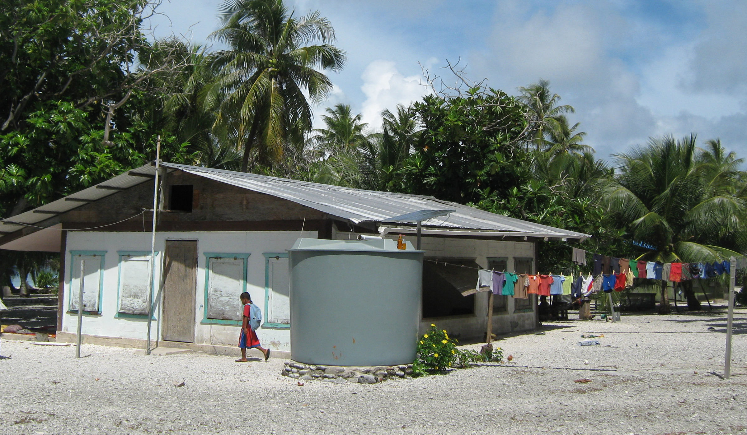
Will you have enough water when the next El Niño event occurs? If you knew this ahead of time, what could you do to prevent water shortages before they occur?
By using the RiskScape Water Resource Module, the Republic of the Marshall Islands (RMI) government can now better prepare for and respond to future rainfall shortages and drought. Tested and developed for the RMI and verified in Tuvalu, the module is designed so that atoll countries can estimate their current and future water resources based on various rainfall and water consumption scenarios.
How was it developed?
The approach was co-developed with the RMI government and local non-government organisations from January to June 2018, focusing on three atolls (Utirik, Wotje, and Kwajalein). The completed module was presented to the RMI government in June this year, and key stakeholders were trained in its use. Following positive feedback, the RMI government has requested assistance from NIWA to extend the tool to include nine additional atolls. This will allow the Marshallese to use the model to plan, target and respond to atolls with the most pressing water shortages.
The drought module has been created through the RiskScape Modelling Drought for Atolls project, a pilot project delivered through NIWA in partnership with Marshall Islands National Disaster Management Office (NDMO) and funded by the New Zealand Ministry of Foreign Affairs and Trade (MFAT). The PARTneR project is contributing to the expansion of the model beyond the initial design phase in the Marshall Islands and Tuvalu.
News
Understanding Risk Finance Pacific Forum
Conference on managing natural resources in a changing climate
A conference has been held recently for experts in the mineral resource sector from the Pacific region to talk about how to prepare and mitigate the threats of climate change on natural resources.
16 July 2018
New Geonode Website Launched
A new Geonode website launched by the Pacific Risk Tools for Resilience (PARTneR) Project in Vanuatu will assist the Government in decision-making on disaster management.
6 July 2018
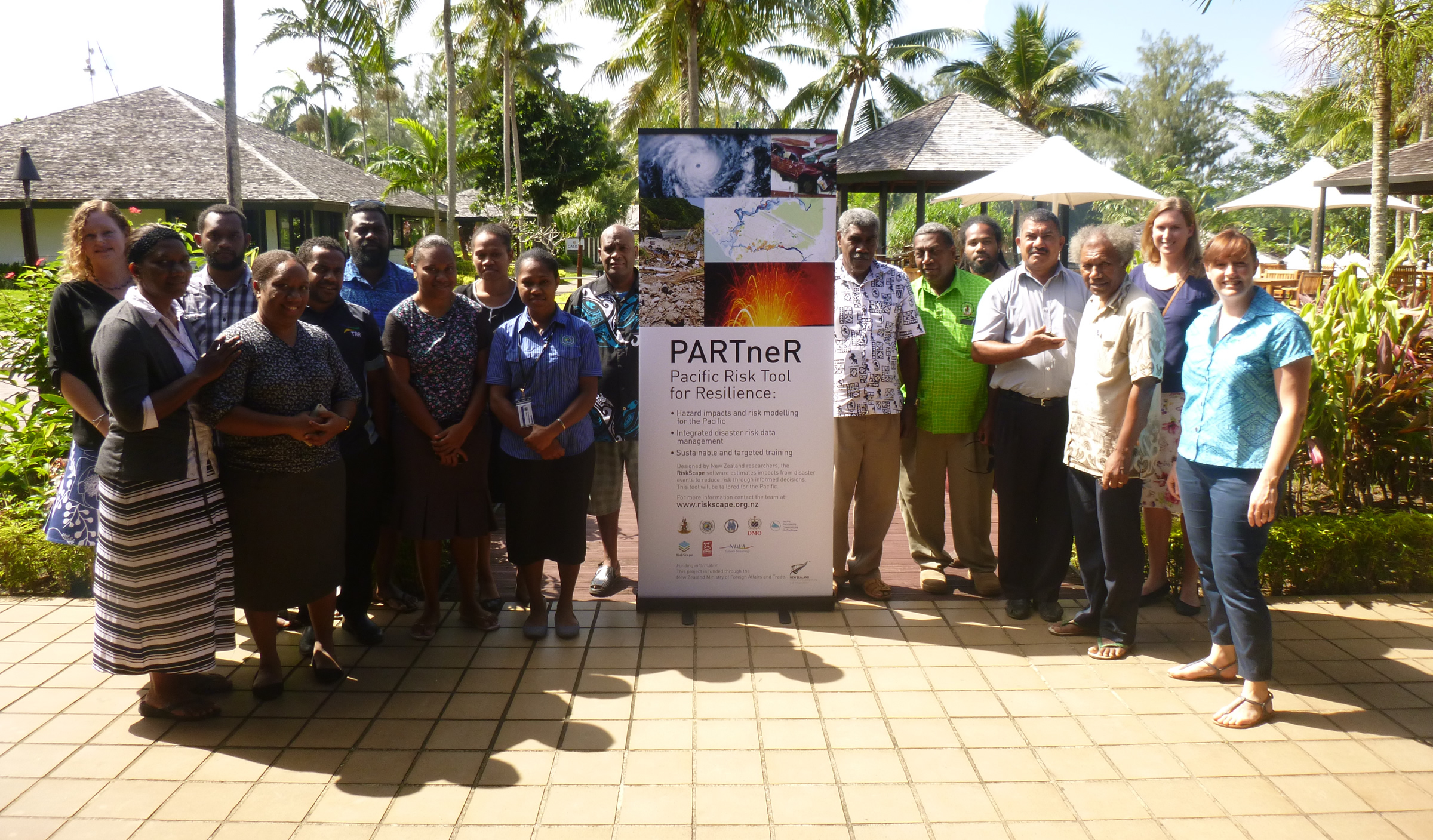
Our partners
PARTneR is managed by the National Institute of Water and Atmospheric Research (NIWA) in collaboration with six partners: the Samoa Disaster Management Office; the Vanuatu Disaster Management Office working with the Vanuatu Meteorology and Geo-Hazards Department; the Republic of the Marshall Islands; GNS Science and the Pacific Community – Geoscience, Energy and Maritime Division.

PARTneR is a three-year project (2016 - 2019) funded through the New Zealand Partnerships Fund, administered by the Ministry of Foreign Affairs and Trade.
Publications
Find out more about PARTneR recent publications, reports and case-studies outputs.