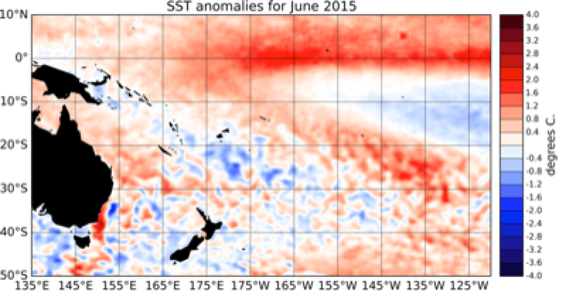
Sea Surface Temperatures (SSTs) have increased considerably in the central and eastern Pacific. After a brief excursion in the positive, the Southern Oscillation Index (SOI) has returned to negative values (i.e. El Niño) and is at -0.8 for June 2015 as a whole. Convection and rainfall anomalies intensified east of the International Dateline and the Inter-Tropical Convergence Zone (ITCZ) was shifted equatorward in the eastern Pacific.
The South Pacific Convergence Zone (SPCZ) was north of its climatological position west of the International Dateline. The ENSO Precipitation Index (ESPI) is close to the El Niño threshold at +0.77 (value to the 30th of June). Monthly SST anomalies are again this month above the 1°C mark in all of the NINO regions: The NINO3.4 index value is +1.3°C, NINO4 (in the west-central Pacific) is currently at +1.1°C and the NINO3 index (in the eastern Pacific) continued to increase during June 2015, and now reaches +1.6°C above normal.
Sub-surface ocean temperature anomalies in the eastern Pacific persisted (exceeding +5C between 50 and 100m depth), while cooler than normal ocean subsurface temperatures that were present in the western Pacific extended slightly eastward. Positive upper ocean heat content anomalies (upper 300m of the Ocean) have intensified in the eastern Pacific and now reach more than +2.5°C off the coast of South America.
A relatively strong MJO pulse reached into the western Pacific during June 2015. The dynamical CPC forecast indicate rapid in-place intensification of intra-seasonal convective activity related to the MJO in the western Pacific for the next two weeks, while the statistical CPC forecasts indicate that this MJO pulse will continue to propagate eastward and decay. International guidance indicates that El Niño conditions are extremely likely (> 95% chance) to continue over the next three months period (July – September 2015) and persist into the summer 2015 / 2016.

