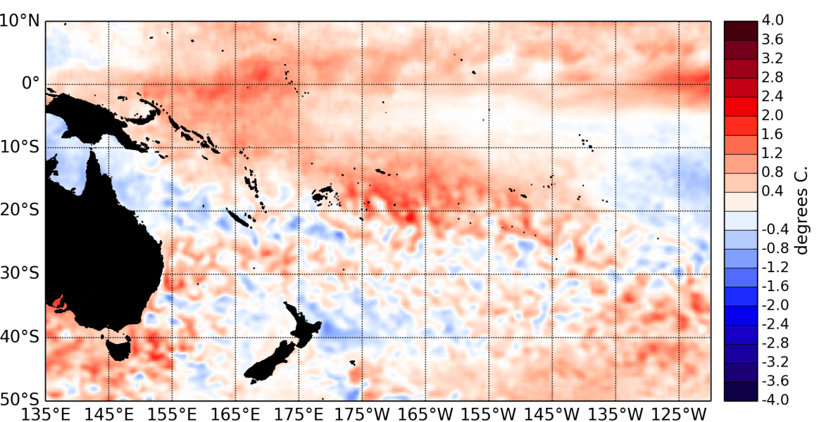
During October 2014, borderline El Niño conditions persisted in the Pacific Ocean. Equatorial sea surface temperatures (SSTs) rose slightly across the equatorial Pacific ocean, but there is still no gradient in the SST anomalies.
The latest monthly anomaly values for the NINO SST indices are: +0.53 for NINO3.4 (up from +0.42°C in September), +0.68°C for NINO3 (up from +0.42°C last month), and +0.75°C for NINO4 (was +0.72°C in September).
Ocean sub-surface temperatures increased in the central Pacific, with anomalies reaching now more than +4°C around the dateline at about 100m depth. Oceanic subsurface heat content also increased in the central Pacific and expanded eastward.
The Southern Oscillation Index (SOI) is at –0.9 for October 2014. The latest value for the TRMM ENSO index for the 30 days to 4 November is weakly positive at +0.24. The Intertropical Convergence Zone (ITCZ) was mostly suppressed in the western Pacific and over the Maritime Continent and intensified in the eastern Pacific.
Increased rainfall within the western limb of the South Pacific Convergence Zone (SPCZ) affected parts of Papua New Guinea, the Solomon Islands and Vanuatu. Further east increased precipitation also occured over large parts of French Polynesia. The Madden – Julian Oscillation (MJO) activity over the Pacific was very weak over the past two weeks, and dynamical and statistical forecasts (from the Climate Prediction Center) for the next two weeks indicate a mostly inactive MJO and reduced levels of intra-seasonal convective activity.
The consensus ENSO forecast from the IRI / CPC indicate that the chance of El Niño developing over the November 2014 – January 2015 period is 66%. Chances of El Niño remain similar for later in the summer, with 67% for the February – April 2015 period.

