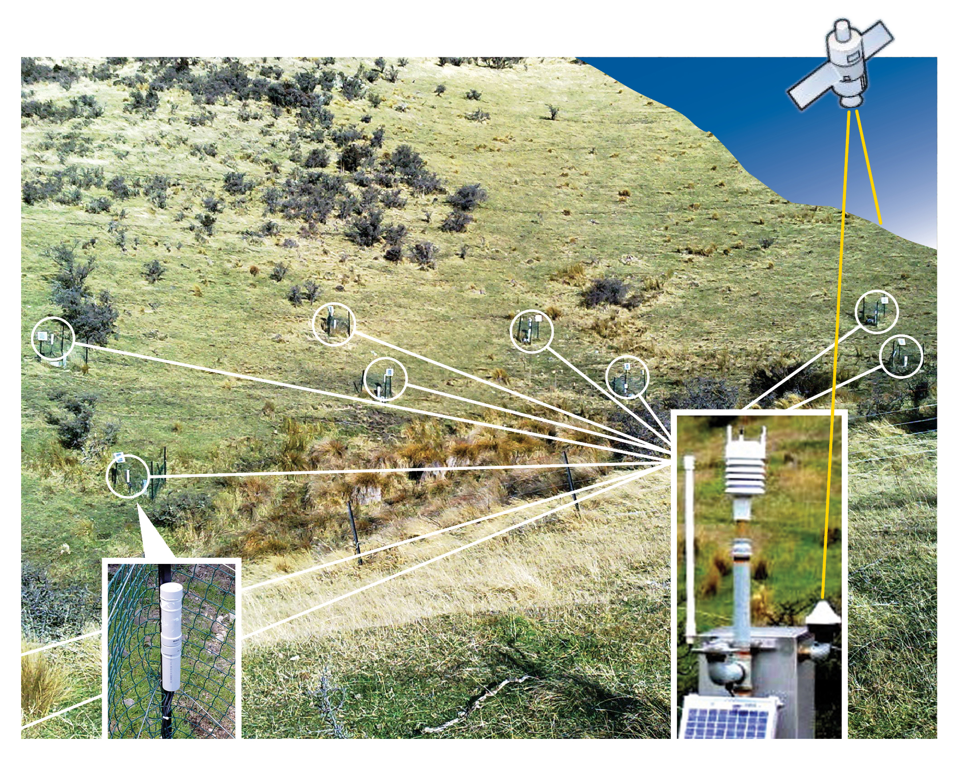
This diagram shows how the sensor data is transferred from each monitoring site to a CWS then uploaded to the Neon Server via satellite. The remote wireless interfaces are enclosed in sealed tubes (bottom left) and the soil moisture and water level sensors are wired directly to them.