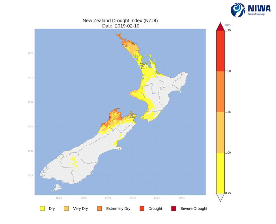
The New Zealand Drought Index (NZDI) map below shows very dry and extremely dry conditions in parts of the upper South Island and parts of upper and western North Island as of 10 February. These areas will likely continue to worsen in the next week. Small areas meeting the drought threshold are currently found in parts of Buller District. Please note: some hotspots in the text above may not correspond with the NZDI map, mainly because the NZDI uses additional dryness indices including one which integrates the rainfall deficit over the past 60 days. Changes are therefore slower to appear in the NZDI compared to the instantaneous status maps of soil moisture anomaly.