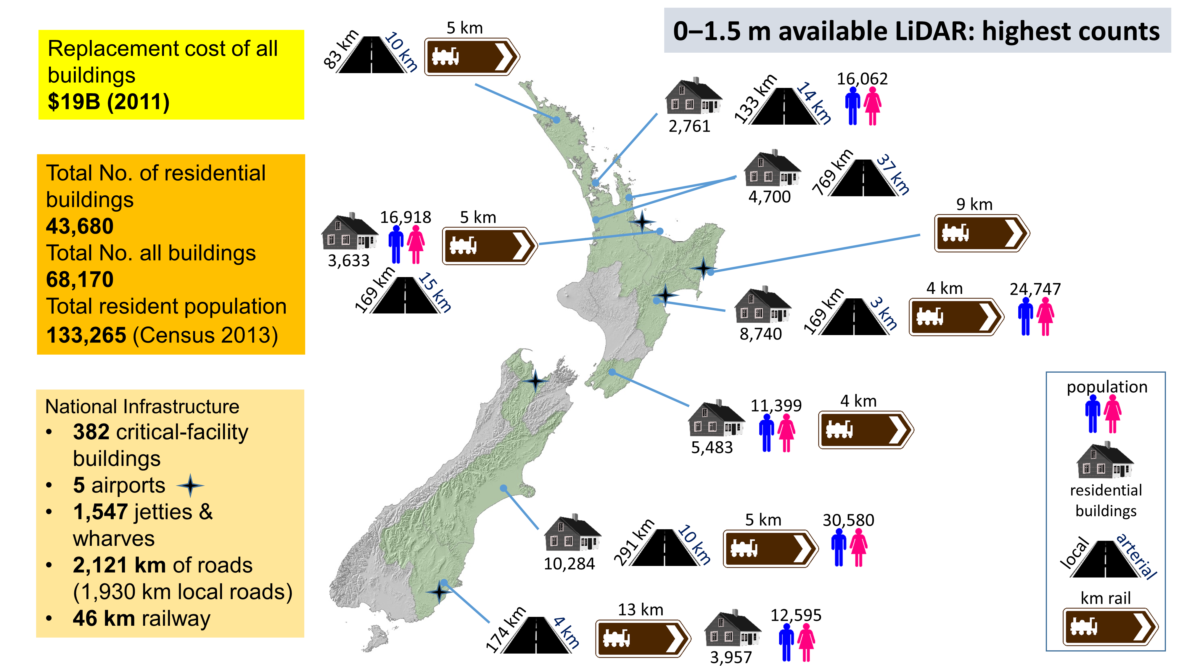
Levels of coastal risk exposure, in terms of resident population, buildings, roads, railway, airports and jetties/wharves for land elevations below 1.5 m above MHWS at the coast. Results on the left have been aggregated from regional totals for regions where LiDAR data was available.