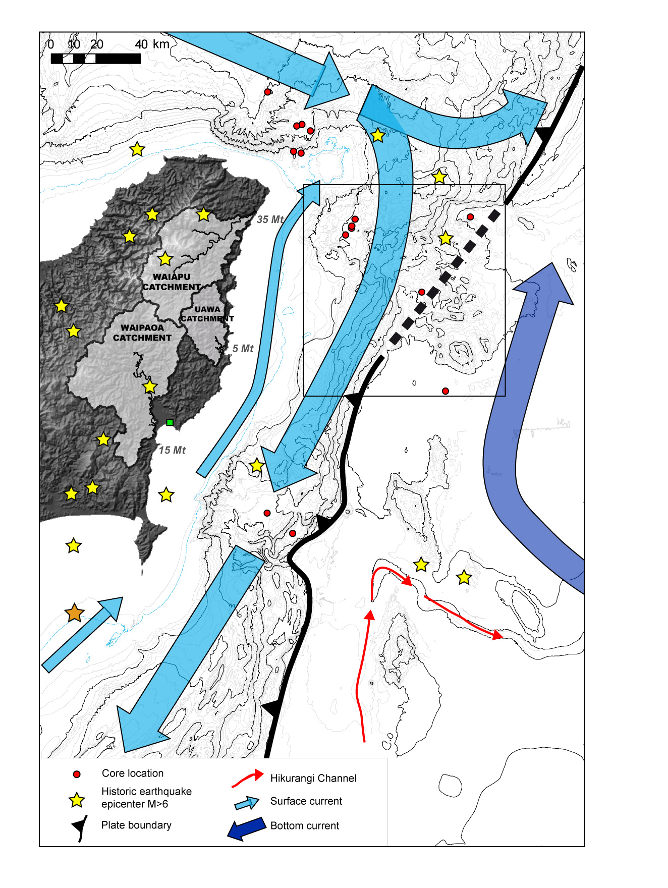
Seafloor map of the East Cape region. The water depth is indicated by contour lines similar to a topographic map on land. The dark thick clack line indicates the position of the plate boundary where the Pacific Plate plunges beneath New Zealand. The stars are the location of previous large earthquakes. The thick blue arrows are ocean currents and the red dots are the cores used in this study to pick up sediment layers triggered by earthquakes. The number with Mt/yr indicate the amount of sediment delivered by the 3 local rivers every years onto the continental shelf.