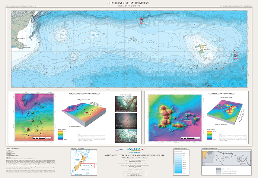
This chart of the Chatham Rise incorporates all NIWA's available bathymetric data from a wide variety of sources, including recent multibeam "swath" data. It is the first time such a detailed map has been produced of this area, and its resolution is able to display small seamount-like features which are important for deepwater fisheries on the Rise. 3-D graphics are produced for two such fishing grounds where these features host aggregations of orange roughy. The map was produced under NIWAs FRST-funded programme "Seamounts: their importance to fisheries and marine ecosystems". The poster is approximately 100 cm x 70 cm. $20