-

Tsunami generated by underwater volcanoes
Research ProjectMarsden-funded research investigating how erupting volcanoes can cause deadly and damaging tsunamis. -
Explosive research sheds light on volcanic tsunami
Feature story07 July 2021Innovative experiments are giving natural hazard researchers and PhD students a close look at how erupting volcanoes can cause deadly and damaging tsunamis. -
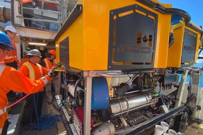
2021 - Hikurangi margin
VoyageUnderwater Remotely Operated Vehicle helping scientists collect the latest earthquake data. -
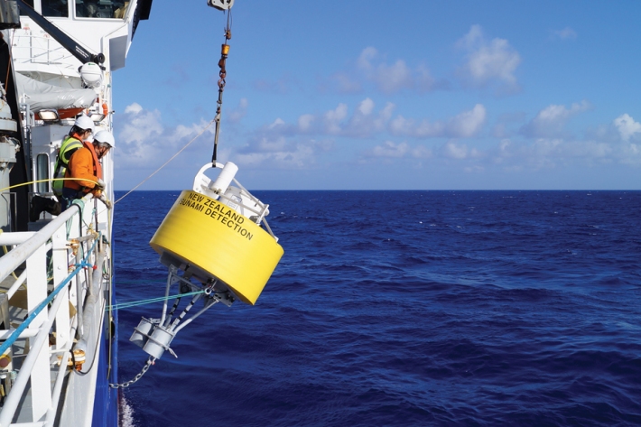
A job for the buoys
Feature story11 February 2021New Zealanders and Pacific Island communities are on their way to having the most advanced tsunami monitoring system in the world. -
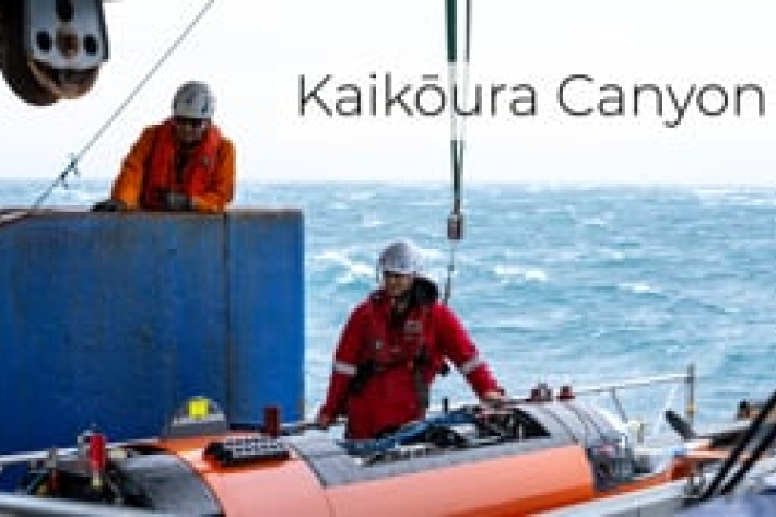
Kaikōura Canyon
Our team of researchers have recently returned from a voyage onboard RV Tangaroa to retrieve moorings deployed to collect sediment samples from the Kaikōura Canyon. -
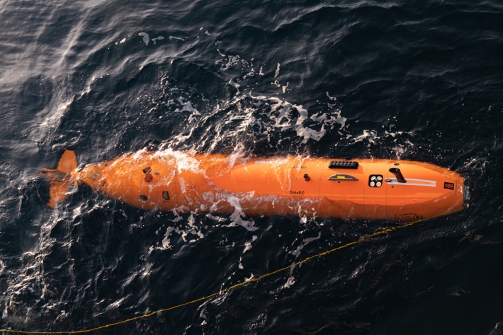
Underwater robot getting close-up look at Kaikōura Canyon
Media release08 October 2020A six-metre long orange underwater robot is flying through the Kaikōura Canyon for the next month collecting information on how the canyon has changed since the 2016 earthquake. -

New tsunami monitoring system for Pacific
Feature story22 September 2020A network of state-of-the-art tsunami buoys is being deployed from New Zealand up into the Pacific to keep communities safer. -
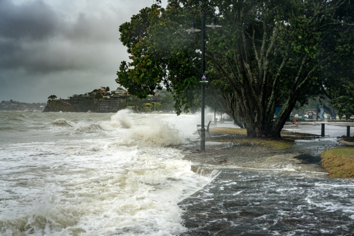
Tsunami evacuation zones home to 1 in 10 New Zealanders
Media release19 August 2020NIWA scientists have completed the first national assessment of people and buildings at risk in New Zealand’s tsunami evacuation zones. -
A flair for finding gas bubble flares
NIWA marine geologist Arne Pallentin is looking for telltale gas bubble 'flares"—using a multibeam echosounder—that indicate new volcanic activity in the Calypso Vent Field. -
Using sound to see what's happening geologically
Marine geologist - Dr Joshu Mountjoy - is mapping the seafloor landscape around Whakaari/White Island to understand how much sediment was dislodged in the eruption and where it has gone. -
What's in a bubble?
Marine Geophysicist Sally Watson, maps the seafloor and takes samples from the water column so we can understand geological processes shaping the volcanic underwater realm around Whakaari/White Island. -

2020 - Bay of Plenty acoustics
During the TAN2007 voyage NIWA scientists headed to the waters around Whakaari/White Island in the Bay of Plenty to survey changes to the seafloor since the volcanic eruption in December 2019.