Since the early 2000s, NIWA has been part of the international Argo programme, which is deploying floats to measure temperature and salinity throughout the world's oceans.
The data being gathered improves our understanding not only of our oceans, and in particular the oceans' role in climate, but also of our weather and climate prediction systems.
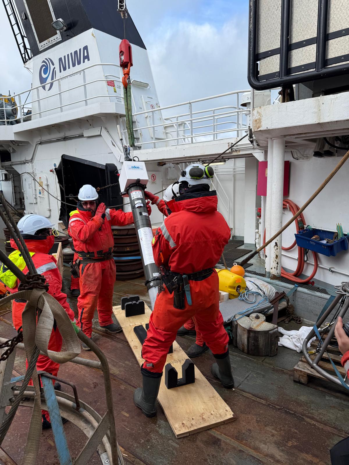
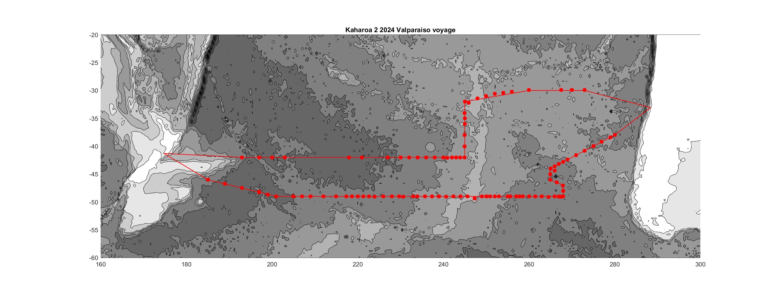
Collaboration between NIWA, the Scripps Institution of Oceanography, the University of Washington and CSIRO has resulted in NIWA vessels deploying around 20% of floats in the network (a contribution second only to that of the US). The Kaharoa II undertakes this important work, taking over from the Kaharoa in 2024.
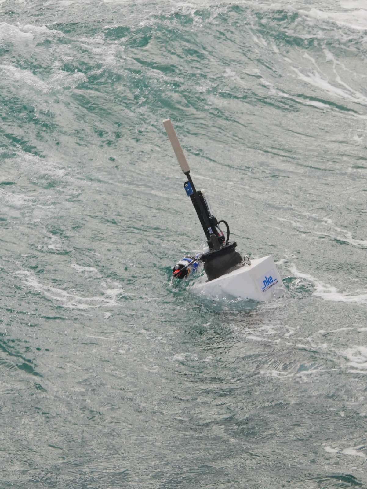
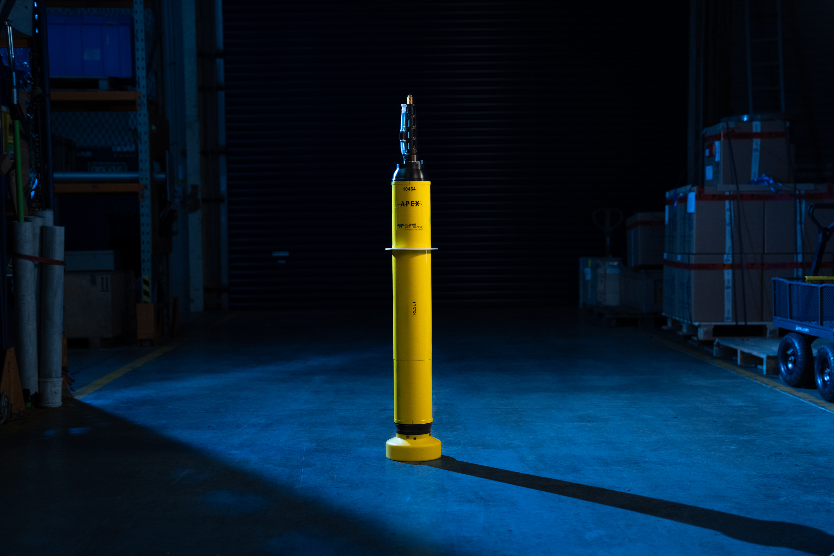
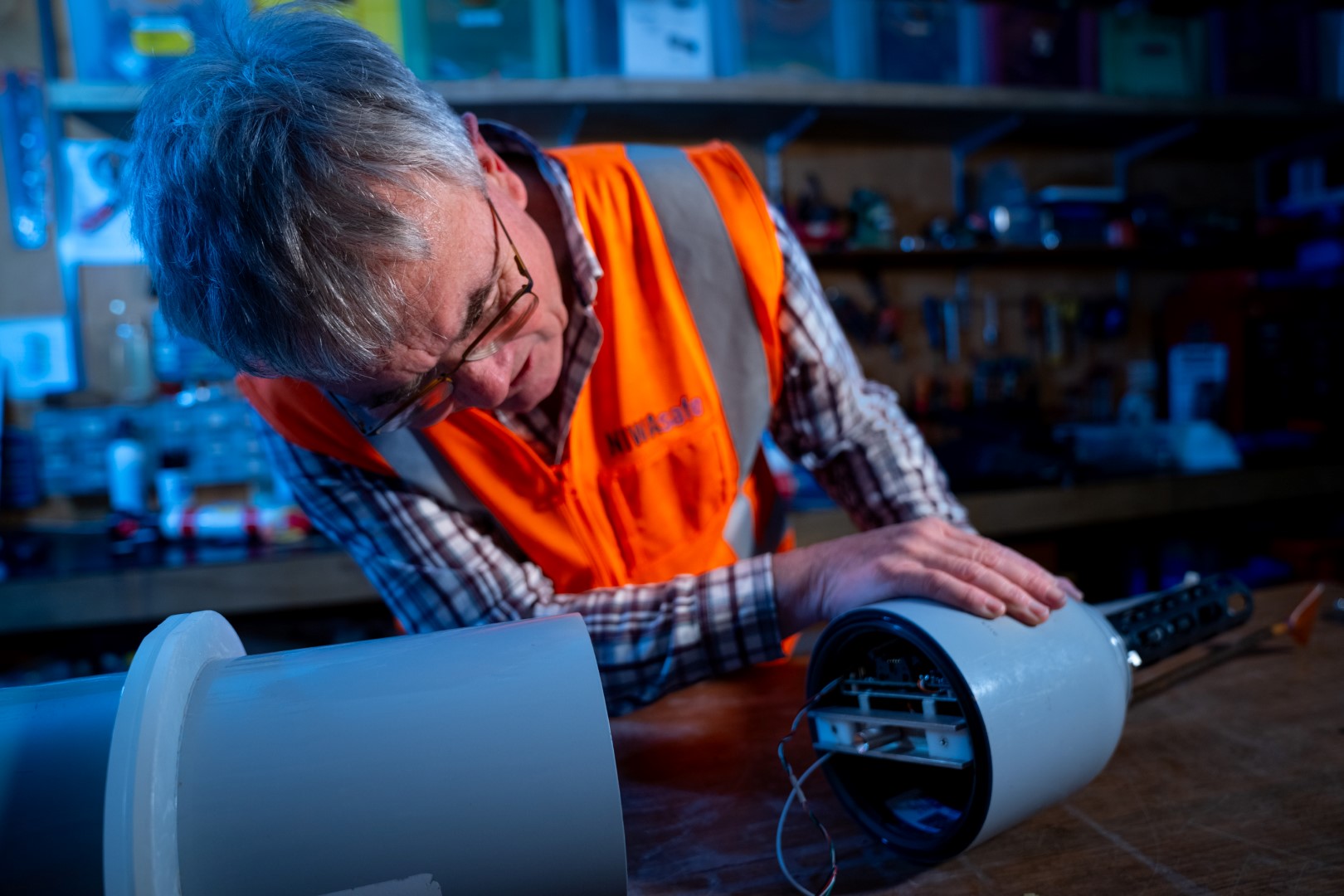
Argo floats are instruments able to measure temperature and salinity in the top 2000m of our oceans. New Biogeochemical agro floats are able to capture more data, such as oxygen, chlorophyll and suspended particles - see map here.
Deep Argo floats sample the full ocean volume. Deep Argo float models include the Deep SOLO and the Xuanwu capable of reaching 6000 m, and the Deep ARVOR, the Deep NINJA and the HM4000 are designed to sample to 4000 m.
Overview
Information from the International Argo programme helps us to better understand:
- Oceanographic research. Near-real time information about the oceans' changes is revolutionising knowledge of ocean dynamics.
- Climate variability. It helps us to understand variability on a range of time scales, interpret previous changes and ultimately improve climate predictability.
- Knowledge of the state of our oceans is beginning to allow us to understand the conditions which affect fish stocks and biological productivity, as well as better understand how our oceans function as complex systems. Because the data are near-real-time and easily available, they are also being assimilated into operational modelling, including for short-term prediction of currents (e.g. offshore oil spills, search and rescue) and temperature (e.g. for fisheries), for seasonal-to-interannual forecasting (e.g. El Niño), and for initializing decadal predictions of the ocean/atmosphere climate system (such as those of the IPCC). Eventually, the data could even feed into short-range weather forecasting.
*See the links below for examples:
How they work
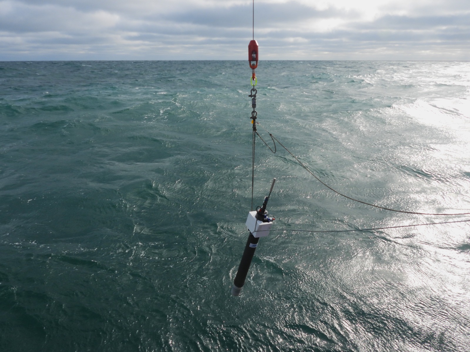
Argo floats have been deployed since 2000.
A typical Argo float cycle consists of an 'initial floating depth' in the ocean about 1km below sea level. After 9 days at this depth, the float then sinks down to 2km before coming back up to the ocean surface. As the float rises, it measures temperature and salinity through the water column. Once on the surface, these data, along with the position of the float, are then transmitted via satellite to data facilities, before the float repeats the process. The data are freely available from websites in the USA and Europe within hours of collection.
The buoyancy of an Argo float, which allows it to rise and sink in the water column, is controlled by pumping oil between internal and external bladders.
A benefit of the 1km primary floating depth is that animals like barnacles don't grow at this depth, due to the lack of light, and so won't attach themselves to the floats (this would affect the floats' buoyancy and could foul the sensors). Additionally, flows at 1km tend to be fairly slow, so the floats don't generally travel great distances (except in the southern ocean).
Argo floats are deployed all over the world - the aim is to have over 3000 of them, distributed roughly every 3 degrees (300km). Deployments began in 2000, and continue at a rate of about 800 a year.

The results
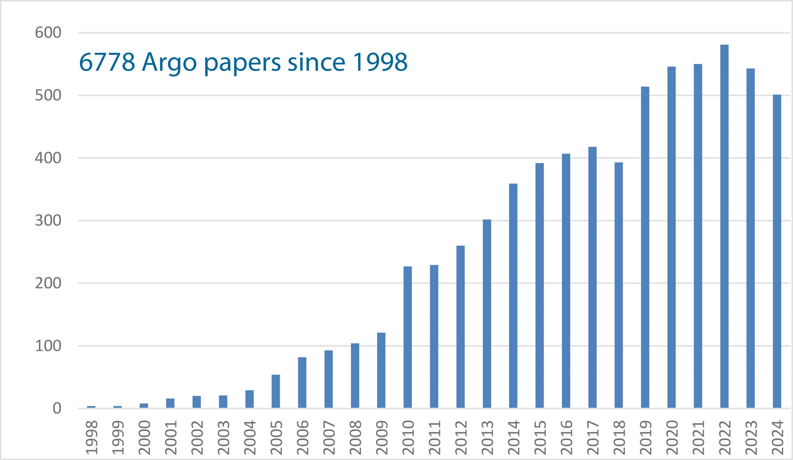
Thousands of peer-reviewed papers have used Argo data - see the full list here. Topics include water mass properties and formation, air-sea interaction*, ocean circulation (large scale currents), mesoscale eddies (ocean weather systems), ocean dynamics, and seasonal to decadal variabilty