Introduction
Understanding wind behaviour over complex terrains, where airflow patterns are highly variable and influenced by topography and surface features – such as hills, mountains, valleys and coastal areas – can be challenging. Direct measurements in these environments can be difficult, costly and limited in spatial coverage.
Computational Fluid Dynamics (CFD) is an advanced simulation technology that uses numerical methods and powerful computing resources to model the movement of air in the natural environment. It provides detailed, site-specific insights into wind flow, turbulence, and atmospheric dynamics for locations where these data are otherwise unattainable.
CFD to predict how wind interacts with natural and built environments
Earth Sciences New Zealand researchers are working to simulate the atmospheric boundary layer, the lowest part of the atmosphere directly influenced by the Earth's surface, where wind speeds and directions change rapidly due to terrain effects.
Using CFD, we can predict how wind interacts with natural and built environments at fine spatial and temporal scales, supporting applications such as environmental impact assessments, infrastructure design, renewable energy planning, and hazard mitigation.
We apply two complementary turbulence modelling approaches to best suit different project needs:
- Reynolds-Averaged Navier–Stokes (RANS) models: These provide efficient, steady-state, time-averaged wind flow solutions by modelling the statistical effects of turbulence. RANS is widely used for capturing general wind trends and average flow patterns over complex terrain with relatively low computational cost.
- Large Eddy Simulation (LES): LES explicitly resolves the large, energy-containing turbulent eddies in the flow while modelling only the smallest scales of turbulence. This approach produces highly detailed, time-dependent representations of turbulent wind structures such as gusts, wakes, and vortices, essential for capturing realistic flow dynamics.
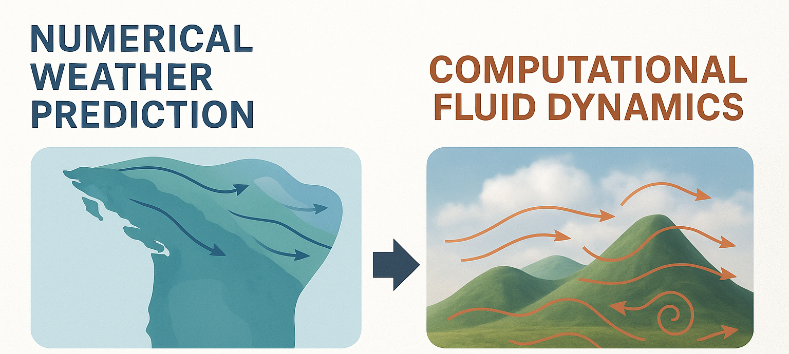
Numerical Weather Prediction (NWP) models, such as those used in our weather forecasting, simulate atmospheric conditions on a regional scale (kilometres to hundreds of kilometres) and forecast weather over hours or days. In contrast, CFD focuses on microscale flows (meters to kilometres) with much finer spatial and temporal resolution.
Coupling NWP and CFD models enables a comprehensive, multi-scale approach that combines large-scale meteorological context with high-resolution local wind flow simulations, improving accuracy and relevance for site-specific applications.
Applying CFD to address complex environmental wind flow challenges
Our team specialises in applying state-of-the-art CFD techniques to address complex environmental wind flow challenges across varied terrain and applications. Key capabilities include:
High-resolution LES as a stand-alone tool
The researchers use LES to perform detailed, transient simulations of wind flow over complex terrain, capturing intricate turbulence and flow separation phenomena. This capability is particularly valuable when understanding localised wind effects that strongly influence safety or operational performance is critical, such as determining design wind speeds for bridges in complex terrain or for stacking containers at ports.
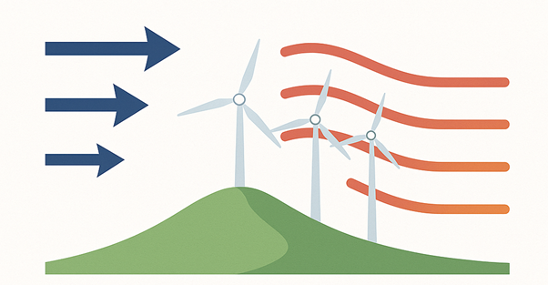
Wind energy assessment and optimisation
The team performs detailed simulations to generate high-resolution maps of wind speed, direction, and turbulence intensity, aiding in the assessment of wind resources at proposed sites. These simulations analyse how turbine wakes form and how airflow recovers downstream.
This work helps in optimising turbine placement and predicting variations in power output due to terrain and atmospheric turbulence.
Coupled NWP-CFD simulations
The team leverages outputs from the Momentum Partnership’s Unified Model (of which Earth Sciences New Zealand is a founding member) to drive CFD simulations with realistic, time-varying boundary conditions.
This coupling ensures local wind predictions reflect evolving regional weather systems, improving forecast skill and reliability.
Coupled NWP-CFD with Lagrangian particle tracking
Integrating particle tracking algorithms within the CFD framework enables simulation of the transport and dispersion of pollutants, dust or other airborne particulates over complex terrain. This approach supports detailed environmental impact assessments and air quality management, with high spatial and temporal resolution.
For example, we have tested this methodology at Auckland’s Mangere wastewater management site in work to refine techniques for quantifying methane emissions.
Caption: The animations above show pollution dispersion modelling (hypothetical cases) from Auckland Mangere Wastewater Treatment site. Left: Single point release. Right: Area release.
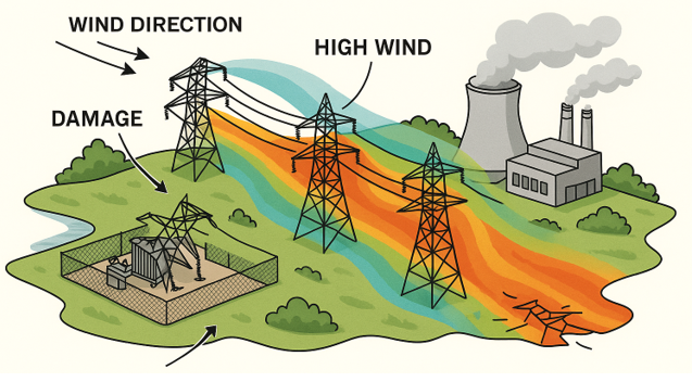
Wind hazard and risk assessment
We provide accurate estimates of extreme and design wind speeds over complex terrain, essential inputs for infrastructure design standards, risk assessment, and regulatory compliance. Our models help identify areas prone to high wind hazards, improving resilience and safety for built environments and communities.
We have used this method to investigate conditions that led to two trucks blowing over on Auckland Harbour Bridge, determining design wind speeds for a cableway over the Manganui Gorge, replicating the tornado event of 18 June 2021, simulating wind conditions at Weka Pass that led to a pylon collapse, and modelling airflow around containers at Ports of Auckland. Read a media article and the research paper about this work.