Day 13 of the Ross Sea Life in a Changing Climate (ReLiCC) 2021 voyage on RV Tangaroa finds us close to Cape Adare on the tip of the Antarctic continent. We’ve had a busy and icy week.
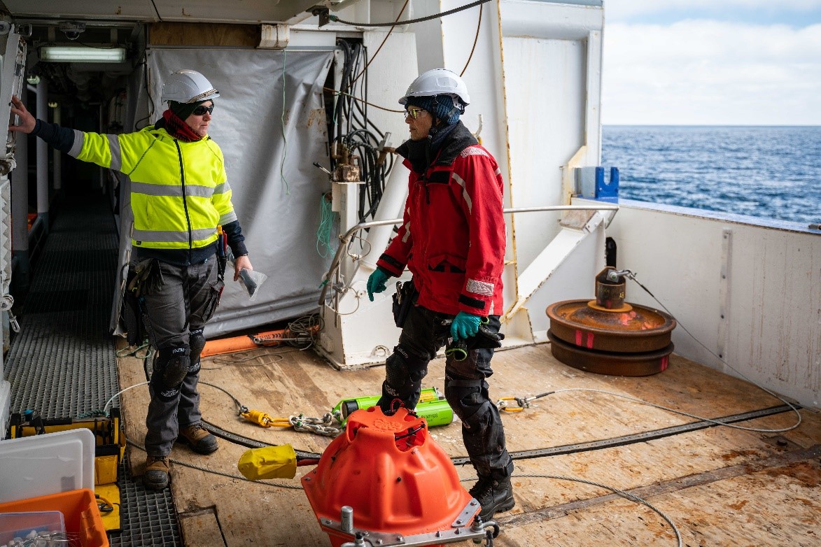
One of the main objectives of the ReLiCC voyage is to retrieve and re-deploy scientific moorings. Moorings allow us to make observations at fixed locations over a long time period – including during winter when the region is inaccessible. Data from moorings will form the basis of long-term time series to monitor the Ross Sea environment. During the 2019 Tangaroa voyage we put down six moorings, each equipped with instruments that have been busy recording over the past two years. There are three different types of moorings: to study whales; oceanography; and fish/krill.
Earlier this week we successfully recovered two of the three passive acoustic moorings (PAMs). PAMs are “whale listening posts”. These are hydrophones that make recordings of calls of whales. This tells us what species are passing through and at what times of year. We recovered the PAM mooring on the Pacific-Antarctic Ridge last Saturday and the one at Scott Seamount on Tuesday. At both locations we recovered the 2019 moorings and then deployed new instruments that will record for the next two years.
The final PAM mooring is on the Iselin Bank which we will visit towards the end of the voyage. The PAM work is being led by NIWA scientist Giacomo Giorli in collaboration with colleagues from the Australian Antarctic Division. Giacomo will download the data when we return and we all look forward to finding out whether we recorded any of the elusive Ross Sea sperm whales. A few whales have already been sighted and photographed in the vicinity of the PAMs – including minkes, humpbacks, and blue whales, so there should be something for Giacomo to listen to.
Yesterday (Thursday) afternoon the moorings team of Sarah Searson and Jennie Mowatt retrieved three other moorings deployed in 2019 near Cape Adare. These are oceanographic moorings, in collaboration with Melissa Bowen at the University of Auckland, and record the outflow of Antarctic Bottom Water (AABW) from the Ross Sea continental shelf. Processes in the oceans surrounding Antarctica influence climate, future sea level rise, and regulation of the carbon cycle worldwide. We know that the outflow of extremely cold, dense, AABW from the Ross Sea has a major influence on the deep water properties of the global ocean but our understanding is limited by a lack of observations. We will download the instruments onboard and re-deploy two of the Cape Adare moorings over the weekend. We also plan to deploy three new oceanographic moorings about 100 km to the southwest in the Drygalski Trough. As well as the outflow of AADW, these new moorings will record the inflow of lighter, warmer, nutrient-rich Circumpolar Deep Water into the Ross Sea. Data from these instruments will allow us to identify the key processes that determine cross-shelf water exchange in the Ross Sea and guide future simulations of global ocean currents.
The final type of moorings are upward looking echosounders that measure fish and krill in the upper 300 metres. No echosounder moorings were put out in 2019, but we plan to deploy two on this voyage: one near Cape Adare to estimate availability of food for Adelie penguins; and the other in Terra Nova Bay record the seasonal spawning migration of silverfish.
As well as retrieving moorings, we have started a daily routine of data collection which has included a lot of water sampling. Hundreds of litres of water have already been filtered, experiments conducted, and samples collected, by our microbial and plankton teams. A big component of the voyage is focused on some of the tiniest organisms in the ocean – the phytoplankton and microbes, and trying to better understand their role in the global carbon cycle and potential effects of climate change.
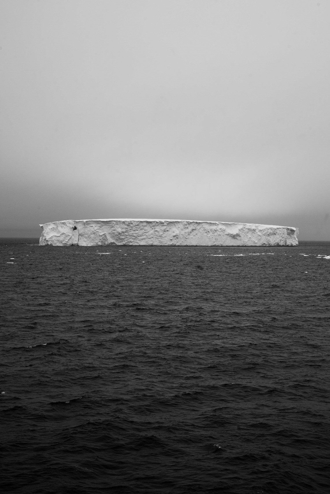
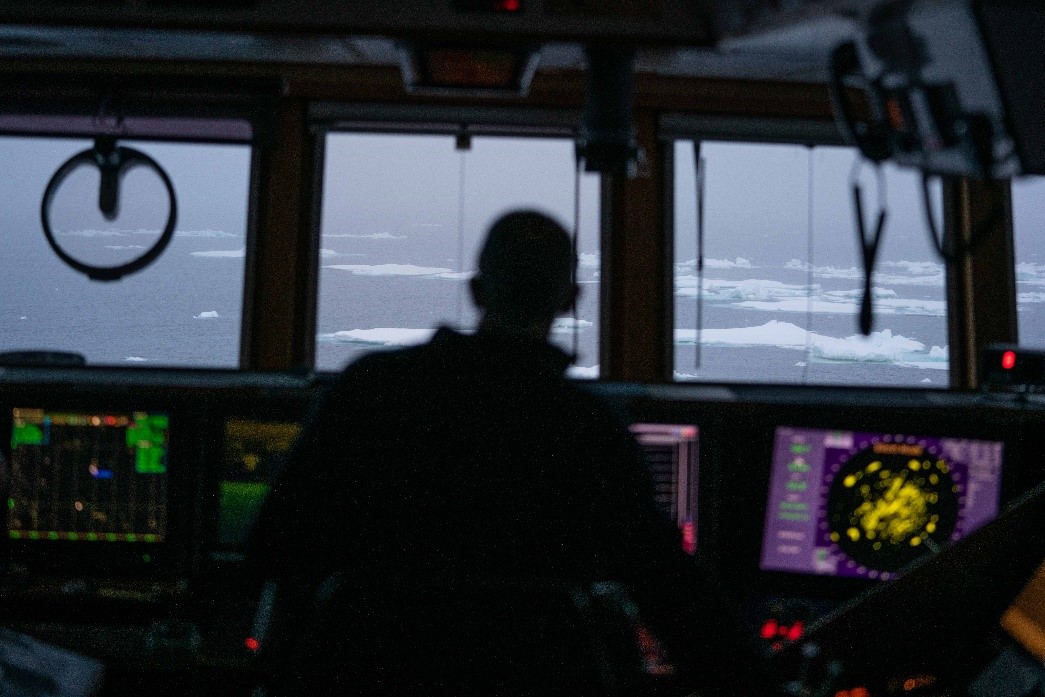
Ice has been a big factor in the past week. We passed our first iceberg at a latitude of 62° 48’S just after midnight last Saturday. The doctor won her own sweepstake, by correctly guessing the latitude of this first sighting. Normally the winner is within a few nautical miles, but this year Dr Jenny Visser was spot-on with her prediction to the exact minute of latitude!
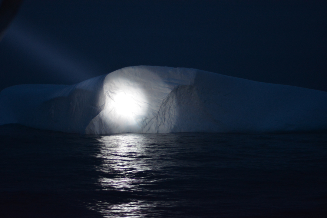
Since then we have seen hundreds of icebergs of all shapes and sizes. The biggest one was 4.5 kilometres long and more than 60 metres high, dwarfing the Tangaroa! Icebergs are relatively easily detected on the ship’s radars – even in fog, but of greater concern are the much smaller ‘bergy bits’ that icebergs trail behind. Since passing 60° S we have had extra lookouts on the bridge, and powerful spotlights at night (which is really more like twilight at these latitudes) to avoid bumping into anything.
Sea-ice has also been an issue for us. Every winter the sea surface in the Ross Sea freezes until it is completely covered by ice. And every summer the sea-ice (mostly) melts. This annual transition from ice to open water is one of the largest seasonal changes on the planet. Melting begins in spring and occurs from the inside out, forming a ‘polynya’ of open water in the southern Ross Sea, which is separated from the waters of the Southern Ocean to the north by a band or ‘bridge’ of sea-ice. The timing and degree of sea-ice melting varies between years. In some years, the Ross Sea is mostly free of sea-ice by 1 January. In other years, the ice can persist into February, and in really icy years may not fully melt at all. I have been down here on Tangaroa in two of the ‘worst’ (i.e., most persistent sea-ice) summers in recent times – in 2008 and 2015 – meaning I have a reputation in some sectors as an ‘ice Jonah’!
During the two most recent Tangaroa voyages in 2018 and 2019 the ice melted early (I was there in 2019 too, so I’m not always bad luck!), and our scientific activities were relatively unaffected. This year the ice persisted much longer. We have been nervously monitoring ice maps produced from satellite images since we departed, hoping that gaps would appear in the ‘ice bridge’ allowing us to get into the Ross Sea without having to travel through ice. But by the middle of last week it was apparent that that wouldn’t happen. After receiving the latest maps and information,and talking to the skippers on the two NZ toothfish fishing vessels that had recently come through from south to north on their way home, we altered our planned voyage track. Instead of going directly from Scott Seamount to Cape Adare, we were forced to detour 250 km to the east where the master and ice pilot decided we would get our clearest path. This proved to be a wise decision, and after navigating through a band of about 100 km of dispersed sea-ice we reached the open water of the polynya on Wednesday morning and had a clear run to Cape Adare. The enforced detour has cost us about 36 hours of science time, but safety comes first.
Everybody onboard has got into the routine of shipboard life. The seas have been calm, and the procession of icebergs and chance of spotting whales and penguins has kept all in good spirits. We have three shifts (midnight to midday, midday to midnight, and 8 am to 8 pm) so we are operating 24-7 to maximise the opportunities to collect data.
After the moorings work near Cape Adare, we will head towards the Victoria Land coast, where our research for the next two weeks will focus on the community of invertebrates that live on the seabed in depths from 50-200 m using underwater video. We are looking forward to the scenery both above and below the water.