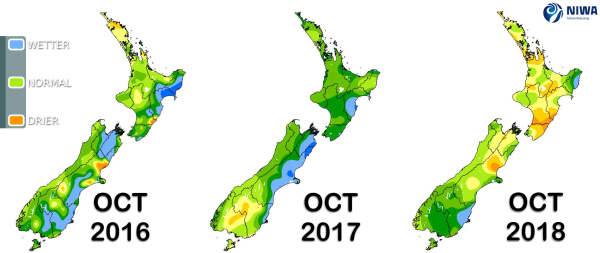
A weekly update describing soil moisture across the country to help assess whether severely to extremely dry conditions are occurring or imminent. Regions experiencing these soil moisture deficits are deemed “hotspots”. Persistent hotspot regions have the potential to develop into drought.
Facts: Soil Moisture
North Island Up to 17th October 2018, rainfall has been below normal or well below normal for a majority of the North Island, excluding the East Cape and the Tauranga area where rainfall has been near normal. The drier than normal pattern has generally been a continuation of what was observed during September.
Consequently, soils are drier than normal for the time of year in parts of Kaipara, Auckland, northern Waikato and the Coromandel Peninsula, around Taupo and Mt Ruapehu, and across Greater Wellington-Wairarapa, excluding Wellington City. The most anomalously dry soils are found in parts of the Far North, Rodney, Franklin, northern Taupo, as well as in the Tararua, Horowhenua and Masterton Districts.
South Island Rainfall patterns have been mixed during the first two weeks of October 2018. Near normal rainfall has occurred in much of the island, excluding the Queenstown-Lakes District in Otago, the Grey and Buller Districts in the West Coast, far northern Marlborough, and the Waimate District in southern Canterbury. September was a rather dry month for the central and upper portion of the island.
Currently, soil moisture values are below or well below normal in the Waimakariri and southern Hurunui Districts of Canterbury along with eastern Tasman and western Marlborough, but near normal elsewhere.
Outlook and Soil Moisture
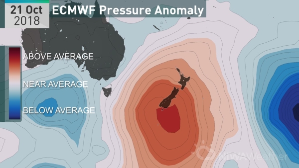
The current pattern of higher than normal pressure and prevailing westerlies, bringing generally dry conditions especially in the east, is expected to continue over the next seven days. Temperatures are forecast to be above or well above average nationwide through the first half of next week, with the largest temperature departures from average in the east of both islands.
There are no currently no hotspots, but an area to monitor is in the southern Hurunui District in northern Canterbury.
North Island Primarily dry weather is forecast in the North Island over the next seven days as high pressure sits overhead. Isolated showers in western areas may bring 5 to 10 mm of rain over the next week, while most other locations receive less than 5 mm.
With temperatures above or well above average, well below normal rainfall, and an increasing sun angle, soil moisture is expected to decrease during the next week. Eastern areas including Gisborne, Hawke’s Bay, and Wairarapa, and northern areas including Waikato, Auckland, and Northland have the highest chance for building dryness during the upcoming week.
South Island A weak front will move up the South Island on Wednesday and Thursday (Oct 17-18), resulting in scattered rainfall. Isolated rainfall amounts of up to 20 mm are possible along the west coast with higher rainfall in coastal Fiordland. Rainfall totals to the east of the Alps will be light with totals generally 5 mm or less.
Except for some showers along the west coast, the next seven days should be mostly dry across the South Island and consequently, soil moisture is expected to decrease island wide.
Looking ahead to the final week of October, the Tasman Sea is expected to turn more active. Several fronts may move up the country, bringing rainfall primarily to western areas where near or above normal rainfall is possible.
Near or below normal rainfall is favoured for the upper and eastern North Island and eastern South Island to end the month.


