
Earth Sciences New Zealand-led analysis of a survey of United States agricultural sites finds that, under certain conditions, methane emissions from intensive dairy feedlots may be underestimated in national inventories.
This is the first study to use remote sensing technology to detect and quantify agricultural methane emissions across multiple regions and research locations.
“We’ve demonstrated that this approach works and could be harnessed to improve the accuracy of emissions monitoring, and to assess the effectiveness of mitigation strategies to tackle agricultural emissions of this highly potent greenhouse gas.”
Dr Penny Smale, Earth Sciences New Zealand Atmospheric Technician
Agricultural methane is the world's largest human-caused methane source, dominated by emissions connected to ruminant animals, particularly beef and dairy cattle. Methane is released both as burps from the cattle and through microbial decomposition in manure management systems such as the open lagoons that are a common feature of intensive feedlot operations.
The study analysed data gathered by the aircraft-borne MethaneAIR instrument that maps plumes of methane at high precision and spatial resolution. Primarily developed to identify large methane leaks from oil and gas facilities, MethaneAIR’s 75 flights across the US and Canada between 2021 and 2024 also flew over vast areas of agricultural land. This provided an opportunity to collect methane emissions data from concentrated animal feeding operations (CAFOs).
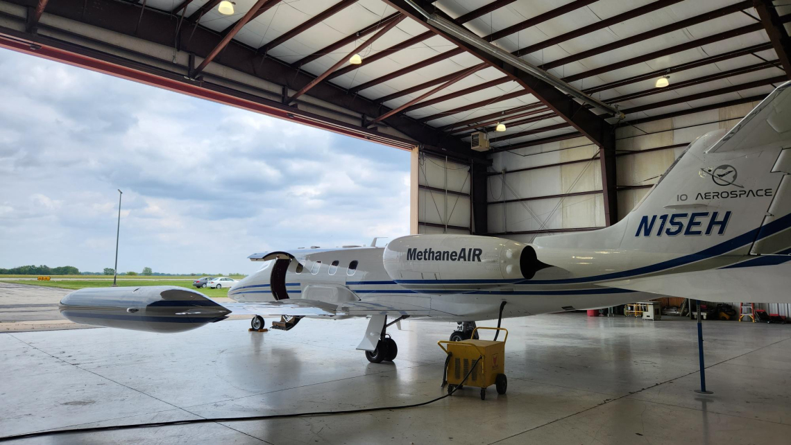
The flights collected data from more than 200 agricultural targets, with this study focussing on the most robust observations from 84 CAFOs in the Colorado region. The researchers developed a new analytical approach to isolate the agricultural methane plumes from other emissions.
“It’s a complex environment for pinpointing methane sources, because the plane flew over regions containing oil and gas infrastructure, alongside large farming operations. We were able to identify agricultural methane emissions that would previously have been difficult separate from other sources,” says Dr Smale.
MethaneAIR data reveals emissions variability hidden in inventory averages
Inventories, which are vital for countries to track agricultural methane emissions, rely on average emissions-per-animal estimates and can struggle to take into account the variability seen in real-world emissions due to animal behaviour, management practices and environmental conditions.
The study found that per-animal emission estimates derived from the MethaneAIR measurements were frequently higher than official inventory estimates, and suggests that emissions from CAFOs may be more variable than currently captured through conventional reporting approaches.
“Our results suggest that emissions from individual farms can differ considerably from what would be expected using average inventory estimates and often are higher when conditions allow emissions to be measured accurately. We suspect some of this variability is due to differing approaches in manure management systems, which could present opportunities for mitigation strategies,” says Dr Smale.
Dr Smale notes that some of the difference with official inventory estimates could be due to the study having limited access to livestock data for the farms surveyed, and potential sampling bias.
“It is important to note that inventories represent annual average emissions, while MethaneAIR measurements provide a snapshot of emissions at the time of observation, with some facilities observed on multiple occasions,” says Dr Smale.
Although the research focused on intensive livestock operations in the United States, rather than the grazing-based farms found in New Zealand, it provides proof of concept for the use of remote sensing technology as a tool to measure agricultural methane.
Building New Zealand’s capability in remote sensing greenhouse gas research
The MethaneAIR instrument is a precursor to that used in the MethaneSAT satellite mission, and the techniques developed for this aircraft-borne research are being applied to data captured by the satellite. Earth Sciences New Zealand Chief Scientist – Changing Atmosphere Dr Sara Mikaloff-Fletcher, says that the MethaneAIR study establishes a strong foundation for satellite-based methane detection and measurement.
“This is the first time remote sensing has been used to quantify agricultural methane emissions on such a large scale, surveying more than 200 individual CAFOs. The findings are generally consistent with ground-based studies on individual farms, but our work demonstrates for the first time that methane emissions may be underestimated across a broad range of intensive agricultural facilities in the US. We’ll be continuing to build on this with our analysis of MethaneSAT results for New Zealand, which is close to publication.”
The study was funded by the Ministry for Business, Innovation and Employment (through the Catalyst Fund) and the Environmental Defense Fund (US) and was published in the scientific journal EGU: Atmospheric Chemistry and Physics.
More about MethaneAIR and MethaneSAT
- Methane absorbs specific wavelengths in the spectrum of sunlight. MethaneAIR uses an aircraft-based spectrometer, which detects the resulting changes in sunlight reflected up from earth. The changes reveal how much methane is in the air column.
- The MethaneAIR and MethaneSAT research is funded through a partnership between the US-based Environmental Defense Fund and the Ministry for Business, Innovation and Employment (MBIE). Dr Sara Mikaloff-Fletcher, Earth Sciences New Zealand’s Chief Scientist Changing Atmosphere, is the scientific lead of New Zealand’s MethaneSAT agricultural research programme.
- The MethaneSAT mission ended prematurely in June 2025. More information about the mission is available on the MBIE website.
- During its lifetime, MethaneSAT captured 97 measurements over a range of different agricultural areas worldwide, including over New Zealand, providing a rich dataset. Earth Sciences New Zealand expects to publish the first results from the analysis of the New Zealand data within the next six months.