The tropical Pacific is still warmer than usual, but regional atmospheric circulation in the southwest Pacific is close to normal for this time of the year.
The international consensus is for a continuation of neutral ENSO conditions throughout the summer and into early autumn.
The global climate forecast models NIWA monitors generally agree that the ITCZ will be positioned south of normal and the SPCZ will be close to its average position for late summer and early autumn.
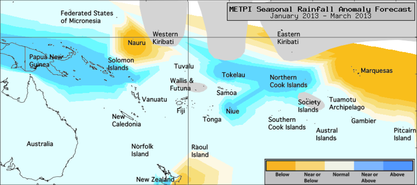
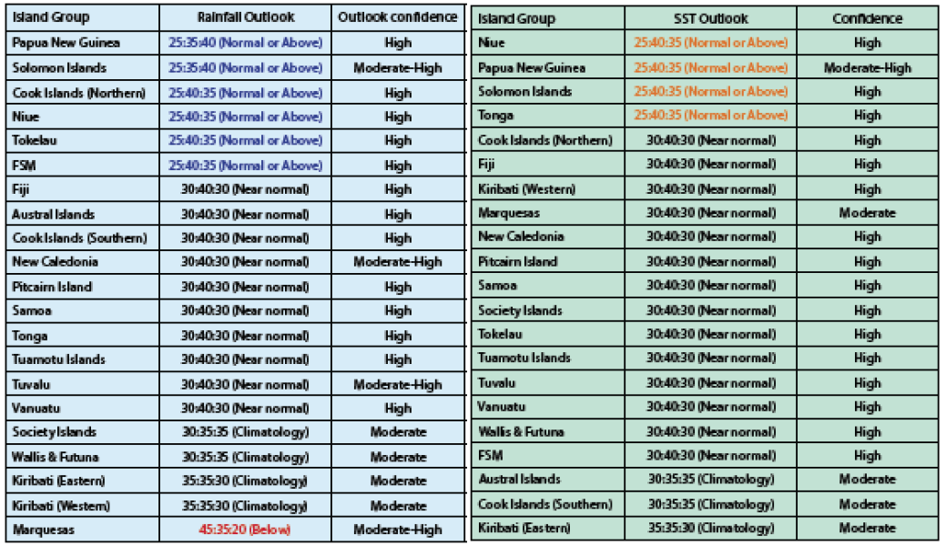
For the coming three months, near or above normal rainfall is forecast for Papua New Guinea, the Federated States of Micronesia, the Solomon Islands, the Northern Cook Islands, Tokelau and Niue.
Below normal rainfall is forecast for the Marquesas.
No clear precipitation guidance is offered for Eastern Kiribati, Western Kiribati, Wallis & Futuna and the Society Islands.
Normal rainfall is forecast for all other island groups.
The global model ensemble shows some patterns that are similar to a weak El Niño in the SST field, however those anomalies are diminished from previous forecasts.
Some of the forecasts in the ensemble show traits that are associated with a weak La Nina SST pattern, but these characteristics exist mostly east of the Dateline and along the Equator to the east of 160°W.
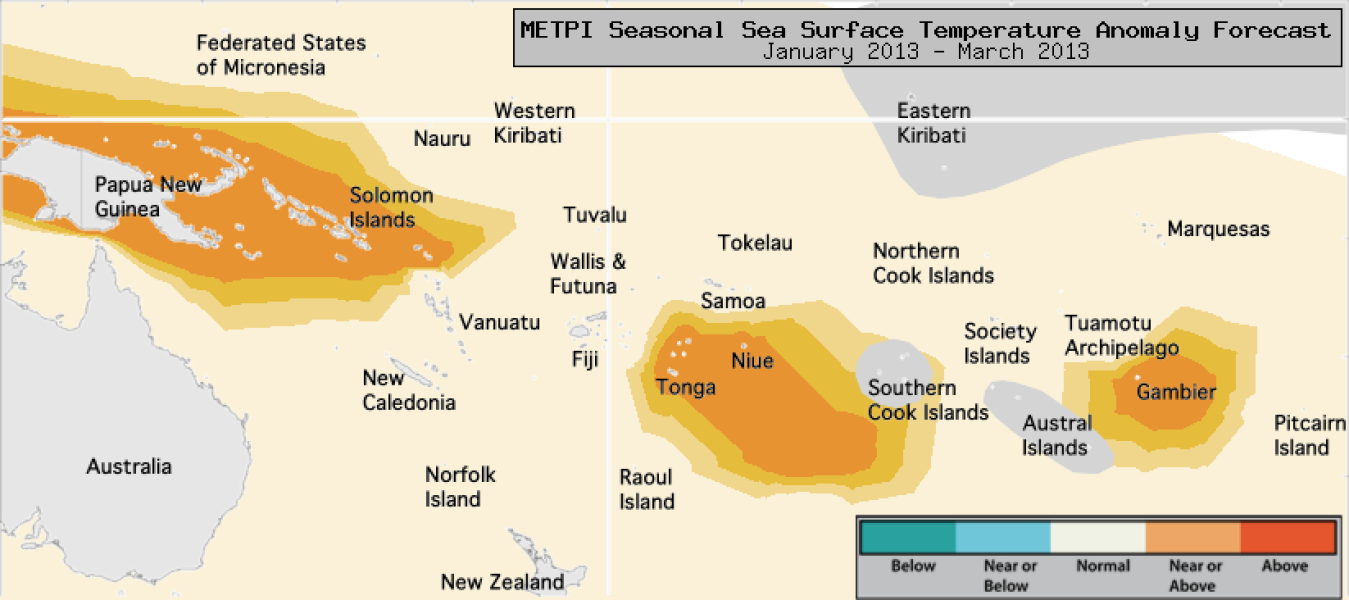
For the coming three months, near normal or above normal SSTs are forecast for Papua New Guinea, the Solomon Islands, Niue and Tonga.
No clear guidance is offered for the Austral Islands, the Southern Cook Islands or Eastern Kiribati.
Normal sea surface temperatures are expected elsewhere.
The confidence for the rainfall outlook is moderate to high. The average region–wide hit rate for rainfall forecasts issued in January is 58%, five points lower than the long–term average for all months combined.
The SST forecast confidence is mostly high across the region, and uncertainty is greatest for islands to the east of the Dateline.


