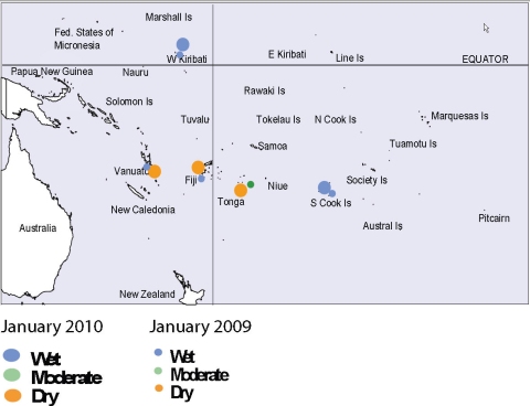
Soil moisture in Janaury 2010
Estimates of soil moisture shown in the map (right) are based on monthly rainfall for one station in each country. Currently there are not many sites in the water balance model, but more stations will be included in the future.
The information displayed is based on a simple water balance technique to determine soil moisture levels. Addition of moisture to the available water already in the soil comes from rainfall, with losses via evapotranspiration. Monthly rainfall and evapotranspiration are used to determine the soil moisture level and its changes. These soil moisture calculations were made at the end of the month, and for practical purposes, generalisations were made about the available water capacity of the soils at each site.
Rarotonga (Southern Cook Islands), andTarawa (Western Kiribati) project moist soil moisture at this time. Port Vila (Vanuatu), Nadi (Fiji), and Nuku’alofa (Tonga) project moderate to dry conditions at this time.

Estimated soil moisture conditions at the end of January 2010, using monthly rainfall data. Soil moisture projections for individual Pacific Island countries are dependent on data availability at the time of publication.
