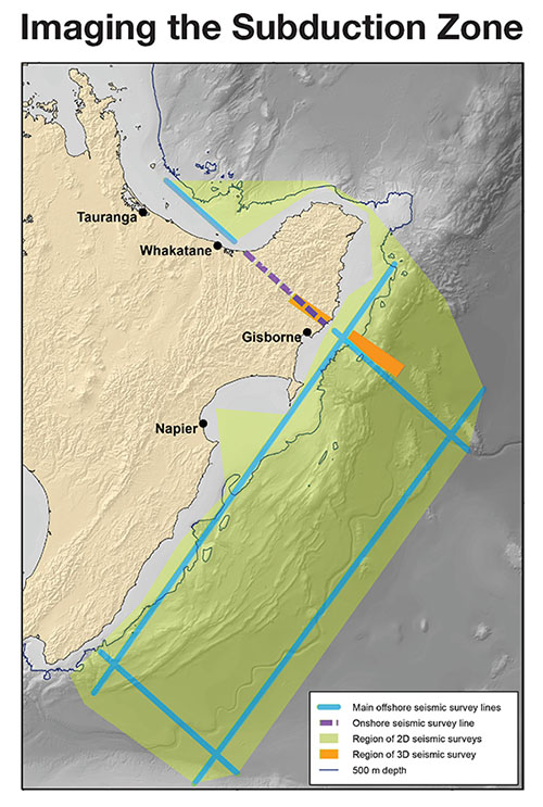
Scientists from four countries are working together to produce the most detailed subsurface images yet of the Hikurangi Subduction Zone. The graphic shows planned deployment lines for marine and land seismometers that are a key part of the project. Spacings of the Ocean Bottom Seismometers will be between 10km and 15km. In the more intensive survey area east of Gisborne, spacings will be 2km between instruments. In the on-land part of the project, instruments will be placed on the ground at 2km intervals. All the instruments will record marine seismic pulses from a ship and this will enable scientists to develop cat scan-like images of the Earth’s crust to a depth of about 30km. The survey area is over the region where megathrust earthquakes and slow-slip earthquakes are known to occur. Scientists regard this as the best place in the world to study and understand these types of earthquakes.