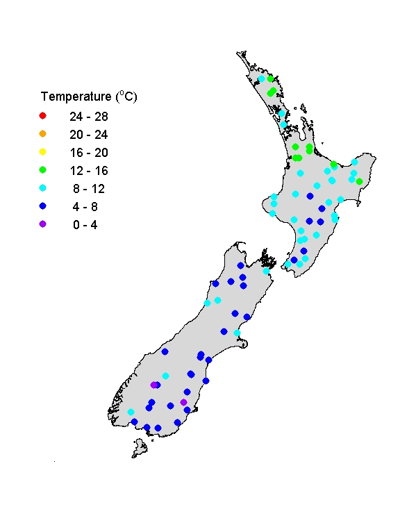
River Temperatures (JAS)
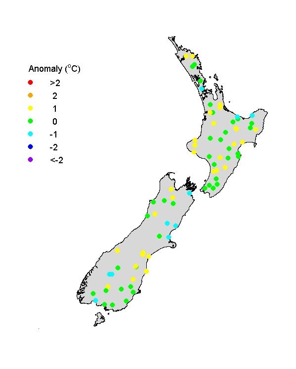
Winter river water temperatures were mostly in the range 0 to 16oC and, as typical, there were weak, but distinct, trends of decreasing temperature with increasing altitude (moving inland, particularly into mountainous areas) and increasing latitude (moving N to S). The temperature anomaly graph shows that river water temperatures were typical for winter at all sites, with no large anomalies either above or below normal.
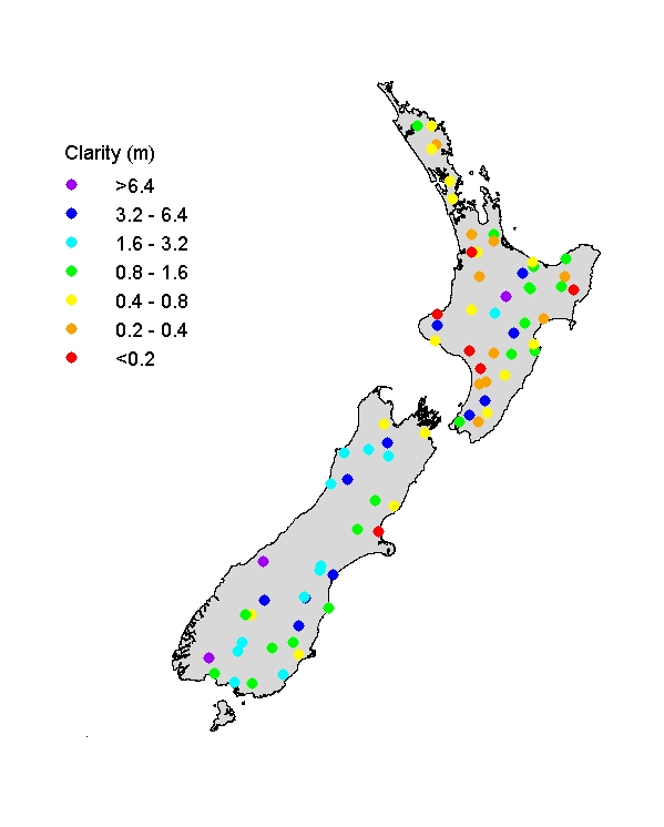
Visual clarity of rivers (JAS)
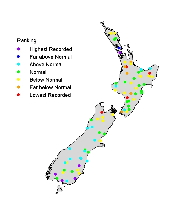
Visual clarity ranged widely, from <0.2m to >6 m, as is typical in New Zealand reflecting the country's diversity of soil types and erosion resistance of rocks interacting with land use patterns (rivers draining pastoral catchments tend to be less clear than in forested catchments). Rivers in the North Island, with generally softer rocks, more clay soils and more pastoral land use tend to be relatively 'turbid' (less clear) compared with those in the South Island – a pattern that was marked over the recent winter. Very low flows in several rivers in the far south of the South Island resulted in unusually high clarity. (Visual clarity is strongly inversely related to flow state in rivers.) However, some rivers in parts of the North Island (including Waikato Region rivers), also the lower Motueka R. in northern South Island, were unusually turbid.