-
Water quality monitoring and advice
More information about our water quality monitoring and advice services. -
Specialist analytical services
ServiceFind out more about our specialist analytical services. -

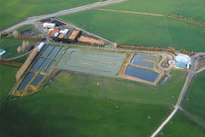
Impacts of meat and dairy processing
What are the impacts of meat and dairy processing activities on water quality and mahinga kai? -
Mitigation
Here are some simple steps to minimise the effects of riparian vegetation loss on water quality and mahinga kai. -
Mitigation
Simple steps to minimise the effects of chemical contamination on water quality and mahinga kai. -
Mitigation
Steps to minimise the effects of barriers and altered water flows on water quality and mahinga kai -
Mitigation
Here are some simple steps to minimise the effects of nutrient overloading on water quality and mahinga kai. -
Mitigation
Simple steps to minimise the effects of infectious substances on water quality and mahinga kai. -
Mitigation
Here are some simple steps to minimise the effects of sediment on water quality and mahinga kai. -
Mitigation and best practice options
Steps to minimise the effects on water quality and mahinga kai.