RV Tangaroa voyage update
Our team on board Tangaroa continues to survey around the Hunga Tonga - Hunga Ha’apai volcano (HT-HH), starting the day 25 km north-west of the volcano.
25 April 2022
We sampled along an erosion channel that was mapped in 2016, extending from the edge of the caldera to the north-east. Multibeam mapping showed this channel has been deepened since 2016, suggesting volcanic density currents flowed down the channel during the eruption. A rock dredge was deployed across the bottom of the channel and up one of the walls to sample the volcanic rocks present on site. This was followed by images captured using our Deep Towed Imaging System (DTIS), showing volcanic ash, rocky rubble and very little signs of life.
Tangaroa then positioned itself around to the south-east side of HT-HH, where another DTIS transect was completed along a line of small mounds and depressions radiating out from the caldera. The imagery showed the usual blanket of ash, but also large piles of volcanic rocks.
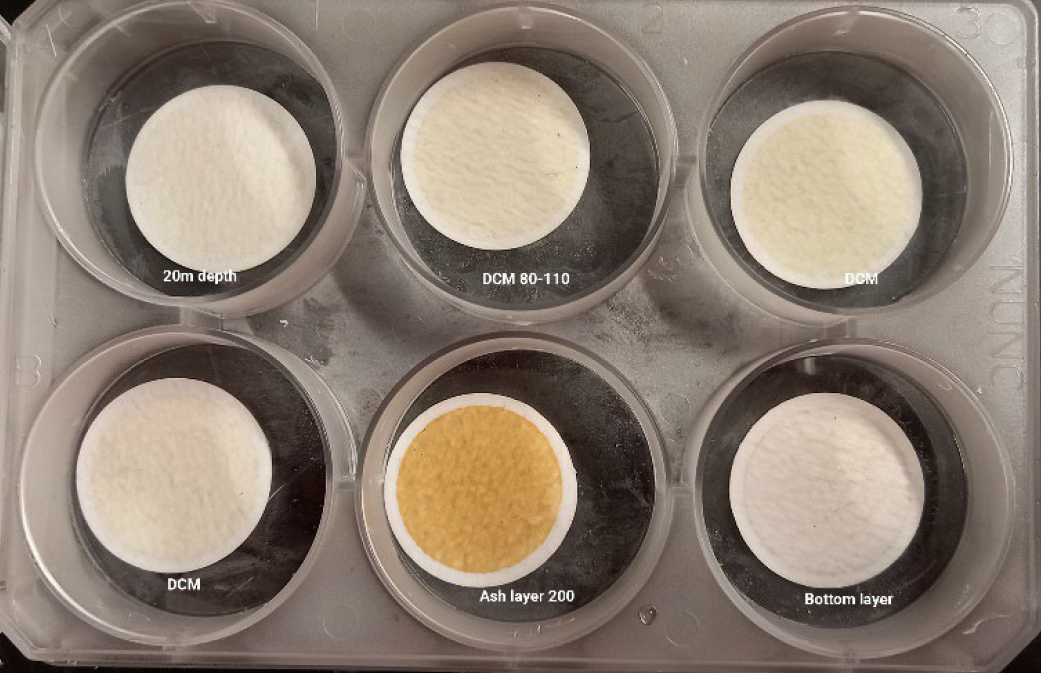
This site was also a perfect opportunity to collect more water samples and do a CTD (Conductivity Temperature Depth) profile of the water column. As with other sites, there was fine-grained ash still suspended in the sea water.
During the evening, we mapped the extent of sediment waves detected along the north-western flank of HT-HH out to deep water, while also completing another CTD and DTIS deployment in the area.