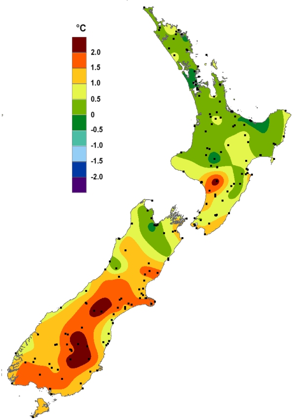
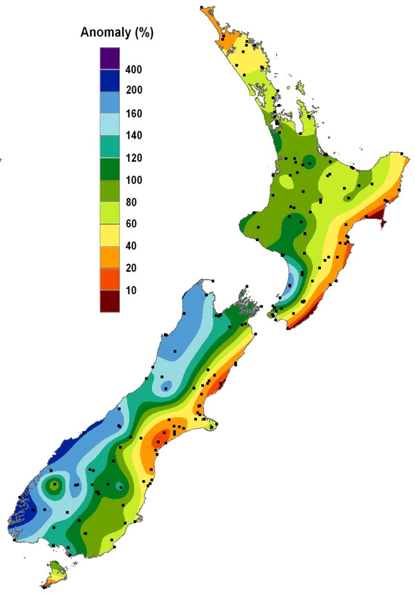
Mean sea level pressure was below normal to the southwest of New Zealand and above normal to the east and north of the country. This led to more northwesterly air flows than normal and allowed warmth from the sub-tropics to occasionally push down toward New Zealand. The pattern led to abundant rainfall across the western South Island, but very dry conditions occurred in the east of both islands which were shadowed by the Southern Alps and Central Plateau, respectively.
Temperature
Temperatures during the month of July were warmer than average for a large part of the country, especially in the South Island. Northwesterly air flows periodically carried warmth across the Tasman Sea from Australia, which warmed further as it descended the eastern slopes of the Southern Alps, with numerous near-record mean monthly temperatures recorded. Seven towns recorded their warmest July on record in terms of mean maximum (daytime) temperature. Compared to June, July also had more sunshine hours for many eastern areas; a welcome reprieve after a dreary start to the winter season and a pattern that supported anomalous warmth.
Rainfall
During July, there was a notable dichotomy of rainfall anomalies experienced in the South Island. Fiordland, the West Coast, and the Tasman District saw several very heavy rainfall events through the month, with nearly 200% of normal July rainfall recorded in some locations. To the contrary, several locations in northern Canterbury recorded less than 20% of the normal July rainfall, a pattern that carried across the Cook Strait and affected areas of Hawke’s Bay and Gisborne. Although the Coromandel Peninsula received one heavy, flooding rainfall event, July monthly rainfall totals were largely below normal.
Soil Moisture
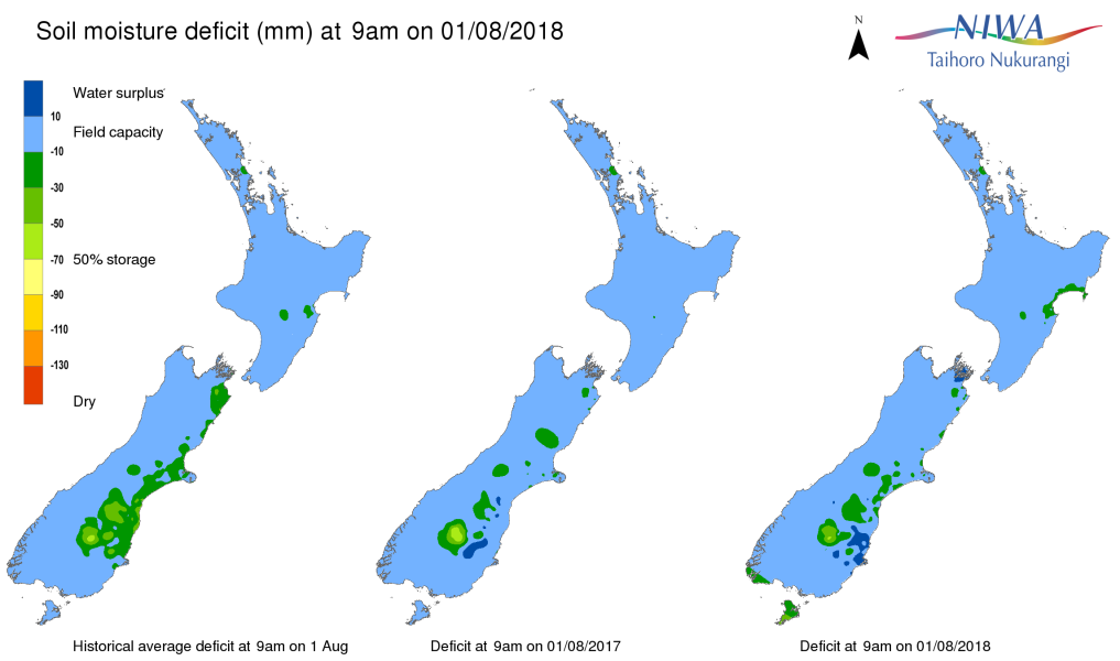
As of 1 August 2018, soil moisture levels were above normal for the time of year in northern Otago and southern Canterbury. Soil moisture levels were generally near or slightly above normal for the time of year across the rest of the country.


