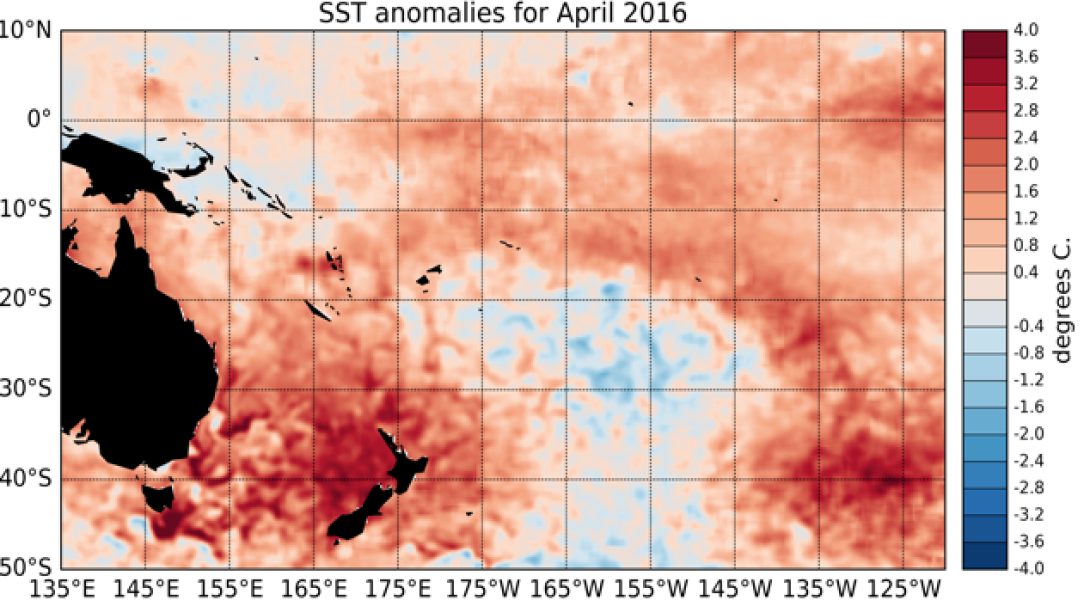
El Niño conditions eased in the tropical Pacific during April 2016, with sea surface temperatures (SSTs) now typically only about +1°C warmer than normal.
The latest monthly SST anomaly in the NINO3.4 region is +1.13°C, the NINO3 region (eastern Pacific: 90°W – 150°W) is currently at +1.10°C, and the NINO4 index (in the western Pacific) is at +0.83°C Moreover, cooler than normal sub-surface waters have spread eastward from the western Pacific, and temperatures are more than 3°C below normal between 50 and 100m depth east of 160°W. These changes in sub-surface temperatures mean the tropical Pacific is poised to make a rapid transition into La Niña conditions.
Enhanced convective activity and rainfall near and east of the Dateline has weakened in April 2016, and the strong westerly wind anomalies (weaker easterly trade-winds) that dominated the western and central Pacific earlier in the year have now almost dissipated. Conversely, the Southern Oscillation Index (SOI) actually intensified (more negative) during April and is now at about -1.8, compared to -0.4 for March as a whole. The South Pacific Convergence Zone (SPCZ) was more intense than normal in the south eastern Pacific. The ENSO Precipitation Index (ESPI) still indicates El Niño conditions with a value of +0.95 (value to the 4th of May 2016). The Madden-Julian Oscillation (MJO) was weak in the western Pacific over April as a whole. At the forecast horizon or 14 days, the CPC forecasts indicate overall low chances of increased intra-seasonal convective activity in the western Pacific.
International guidance indicates that neutral ENSO conditions are very likely (76% chance) over the next three month period (May – July 2016), as a whole. The likelihood of La Niña development increases into early spring, with a 52% chance over August – October 2016 (according to the IRI 21 April discussion), and the likelihood increases further in early summer (60% over November 2016 – January 2017).

