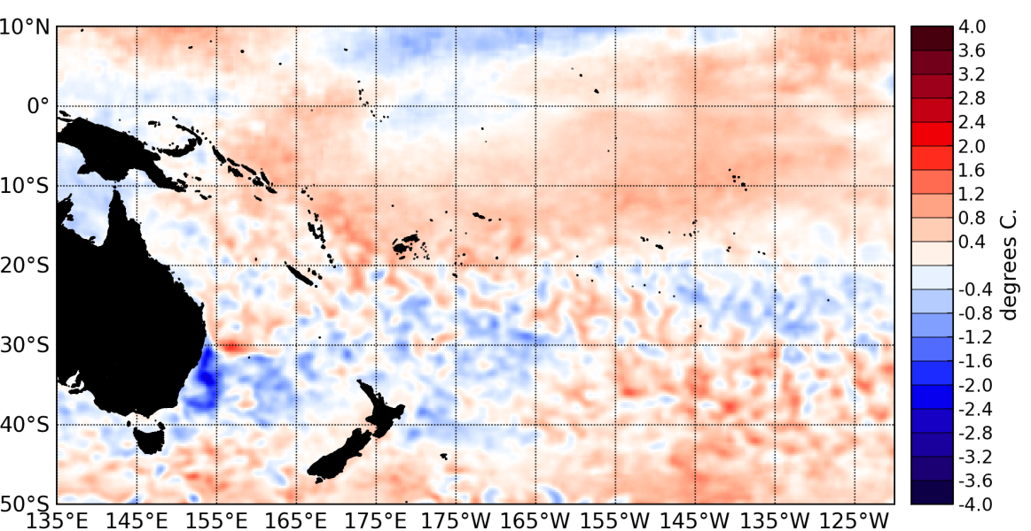
The equatorial Pacific ocean remains warmer than normal and in a borderline El Niño state, but the atmospheric conditions are close to neutral and are displaying anomalies atypical of El Niño.
Sea surface temperatures have dropped slighly over the last few weeks along the Equator. Heat content in the upper ocean (0 to 300 m) has recently changed from weakly positive to weakly negative in the central Pacific (~ 160 °W).
The TAO analyses also show less coherent and weakened subsurface temperature anomalies compared to August.
Surface westerly anomalies are present in the far equatorial western Pacific (~ 150 °E) but weakly negative (i.e. easterly) anomalies dominate the central and eastern Pacific.
Convection and rainfall are still anomalously high along the Equator west of the Dateline. The ITCZ and the SPCZ are both displaced south of their climatological positions and the SPCZ is now well organized compared to last month.
The latest value for the TRMM ENSO index for the 30 days to September 3rd is + 0.11 (i.e. neutral) and the monthly SOI for September is + 0.2, which is on La Niña side of neutral.
A Madden – Julian Oscillation (MJO) moved from the eastern Indian Ocean into the Maritime Continent in the last few weeks and is forecast to propagate eastward and strengthen over the next two weeks as it reaches the western Pacific. The MJO is expected to interact constructively with the westerly anomalies recently recorded in the western Pacific around 150 °E. This pattern has been associated with El Niño onset in the past.
Based on the climate models NIWA monitors, ENSO conditions are expected to remain neutral or transition towards El Niño. Even if El Niño develops during October – December, it is very likely to be a weak and short – lived event.

