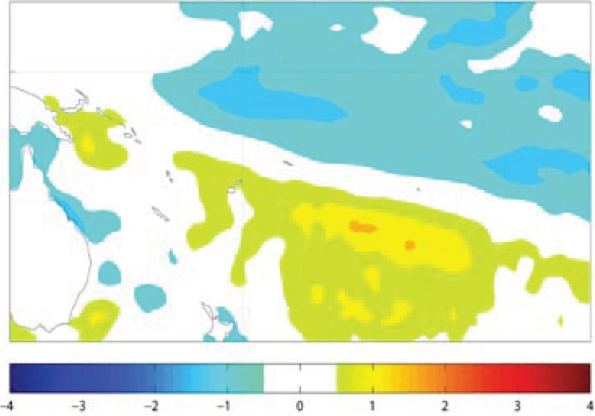
The tropical Pacific is moving back towards La Niñaconditions.. The SOI for September was +1.1, with the 3–month mean for JAS at +0.8. The NINO3 and NINO4 indices have become more negative, –0.4 °C and –0.2 °C respectively, although for the month as a whole are below the La Niña threshold. The 19 September CPC/NCEP ENSO summary states the latest weekly values of NINO3 and NINO4 were –0.7°C and –0.5°C. Subsurface temperature anomalies show a cold anomaly centred near 140°W, and a negative heat content anomaly (0–300m) that intensified in the central Pacific during September. In the extra-tropics, the remnant cool "horseshoe" from the previous La Niña (July 2010 – Apr 2011) is still evident.
The TRMM ENSO index was –0.5 for the 30 days to 25 August OLR anomalies are negative (enhanced convection) over and north of the Maritime Continent, and positive (suppressed convection) near the Date Line, south of the Equator. The Trades have strengthened near the Date Line, and the SPCZ is displaced southwest of its normal. An MJO pulse has been propagating across the Maritime Continent during September, and BoM's Weekly Tropical Climate Note (27-Sep) suggests the MJO is expected to remain weak as it propagates into the western Pacific, but the NCEP GFS ensemble suggests at least moderate strength MJO activity.
Seven of the 11 dynamical ENSO models NIWA monitor are now predicting La Niña conditions over the next 6 months. The NCEP ENSO discussion of 8 September states that "La Nina conditions have returned and are expected to gradually strengthen and continue" into the southern summer 2011-12. The IRI summary of 15 September agrees on a current (weak) La Niña being in place, and predicts a 52% probability for continuing La Niña during the September-November season, although a return to neutral conditions is still considered possible.

