NIWA’s recently commissioned autonomous hydroacoustic boat has been used to survey lakes for Auckland Council, including Lakes Rototoa and Tomarata. Hydroacoustic surveys provide detailed information about the underwater environment for lake management.
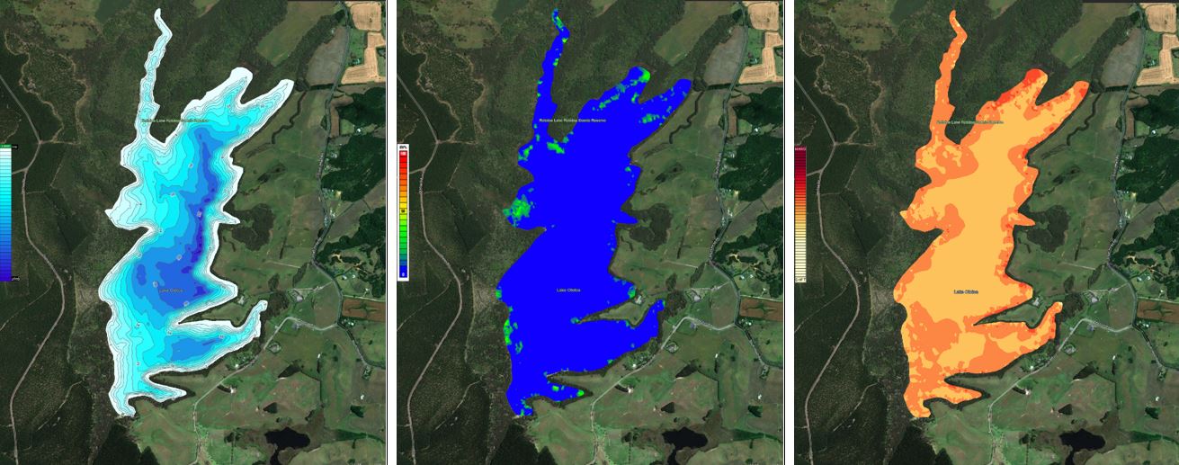
The hydroacoustic boat allows for the simultaneous acquisition of data on submerged aquatic vegetation, sediment type (hardness) and bathymetry, without time-consuming manual measurements.
Data from the surveys go to NIWA researchers for interpretation and provide to Auckland Council’s environmental team for developing management interventions
NIWA Freshwater Ecologist Dr Daniel Clements, says, “the development and implementation of this technology will allow submerged vegetation and the underwater environment of more lakes to be assessed more frequently, efficiently and precisely, which will help councils improve their lake management strategies”.
The survey data from Auckland lakes is intended to help to characterise lake conditions prior to the initiation of pest management interventions for introduced fish and aquatic weeds. Data from subsequent surveys will be used to assess the effectiveness of restoration and protection programmes and contribute to biosecurity monitoring and control activities.
Senior Biosecurity Advisor at Auckland City Council, Belinda Studholme, says, “the data will allow us to find opportunities to manage non-native fish. The maps will indicate where their preferred habitats are so we can design our control methods around these spots. It’s also assisting us in identifying hotspots for invasive weeds, so we can protect this precious environment for our native biodiversity.”
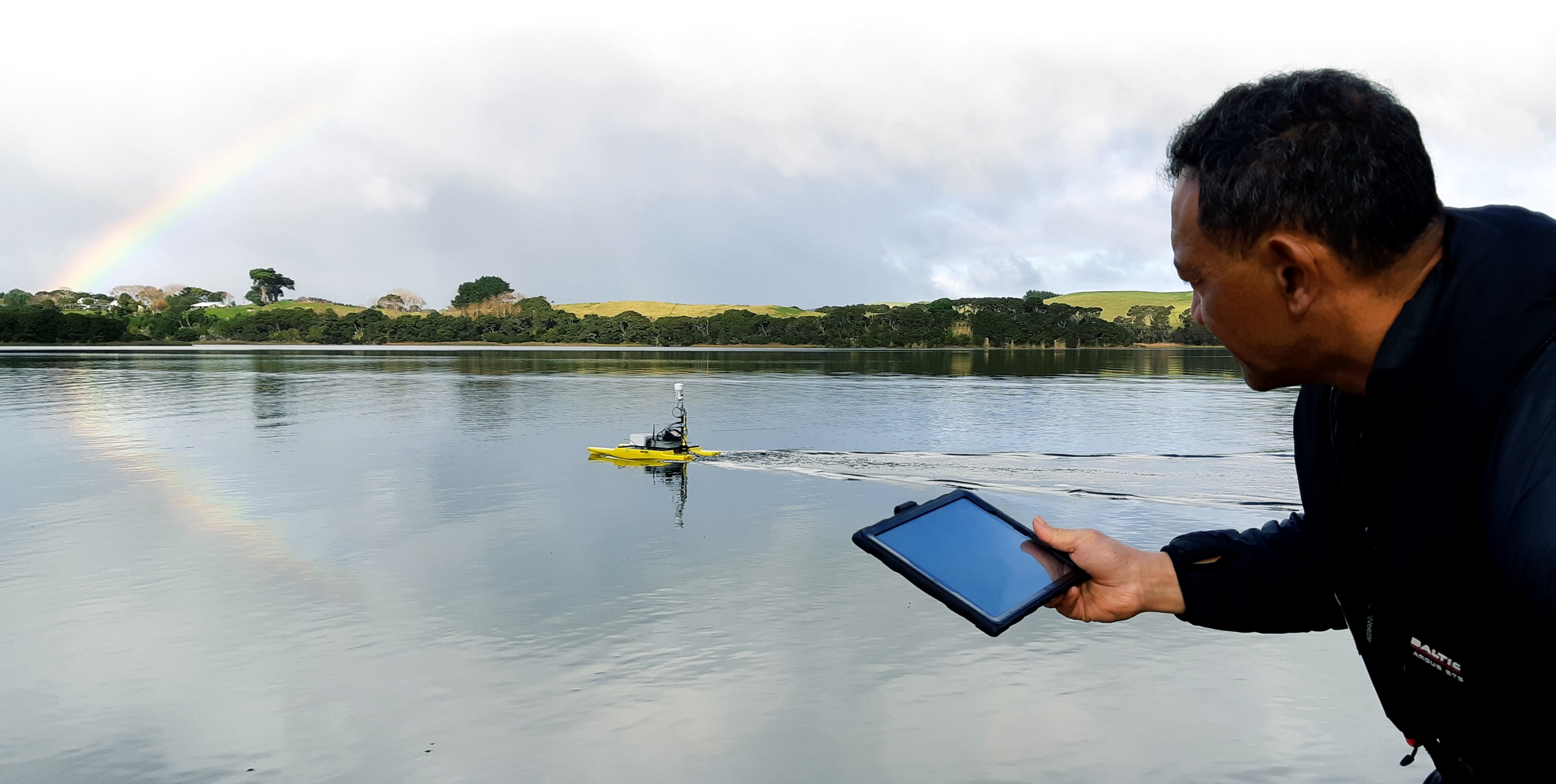
NIWAs aquatic biology technician Aleki Taumoepeau, says, “we can programme the best repeatable lake routes for the boat to follow and view live data on a tablet. Then it’s a case of making sure the boat doesn’t get fouled by weed or stuck in reeds at the lake edge.”
The incorporation of underwater imagery and automated detection algorithms into these surveys in the future will help to progress lake management.