
-
Climate change will cause more deaths from air pollution, study finds
Media release01 August 2017New research estimates that if climate change goes unchecked 60,000 more people will die globally from air pollution in 2030 – just 13 years away. -
So far, so stormy
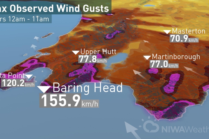
Media release13 July 2017Today’s low came spinning off the coast of Hawke’s Bay funneling strong winds through the Cook Strait and hitting Wellington region with strong winds before moving on to Taranaki and Auckland this afternoon. -

UVI smartphone apps
Several apps that provide forecasts of the UV index (UVI) are available for smartphones. -

'Eleven-station' series temperature data
Research ProjectTemperature trends from 1930s to present day -
West Coast
West Coast is New Zealand’s wettest region, and this may be attributed to its exposure to the predominant westerly airflow over the country, combined with the orographic effect of the Southern Alps. -
Climate data and activities
We provide an overview of New Zealand climate data for use in school projects. -
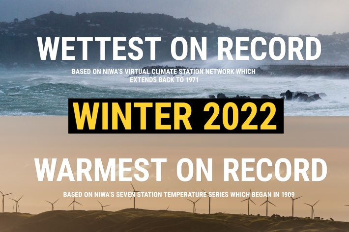
NZ's warmest and wettest winter on record
Media release06 June 2017NIWA’s climate scientists can now confirm what you may have suspected. After carefully poring through more than a century’s worth of data, it has been officially determined that winter 2022 was Aotearoa New Zealand’s warmest and wettest on record. -
Map Alpine
Education ResourceMountainous areas are subject to heavy snowfalls, high winds, and low temperatures. Semi-permanent snow and ice fields exist at about 1000-1100 metres during winter. -
How do we determine past climate?
Information about past climate is obtained from piecing evidence together from various sources. -
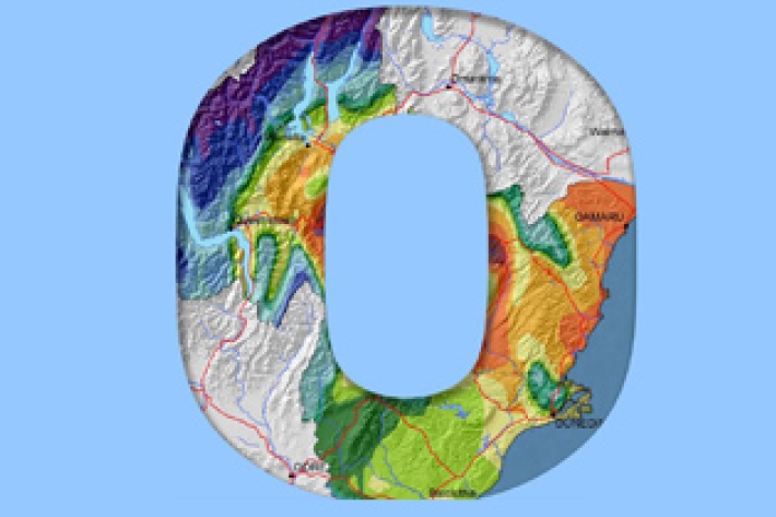
Otago
The climate of Otago is perhaps the most diverse of any region in New Zealand.