13 January 2019. By Voyage Leader Dr Richard O'Driscoll.
Five days into the Ross Sea Environment and Ecosystem Voyage 2019 on RV Tangaroa and we have officially entered Antarctic waters.
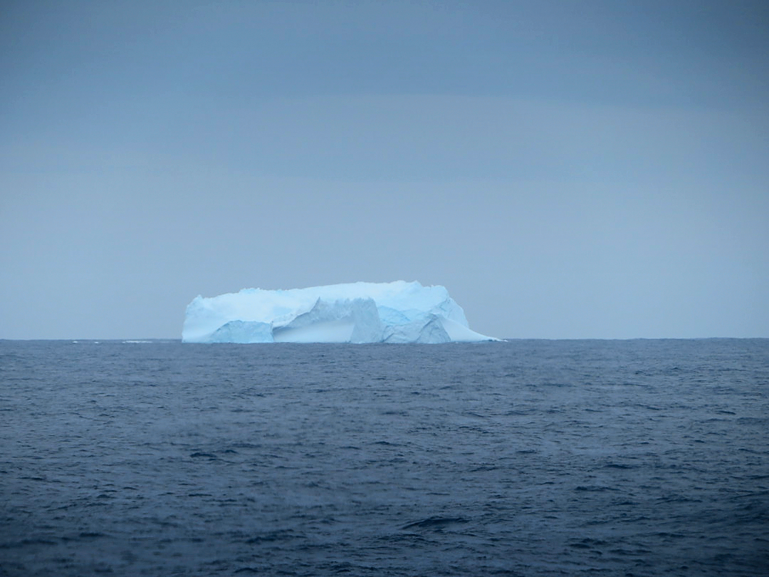
At 5:30 am this morning we passed 60 degrees south and notified the Commission for the Conservation of Antarctic Marine Living Resources (CCAMLR) of our arrival. Then, only a few hours later, the first iceberg of the trip was spotted on the horizon at 60 degrees 49 minutes south. The winner of the sweepstake for predicting the latitude of the first sighting was French PhD student Natalia Llopis Monferrer—who scooped the pool with the first iceberg she has ever seen!
To celebrate we had a lunchtime ceremony for those onboard who hadn’t come this far south before. Details are sworn to secrecy, but it provided light-hearted relief, especially for the few who have suffered sea-sickness as we pounded our way through 40 knot winds and 4-6 metre swells for the past 48 hours!
The science on the voyage began as soon as we left Wellington. During our transit south vessel crew and scientists have deployed three types of autonomous oceanographic drifter instruments: oceanographic profiling floats as part of the global Argo programme; wave measurement buoys for the New Zealand Defence Technology Agency (NZDTA), and meterological drifters for the New Zealand MetService as part of the Global Drifter Programme (GDP).
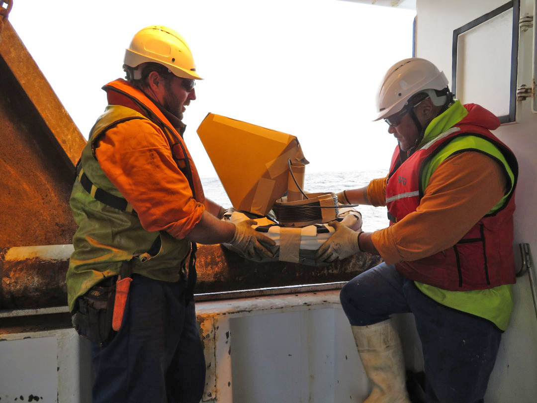
The Argo programme maintains about 3,500 individual floats world-wide, each of which collects oceanographic information during programmed descents and ascents through the water-column, routinely transmitting data to base stations via satellite. During this voyage we are contributing to international efforts to maintain global coverage of the oceans, by deploying 17 Argo floats south of 55 S—a region of the Southern Ocean that has limited coverage. All Argo data are freely available in near-real-time.
The 10 GDP drifter buoys we have (or will soon) deploy provide data on atmospheric pressure and sea-surface temperature. Because the Southern Ocean is so remote and is home to some of the most extreme marine conditions, gathering data in this region has historically proven difficult. Drifters deployed south of New Zealand are transported around the Southern Ocean by the Antarctic Circumpolar Current, making them one of the best sources of meteorological data for the region. In addition to the weather forecasting improvements, these buoys are key instruments in the detection of climate variability, as scientists also use them to measure ice flow/melt off the coast of Antarctica.
Wave buoys measure ocean waves. Increased understanding of waves in the area can help to improve vessel safety. We have already deployed 3 of the 4 wave buoys provided by NZDTA.We are also monitoring a suite of instruments that collect data on water properties while underway to help us better interpret satellite images of ocean colour. Remote sensing by satellites allows large area and long-term observation of the Southern Ocean. Ocean colour satellite sensors (e.g., SeaWiFS, MODIS) provide information on the plant- or phyto-plankton in the upper ocean. Understanding seasonal variation, spatial patterns, and long-term trends in oceanic phytoplankton production is an important part of ecosystem monitoring as this underpins the entire marine food-web.
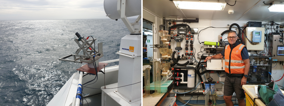
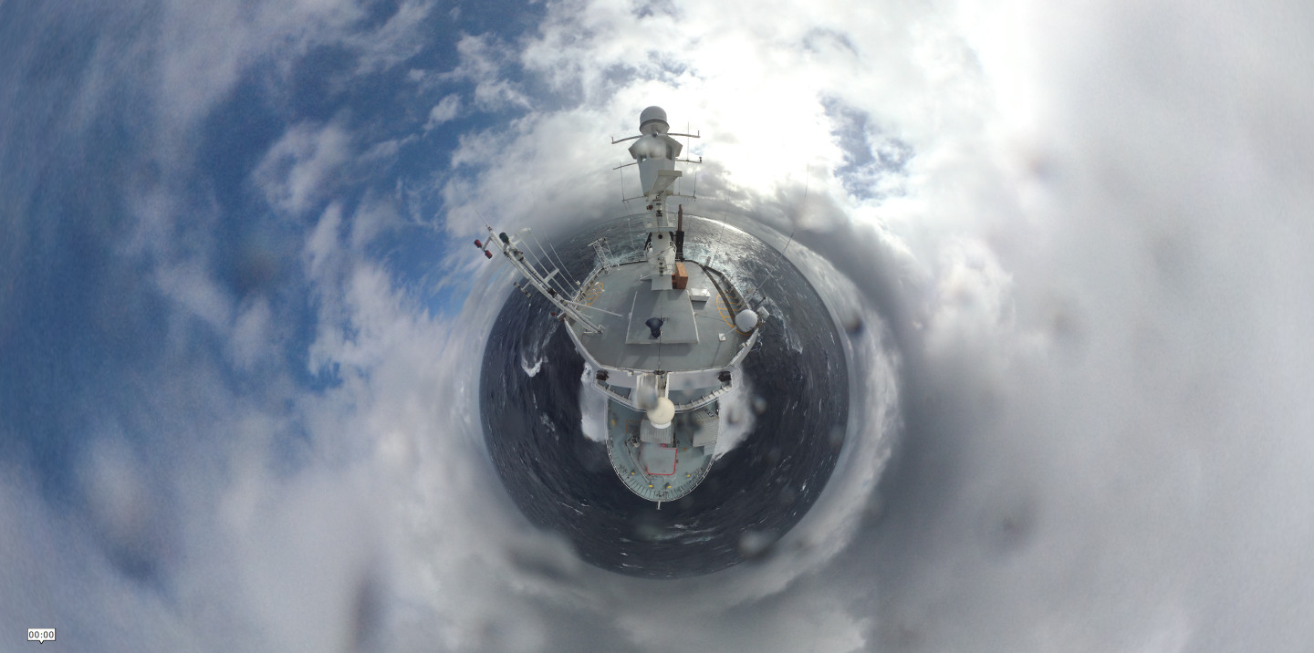
We have specially installed hyperspectral irradiance sensors to monitor sea surface colour throughout the voyage. A 360° camera on the “monkey island” above the Tangaroa bridge also provides total sky and sea conditions surrounding vessel (and a unique perspective on our surroundings). NIWA scientist Mark Gall is responsible for the colour sensors and is also collecting daily samples of phytoplankton from the underway flow through system to measure their bio-optical properties and help to “ground truth” the satellite data. In particular, we are investigating if different function groups of phytoplankton can be distinguished using satellite data.
We still have about 300 km left to go to get to the first of the seven moorings that we will retrieve and re-deploy during the voyage. Over the next week or so we will work south to Cape Adare picking up moorings as we go. I’ll talk more about what we hope to achieve with these moorings (and whether we have been able to successfully find the ones deployed last year!) in my next report.
Excitement onboard is ramping up now we are actually in Antarctic waters with icebergs on the horizon. We are looking forward to a busy research programme over the next 30 days or so before we have to head home.