NIWA completes development of New Zealand River Environment Classification


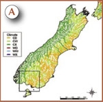
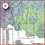
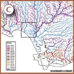
River Environment Classification for stream channels in an area of 125 km2 just northwest of Invercargill (A). Small coastal streams draining low-lying swampy areas (blue and purple) are distinguished from larger streams that drain larger areas of other landscapes. The classifications are derived from the other three maps at larger scales showing: climate zone (A ); source of flow (B); geology (C & D). [Graphics: Mark Weatherhead]
NIWA has completed the development of a New Zealand River Environment Classification (REC) system on behalf of the Ministry for the Environment (MfE). MfE launched the REC on World Water Day (22 March 2004) at a function in Wellington.
The REC groups rivers and parts of river systems at a range of spatial scales based on environmental attributes of the catchment as well as attributes of the valley that a river channel occupies. Characteristics such as flow regime, water quality, and biological communities of rivers are strongly determined by physical attributes. REC classes are, therefore, a useful way of subdividing rivers into units for management.
The REC is based on a controlling factor approach. A hierarchy of factors is used, each factor subdividing the preceding class into smaller classes. Classes at the first four levels are determined by the dominant climate, topography, geology, and land cover of a river’s catchment. The fifth level is based on the network position (stream order). The final level is determined by landform attributes of the valley a river section occupies.
The advantage of this type of controlling factor classification is that existing maps and other data can be used to map the classes. Maps of the REC have been developed at a scale of about 1:50 000. Maps appear as ‘linear mosaics’ because classes apply to individual sections of the river network. Because the first four levels are based on attributes of the upstream catchment, main stem rivers are often classified differently to local tributaries, reflecting the source of the river rather than the adjacent landscape.
The REC has undergone some testing and more is being planned. Qualitative testing indicates that hydrological and water chemistry data are well partitioned by REC classes. Quantitative statistical tests of the REC indicate that the system explains up to 55% of macro-invertebrate community variation between sample sites, a very good result for inherently ‘noisy’ biological data.
In conjunction with regional councils, NIWA has also completed various case studies using the REC as a ‘spatial framework’ for broad scale environmental assessment. Such assessments are intended to support regional plan preparation and state of environment reporting. The case studies included use of REC for water quality assessment, water quantity planning, and national and regional state of environment assessment and reporting.
NIWA is currently developing a user manual for the REC on behalf of MfE. A final release of the REC as GIS data and software and the manual is planned for later this year. Further information on the REC can be found at www.niwa.co.nz/ncwr/tools
Ton Snelder [[email protected]]
