15 August 2013
Riverflow maps April to June 2013
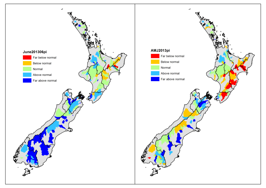
The June map shows the effects of snow in the south, some large NW events in the Southern Alps, and rain events in Nelson, Marlborough and Wellington.
The April – June map shows that the longer term drought effects persist in the eastern North Island, and are slowly fading in the Southern Alps, whereas the eastern and northern South Island have become wetter than normal for the time of year.

