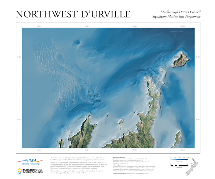
In May 2015 a joint mapping initiative between Marlborough District Council and NIWA was undertaken using NIWA’s high resolution multibeam echo-sounder to reveal the shape and depth of the seafloor off Rangitoto ki te Tonga/D’Urville Island. This survey acquired close to one hundred square kilometres of multibeam bathymetry consisting of over 200 million soundings, is located within the wider Cook Strait region, and shaped by dynamic climatic, oceanographic and tectonic processes. Published in 2015, the poster is approximately 42 cm x 60 cm. $30 (plus $5 for overseas orders).