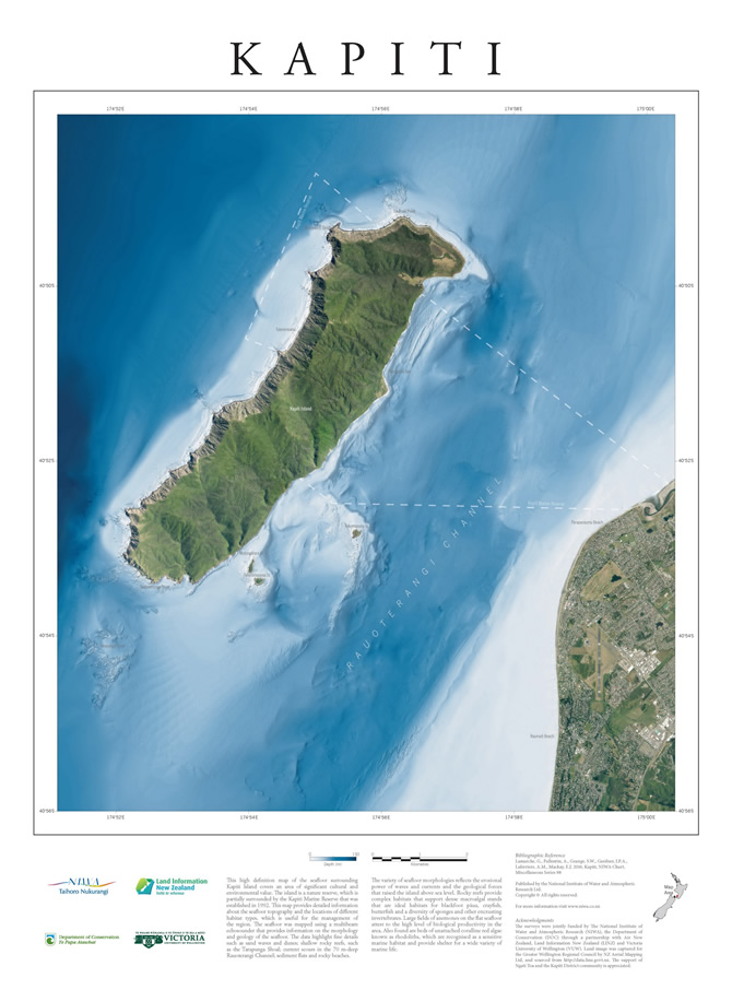
This high definition map of the seafloor surrounding Kapiti Island covers an area of significant cultural and environmental value. This map provides detailed information about the seafloor topography and the locations of different habitat types, which is useful for the management of the region. The seafloor was mapped using a multibeam echosounder that provides information on the morphology and geology of the seafloor. Published in 2017, the poster is approximately 42 cm x 60 cm. $30 (plus $5 for overseas orders).