Written by Ngāpera Keegan, NIWA Māori Graduate Intern, Tekiteora Rolleston-Gabel, NIWA Māori Graduate Intern, and Darren Ngaru King, Pou Hononga – Climate, Atmosphere and Hazards
On this page:
Download a shorter version of this lesson in PowerPoint or as a PDF or continue below to see the lesson in full.
This lesson will explore the use of Māori environmental indicators [tohu] to anticipate local weather and climate conditions. You will learn about some widely known tohu around Aotearoa-New Zealand, drawing upon recent research alongside Māori knowledge holders from the North and South Islands.
In this lesson you will:
- keep a diary observing local tohu and weather conditions in your local area
- look for patterns and/or sequences in events that potentially link changes in biophysical phenomena such as the behaviour of bird life, animals and insects, to changes in local weather conditions.
Note for teachers: Learning to anticipate local weather and climate conditions by fostering greater awareness of the natural world and the inherent linkages between atmospheric and biophysical phenomena is a key outcome sought by this lesson.
What are tohu?
Tohu are environmental indicators developed and used by Māori to signal, monitor and forecast changes in the natural environment.
These indicators help us make judgements about the health of wildlife, the time for planting and harvesting, and the management of risks such as crossing seas and local rivers. Many of the tohu used by Māori are closely aligned with changes in local weather and climate conditions.
The use of tohu comes from Te Ao Māori (the Māori world) principles that all things are connected through whakapapa (genealogy). These whakapapa connections in the environment reveal much about what’s happening in our skies.
How were tohu developed?
Tohu were developed through close interactions with local environments and processes over time. Māori learned and developed a detailed knowledge of the links between the natural environment and changing weather conditions based on careful observations of daily, monthly and seasonal conditions.
These observations included the behaviour of certain birds, the blooming of certain trees and flowers, and the movement of certain stars.
For example, according to iwi from Te Wai Pounamu (the South Island) the appearance of an arch of dark clouds above the Southern Alps indicates forthcoming southerly weather conditions.
How are tohu used?
There are two key things to remember when looking for tohu.
Firstly, tohu are specific to a certain place or area. Each hapū and iwi developed tohu based on observations that are specific to their local environments.
For example, the shape of the plume of Whakaari/White Island is used by Te Whānau-ā-Apanui to indicate rainfall or extreme weather conditions. When you are looking for tohu it is important to be aware that a tohu used in one area may not be effective in another.
Secondly, a single tohu is rarely used on its own. To forecast the weather more than one tohu are usually used.
Multiple tohu used together can sometimes signal different expected outcomes. When this happens, forecasts are usually made based on what the majority of the tohu indicate.
However, in some cases there may be a known tohu that strongly indicates a particular outcome specific to that area. In this case the forecast will be made based on that one known tohu.
What are some examples of tohu?
There are lots of different tohu used by many hapū and iwi throughout Aotearoa-New Zealand. Here’s a selection of some of these tohu used to forecast both the weather and climate conditions.
Sources: King et al. 2007; Skipper et al. 2018.
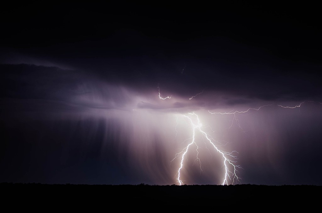
Kōhara (Lightning)
Indicator: Lightning flickering above the horizon.
Expected outcome: The side on which the flashes are strongest signal the direction from which the wind will come.
Iwi/Region: Kāi Tahu - E South Island
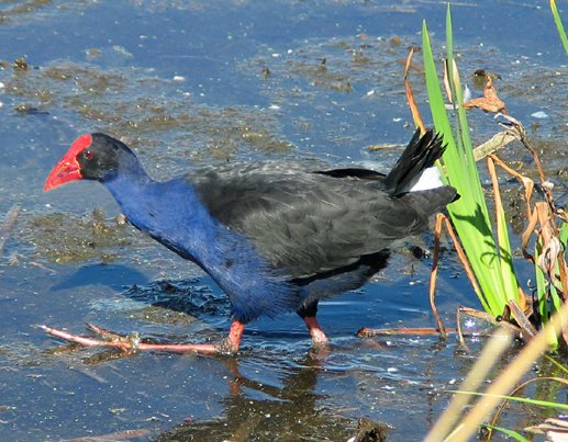
Pūkeko (Swamp hen)
Indicator: Pūkeko head for higher ground.
Expected outcome: Imminent storm and flooding.
Iwi/Region: Ngāti Wai - NE North Island
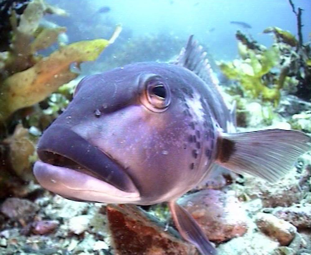
Rāwaru (Blue cod)
Indicator: Stones in the belly of the fish.
Expected outcome: Bad weather is coming.
Iwi/Region: Ngāti Koata - N South Island
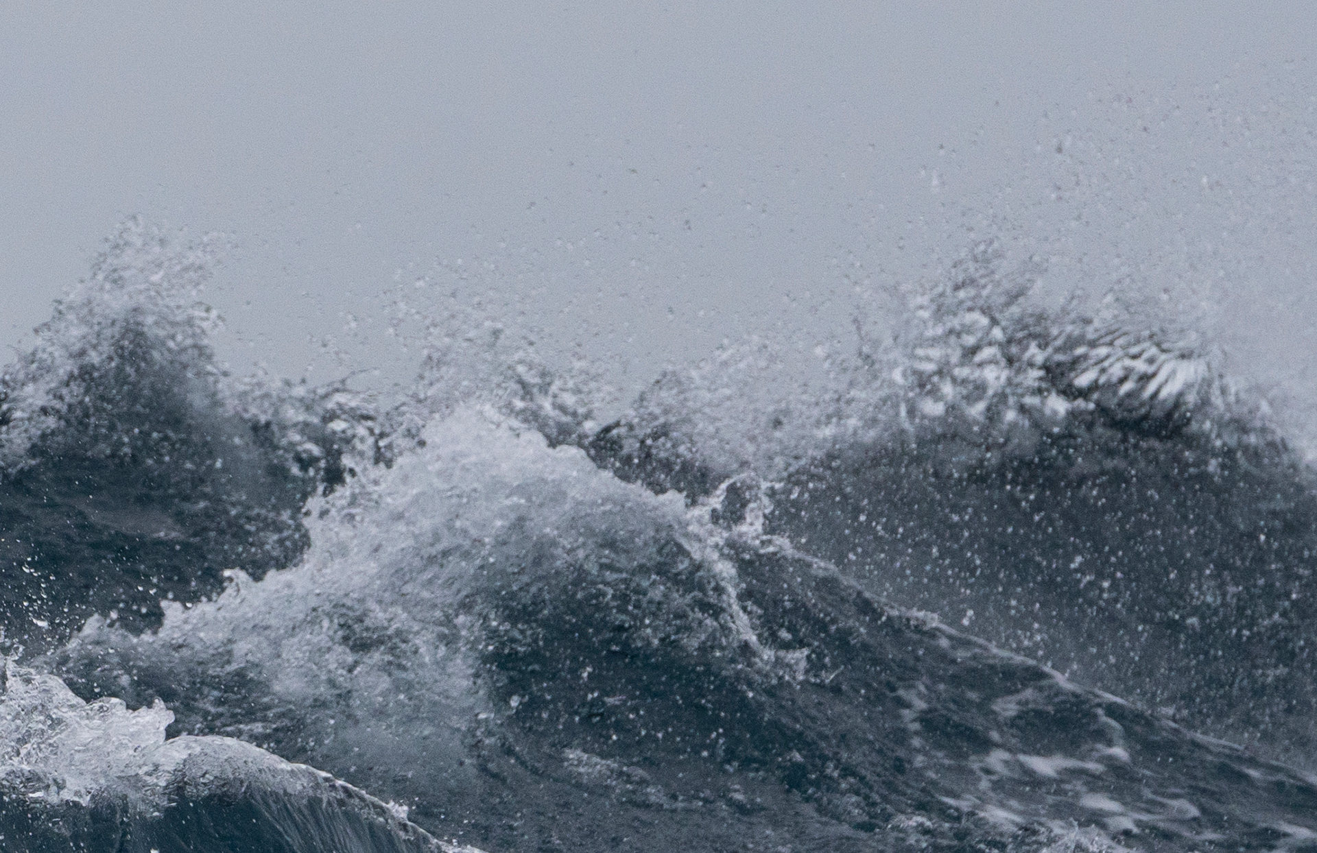
Ocean waves
Indicator: The sound of breaking waves up the valley.
Expected outcome: Approaching rainfall and inclement weather is expected.
Iwi/Region: Te Roroa - NW North Island
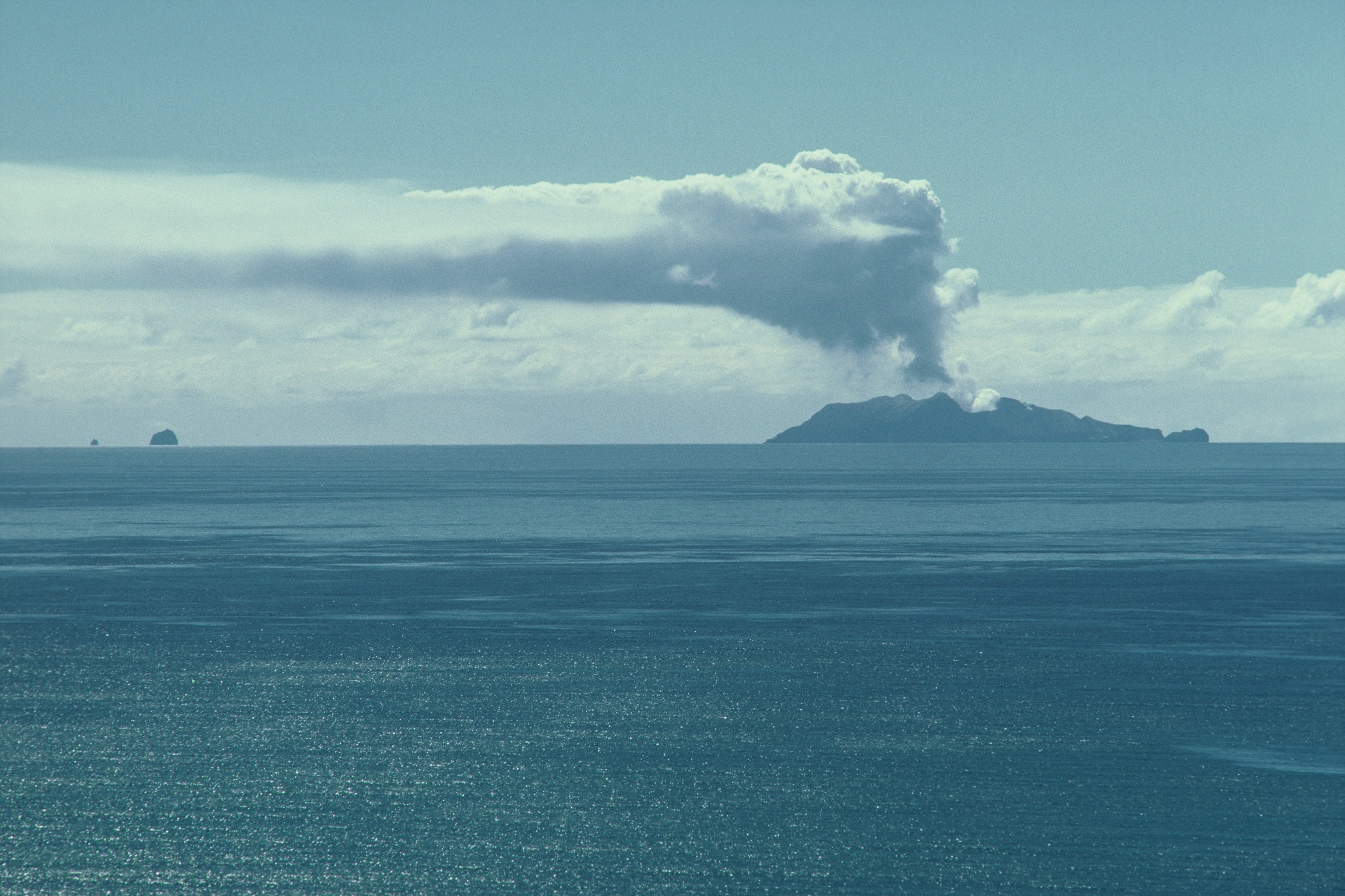
Whakaari (White Island)
Indicator:
- The plume lies to the left
- The plume flattens, and the end breaks off.
Expected outcome:
- Rainfall is expected
- Watch out, extreme weather is expected.
Iwi/Region: Te Whānau-a-Apanui - E North Island
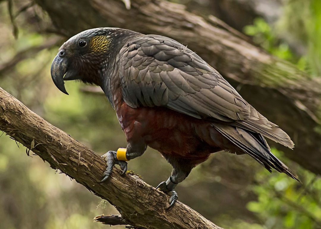
Kākā (Native parrot)
Indicator: Kākā begin acting up, twisting and squawking above the forest.
Expected outcome: A storm is on its way.
Iwi/Region: Ngāti Pare - NE North Island
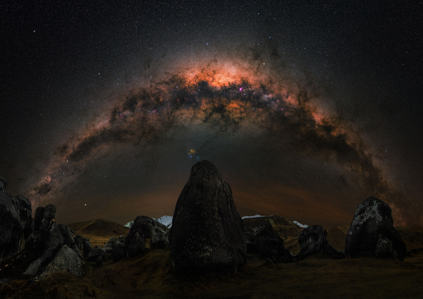
Mangoroa (Milky way)
Indicator:
- Mangoroa is curved.
- Mangoroa is straight.
Expected outcome:
- Bad weather is expected.
- Fine weather is expected.
Iwi/Region: Kāi Tahu - E South Island
Video – tohu huarere (weather indicators)
The following video shows practitioners from across Te Wai Pounamu describing tohu huarere (weather indicators) in their local environment.
Activity – keep your own daily diary
Keeping a daily diary is an easy and useful way to record your weather observations. You can use it to look for links between changes in the weather and responses in the environment, such as the sound of breaking waves or the behaviour of birds and insects.
We recommend you keep a diary of weather conditions in your local area for at least two weeks. Each time you make an entry, record:
- when and where you make the observation (i.e. the date, time, and location)
- the weather conditions
- any changes you see in the natural environment.
You can either select one tohu to focus on or observe more generally the conditions around you. The most important thing is that you make an entry every day. Over time, you can use your diary to look for patterns that might link changes in weather to tohu in the environment. At the end of two weeks it is important to take time to reflect on your observations and make an entry on the potential patterns identified. This may be the starting point for further exploration of the topic.
How you create and maintain your diary is up to you – have fun with it! Here are some ideas to get you started:
Visual diary
You could take daily pictures of the weather and any tohu to use as evidence for your observations. Be sure to also make notes and include anything that the photo cannot capture, like the wind blowing or other sounds you can hear. You can use these photos to compare changes in weather over time.
Written diary
You could keep a written diary where you describe your observations each day. There are lots of different types of written diaries including journals, a table you can fill out each day, or you could even include drawings and sketches of the tohu or the weather.
Video diary
You may want to create a video diary. Instead of writing your observations, you could record your observations and talk about them to the camera. You could then combine all of your daily recordings into a single video.
Quiz – Ngā Tohu o te Taiao
- What are tohu?
- What is an example of a weather tohu? What does it indicate and who uses it?
- What are the two key things to remember when looking for tohu?
Glossary
- Hapū: Sub-tribe
- Iwi: Tribe
- Te Ao Māori: The Māori world
- Te Ika a Māui: The North Island
- Te Wai Pounamu: The South Island
- Tohu: Indicator or sign
- Whakapapa: Genealogy, relationships between people or things.