
Neutral El Niño/Southern Oscillation (ENSO) conditions are likely to give an average chance of tropical cyclone activity for most tropical South Pacific countries over coming months. Communities should remain alert and prepared.
For the coming tropical cyclone season, from November 2008 – May 2009, we are likely to see a normal risk of occurrence over much of the South Pacific. A reduced risk of tropical cyclones is likely in parts of French Polynesia east of the Date Line.
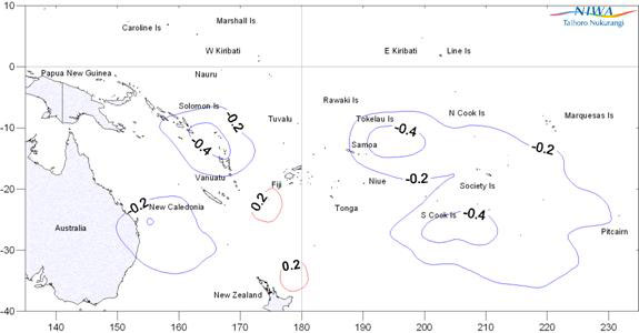
Climate forecasting organisations in the Pacific are in general agreement that neutral ENSO conditions are likely to persist from spring into summer in the Southern Hemisphere. As a result, the likelihood is for a normal risk of tropical cyclones. There is a good chance that the first tropical cyclone of the coming season in the South Pacific region may occur before the end of December, which is normal during neutral seasons. On average eight to ten tropical cyclones can be expected over the entire South Pacific region during a neutral ENSO season.
In the South Pacific, tropical cyclones usually develop in the wet season, from November through April, but occasionally occur in October and May. Peak cyclone occurrence is usually from January to March. In seasons with similar climate backgrounds, several tropical cyclones usually occur in the region between Vanuatu, New Caledonia, Fiji, and Tonga, while a few affect other areas. In an average season about half of the tropical cyclones that develop reach hurricane force with mean wind speeds of at least 64 knots (118 km/h).
For New Zealand, the neutral ENSO conditions increases the risk of experiencing an ex-tropical cyclone. There is just over a 4 out of 5 chance of an ex-tropical cyclone passing within 500 km of the country sometime between November and May, with the highest risk districts being Northland and Gisborne. By the time such systems reach New Zealand they are no longer classified as tropical cyclones, but can still cause strong winds and heavy rainfall. The most common months for ex-tropical cyclones to affect New Zealand are January to March.
South Pacific tropical cyclones are grouped into classes ranging from 1 to 5, with 5 being the most dangerous. In an average season, four are likely to reach class 4 with mean wind speeds of at least 64 knots or 118 km/h, and one to two, class 5, with mean speeds in excess of 90 knots or 167 km/h.
For further information:
In the Pacific islands – contact your local Meteorological Service.
In New Zealand – contact: Dr Jim Salinger, NIWA, Auckland
Tel: + 64 9 375 2053 (Bus) or + 64 27 521 9468 (mobile)
Acknowledgements
This tropical cyclone information has been prepared as a collaborative effort between NIWA and Meteorological Services around the Pacific. It has been prepared based on contributions and climate information received from the Meteorological Services of Australia (Bureau of Meteorology), Cook Islands, Fiji, French Polynesia, Kiribati, New Caledonia, Niue, Papua New Guinea, New Zealand (Meteorological Service of NZ), Samoa, Solomon Islands Tonga, Tuvalu, Vanuatu and in the United States National Oceanic and Atmospheric Administration (NOAA) and the International Research Institute for Climate and Society (IRI).
Summary of last tropical cyclone season
There were five tropical cyclones in the Southwest Pacific (east of 150 °E) during the 2007–08 season, 4 less than the average (based on figures from the previous 30 years). The first tropical cyclone of the season occurred on 13 November, slightly earlier than normal. The season also finished unusually early with the last one in late January/early February. The table below details the tropical cyclones during the 2007–08 season.
| Name | Origin | Period of occurrence | Estimated maximum sustained wind speed (km/hr) | Classification |
|---|---|---|---|---|
| Guba | Papua New Guinea | 13-19 Nov. | 139 | Hurricane |
| Daman | NE of Rotuma, Fiji | 5-9 Dec. | 185 (925 hPa) | Major hurricane |
| Elisa | SW of Nukualofa, Tonga | 10-11 Jan. | 93 (980hPa | Tropical storm |
| Funa | West of Northern Vanuatu | 16-19 Jan. | 176 (930hPa) | Major hurricane |
| Gene | NE of Fiji | 27 Jan – 1 Feb. | 157 (945hPa) | Major hurricane |
Average and outlook for the full season: November to May
The following table shows the average number of tropical cyclones passing within 5º (550 km circle) of the main island groups of the South Pacific over the full November through May period. (Based on 37 seasons of data, and for tropical cyclones having mean wind speeds over 34 knots*)
| Area | Average over all years | Average over neutral - weak La Niña seasons | Comment |
|---|---|---|---|
| Vanuatu | 3.0 | 2.8 | Average risk |
| New Caledonia | 2.6 | 2.7 | Average risk |
| Fiji | 2.4 | 2.5 | Average risk |
| Tonga | 2.0 | 2.1 | Average risk |
| Wallis & Futuna | 1.9 | 1.8 | Average risk |
| Niue | 1.8 | 1.8 | Average risk |
| Southern Cook Islands | 1.5 | 1.3 | Average risk |
| Tuvalu | 1.2 | 1.1 | Average risk |
| Northern New Zealand | 0.9 | 1.0 | Average risk |
| Tokelau | 0.8 | 0.6 | Average risk |
| Society Islands/Tahiti | 0.8 | 0.6 | Average risk |
| Samoa | 1.6 | 1.3 | Variable risk – uncertain |
| Solomon Islands | 1.4 | 1.0 | Average risk |
| Austral Islands | 0.8 | 0.5 | Average risk |
| Northern Cook Islands | 0.8 | 0.4 | Reduced risk |
| Tuamotu Islands | 0.4 | 0.1 | Reduced risk |
| Pitcairn Island | 0.3 | 0.1 | Cyclones unlikely |
| Marquesas | 0.1 | 0.0 | Cyclones unlikely |
| Western Kiribati | 0.0 | 0.0 | Cyclones unlikely |
| Eastern Kiribati | 0.0 | 0.0 | Cyclones unlikely |
* For the South Pacific, a tropical cyclone is a tropical low-pressure system intense enough to produce sustained gale force winds (at least 34 knots or 63 km/h). A “severe tropical cyclone” produces sustained hurricane force winds (at least 64 knots or 118 km/h).
In the French language, the term “Cyclone tropical” refers to the hurricane phase (64 knots or 118 km per hour or more) but the Island Climate Update publication follows the English language definition of “Tropical cyclone” as defined in the World Meteorological Organisation Tropical Cyclone Operational Plan for the South Pacific and South-East Indian Ocean as follows “A non-frontal low pressure system of synoptic scale developing over warm tropical waters and having a definite organised wind circulation with maximum 10-minute average wind speed of 34 knots (63 km per hour i.e. gale force) or greater nearer the centre”.