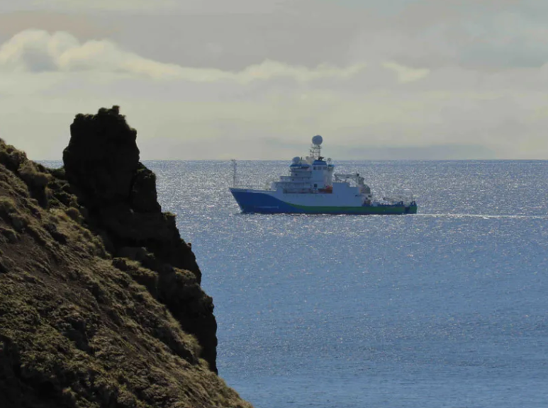
RV Tangaroa heads to the Macquarie Ridge to collect scientific instruments.
Key voyage information
- Voyage duration: 10 November 2021 - 2 December 2021
- Vessel: RV Tangaroa
- Destination: Macquarie Ridge, The Southern Ocean
- Partners & institutions:
- Research School of Earth Sciences/Australian National University (RSES/ANU)
- University of Tasmania (UTAS)
- University of Cambridge
- California Institute of Technology (Caltech)
- Grant of sea time: Commonwealth Scientific and Industrial Research Organisation/Marine National Facility (CSIRO/MNF).
- Research grants:
- The Australian Research Council
- Natural Environment Research Council
- In-kind and other support:
- Research Facilities for Earth Sounding ANSIR – AuScope
- Geoscience Australia,
- Tasmania Parks and Wildlife Services
- ANU
- UTAS
- Cambridge
- Caltech
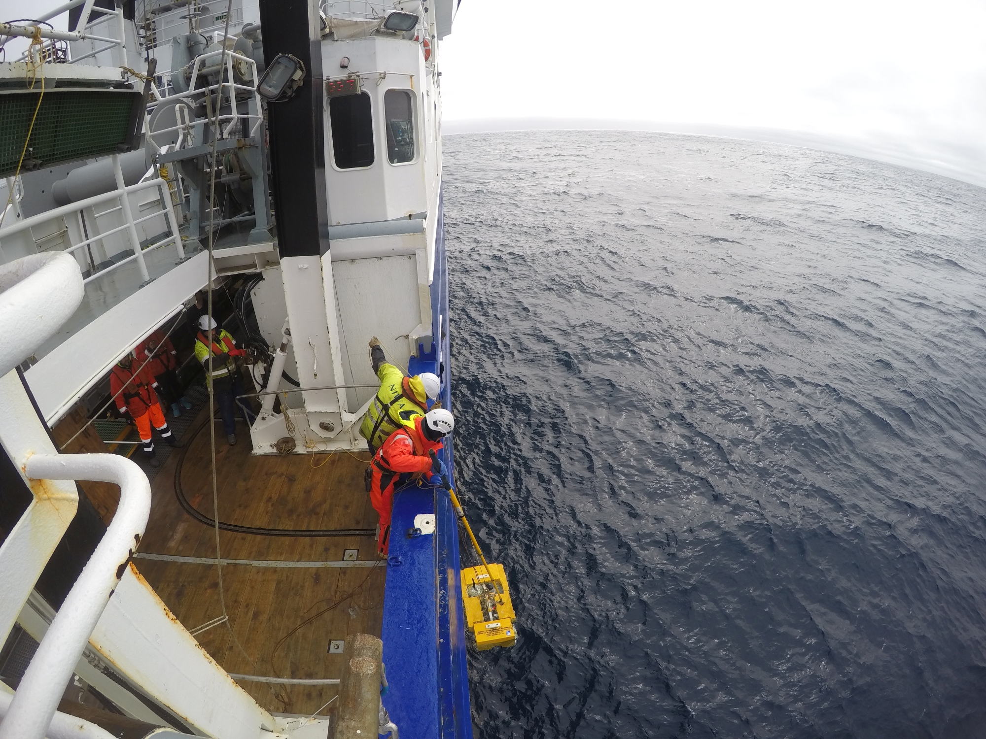
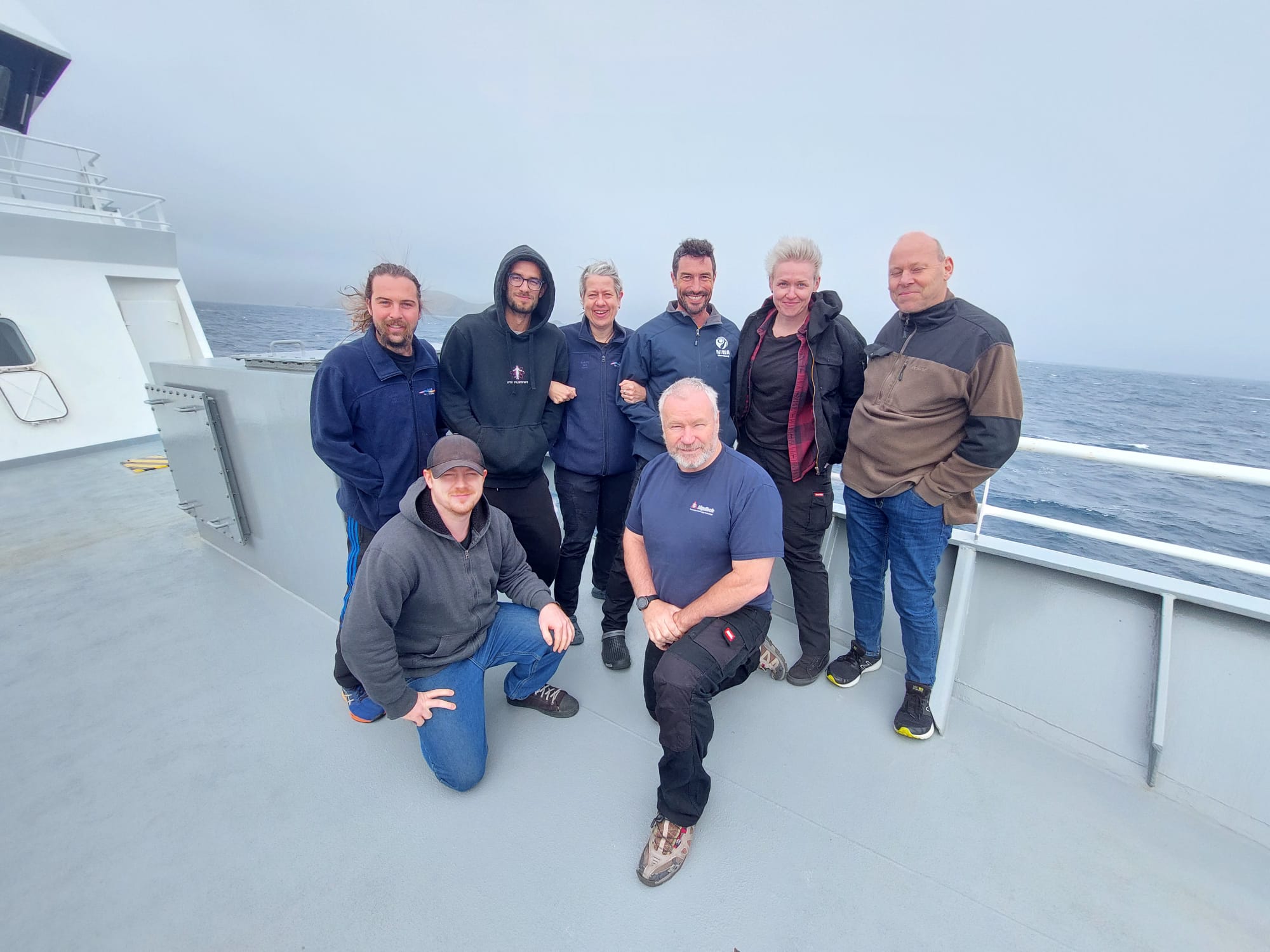
Australia’s CSIRO (Commonwealth Scientific and Industrial Research Organisation), operator of the Marine National Facility (MNF) has contracted NIWA’s RV Tangaroa to complete a project started in 2020 at the Macquarie Ridge Complex by CSIRO research vessel (RV) Investigator. NIWA crew and technical staff are executing the voyage objectives in the field while 24/7 technical discussions and voyage decisions are provided remotely by the science team on shore, with support from the MNF.
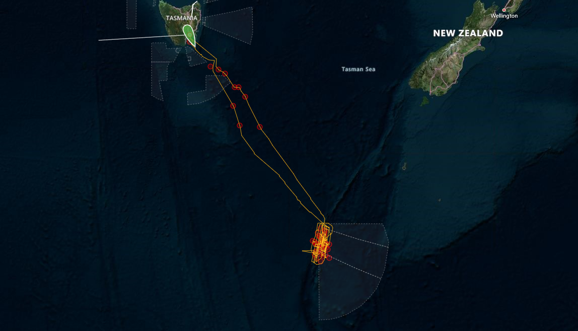
Last year, the team on board RV Investigator successfully deployed 27 seismometers in tough waters, mainly at the base of the steepest mountain on the planet - the Macquarie Ridge in the Southern Ocean. Indeed, the steepness of the Macquarie Ridge slopes from the floor to the summit (the tip of the Macquarie Island) exceeds that of Mt Everest, Aconcagua or Denali. The team published a story dedicated to the first voyage at https://eos.org/features/deploying-a-submarine-seismic-observatory-in-the-furious-fifties
In the meantime, five more seismometers were deployed on Macquarie Island itself, supported by the Geoscience Australia and the Australian Antarctic Division. Together with the instruments sitting on the ocean floor, they form the Macquarie Ridge Array, a giant telescope pointing to the Earth’s centre. More about this is written in a story here: https://www.antarctica.gov.au/news/2021/shaking-up-earthquake-science-on-macquarie-island
This multi-million investment is an international collaboration led by the Australian National University (ANU) and the University of Tasmania (UTAS), supported by a grant of sea time from the CSIRO Marine National Facility, the Australian Research Council, UK’s Natural Environment Research Council, Research Facilities for Earth Sounding ANSIR - AuScope, Geoscience Australia, the Australian Antarctic Division, Tasmania Parks and Wildlife Service, and in-kind support from ANU, UTAS, the University of Cambridge and California Institute of Technology. The project aims to elucidate the processes behind some of the largest intraoceanic earthquakes of the 20th and 21st centuries.
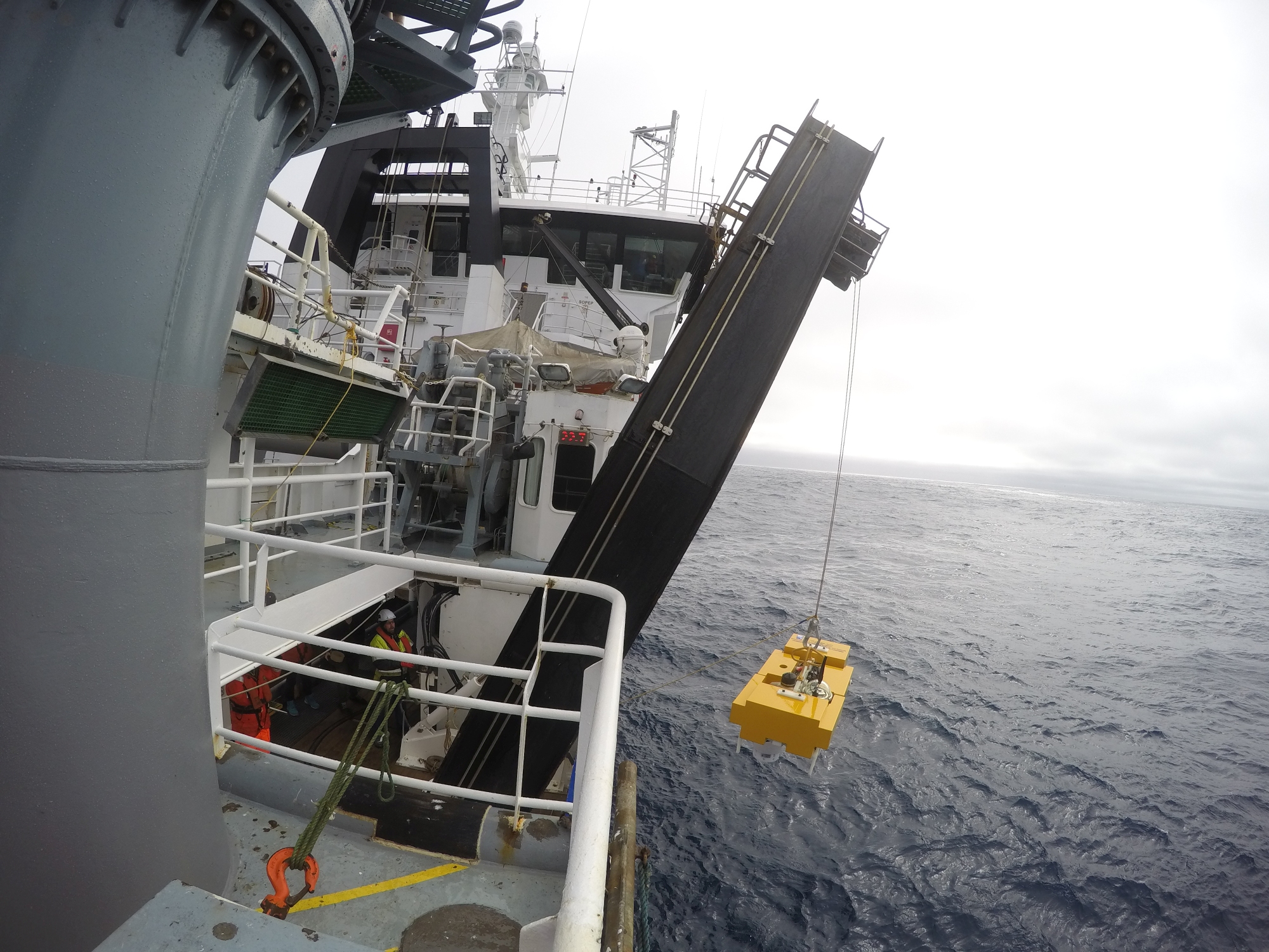
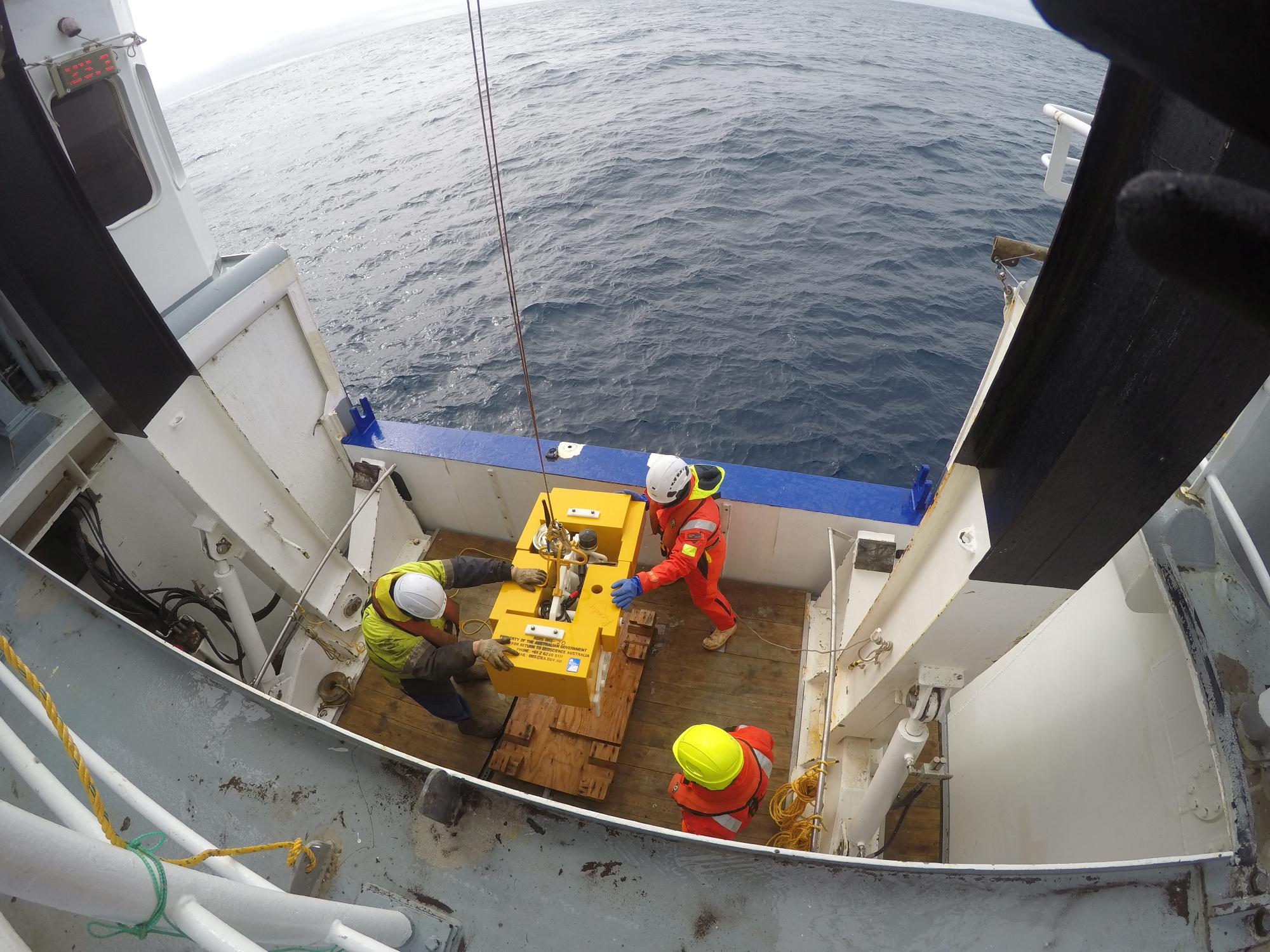
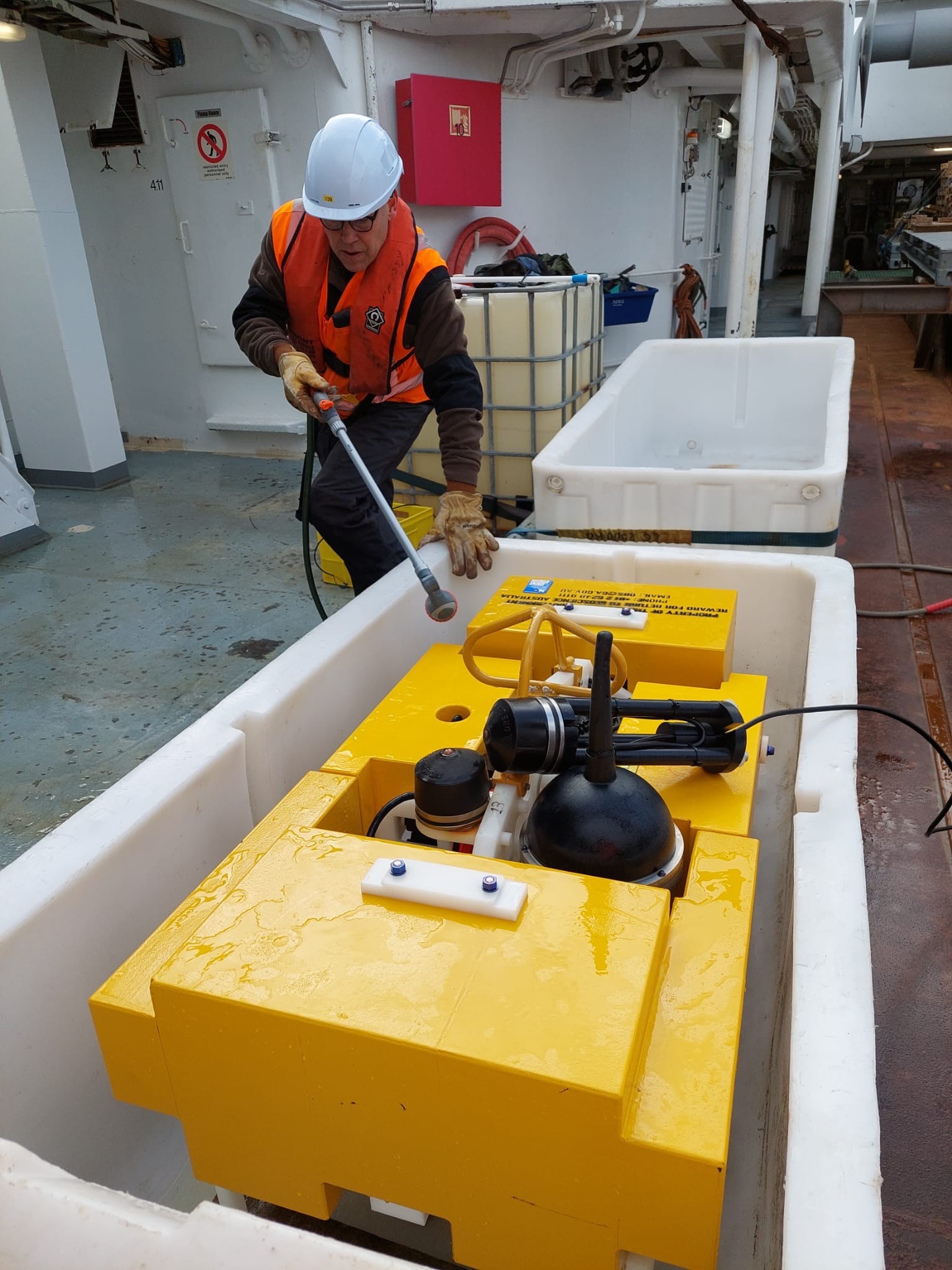
The primary scientific objective of the project, which is being led by the Australian National University (ANU), is to acquire, analyse, and interpret newly collected passive seismological data in the Macquarie Ridge Complex area using 27 Ocean Bottom Seismometers (OBSs) deployed in October 2020. Multibeam sonar and sub‐bottom profile data will also be collected, to increase the high-quality seafloor mapping of the area and supplement the dataset acquired by RV Investigator voyage IN2020_V06 https://data.csiro.au/collection/csiro:53960
The project data will allow scientists to characterise the 3‐D structure of the oceanic crust and sub‐crustal lithosphere along the Macquarie Ridge Complex using novel lithospheric seismic imaging. Scientists will then be able to better understand the structural, thermal, and compositional nature of the area and identify anomalies in the crust and mantle, analyse the source of past and present earthquakes and determine their submarine landslides and tsunamigenic potential. It will also allow scientists to peak deep inside the Earth’s interior and study its structure and dynamics as deep as the core and lowermost mantle. A carefully designed Macquarie Ridge Array will allow monitoring regional and distant earthquakes, ambient noise, storms, and processes related to the interaction between the solid Earth, ocean and atmosphere.
More information about CSIRO and MNF
CSIRO, the Commonwealth Scientific and Industrial Research Organisation, is Australia’s national science agency. It manages MNF, the Marine National Facility to provide Australia with a dedicated blue-water research facility. The MNF is funded by the Australian Government and operated by CSIRO on behalf of the nation.

Research project contacts
- Professor Hrvoje Tkalčić, ANU - Chief Scientist
- Professor Mike Coffin, UTAS - Alternate Chief Scientist and Chief Investigator
- Dr Caroline Eakin, ANU - Chief Investigator
- Professor Nicholas Rawlinson, Cambridge - Chief Investigator
- Professor Joann Stock, Caltech - Chief Investigator
