NIWA meteorologists say last week’s atmospheric river (AR), which was responsible for widespread devastation in both the North and South Islands, was a record-breaker.
The AR, a huge plume of moisture from the tropics, was New Zealand’s strongest ever for August since records began in 1959.
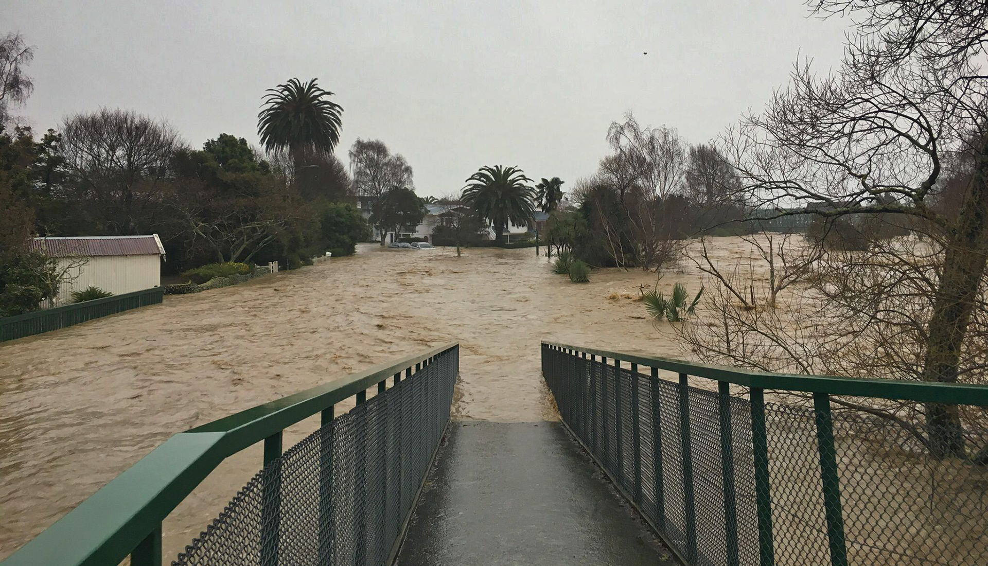
NIWA meteorologist Ben Noll says it was also the second strongest for winter as a whole (June-August), pipped to the post only by an AR in July 1998. Last week’s AR which caused widespread flooding and devastating slips was responsible for a 1 in 120-year rainfall event in Nelson and one third of Tākaka’s annual rainfall in three days.
ARs are measured by integrated water vapour transport (IVT) values, which have been ranked around New Zealand for every hour since 1959.
IVT indicates an AR’s magnitude by calculating the amount and flow of moisture in the atmosphere, both of which are crucial to the occurrence of heavy rainfall. IVT values above 1250 kg m -1 s -1 are considered "exceptional".
Mr Noll said that last week’s AR greatly exceeded that threshold, with the top value in the New Zealand region reaching 1749 kg m-1 s-1.
"ARs are a normal feature of New Zealand’s climate. However, this analysis demonstrates that the flood-inducing AR was extremely unusual for the time of year, being both long-lasting and very moisture-laden. Atmospheric moisture was the highest it’s ever been in August’s climate data, going back to 1959," Mr Noll said.
The New Zealand region usually sees its moistest AR events in summer, not winter. In fact, August is usually the annual minimum for regional water vapour content.
"It was a perfect storm of climate drivers that contributed to this AR, including La Niña, a negative Indian Ocean Dipole, warmer than average sea water in the Southwest Pacific, and a subsequent synoptic (weather) set up that fostered a long-lived atmospheric river, including a blocking high pressure system to our east," Mr Noll said.
Climate Scientist Peter Gibson said that climate change could have a big influence on the future strength of ARs and their resulting weather impacts.
"A warmer atmosphere can hold more water vapour, so it’s likely that New Zealand will see more intense ARs as climate change continues. The challenging part will be figuring out precisely which locations will see the biggest increases.
"Other elements that impact their occurrence and strength include blocking areas of high pressure to the east of the country, which can lock an AR in place for several days," Dr Gibson said.
"Extreme precipitation from ARs is already being enhanced by climate change in New Zealand. Research is ongoing at NIWA to understand how these conditions may change in the future."

August maximum integrated water vapour transport (kg m-1 s-1) in the New Zealand region (1959-2022)
Date |
Rank |
Max IVT |
| 17/08/2022 | 1 | 1749 |
| 18/08/2022 | 2 | 1533 |
| 7/08/2010 | 3 | 1509 |
| 3/08/1990 | 4 | 1504 |
| 9/08/1992 | 5 | 1445 |
| 25/08/1988 | 6 | 1418 |
| 4/08/1990 | 7 | 1397 |
| 7/08/1990 | 8 | 1390 |
| 24/08/1988 | 9 | 1386 |
| 6/08/1991 | 10 | 1344 |