New Zealand’s marine domain is more than 21 times the area of our land, and that is a huge area to look after. However, a NIWA research project testing new approaches to measuring water quality has found that specialist optical sensors mounted on drones that detect the play of light on water can be used to measure and map large areas of shallow water habitat.
Scientists experimentally deployed drones over the Goat Island Marine Reserve (Leigh, north of Auckland) and found that it is possible to determine water quality without even getting your feet wet.
Principal Scientist Matt Pinkerton says the team used two high-resolution 360° cameras, as well as a multi-band camera and a hyperspectral spectroradiometer, to map the angular distribution of light from the sky and from the sea, as well as a multi-band camera and a hyperspectral spectroradiometer.
“We used modelling to investigate different ways of correcting for light reflected from the water surface in order to measure radiance leaving the water.
“In deep water, this water-leaving radiance signal provides information on coloured material in the water (like suspended sediment and algal blooms). In shallow water, it provides information on the type of life-supporting seabed habitat,” says Pinkerton.
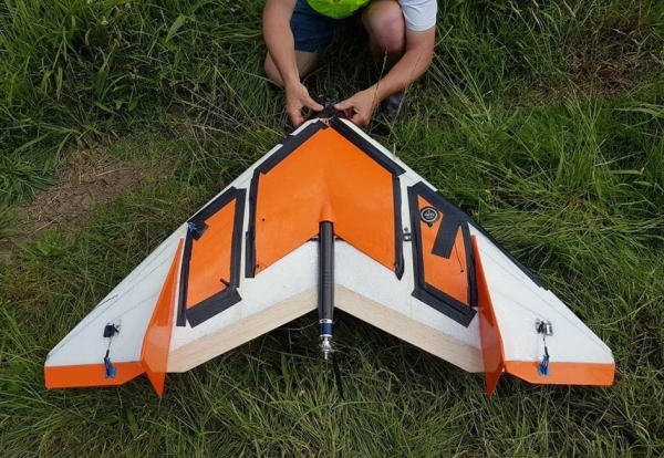
He notes that this is the first time a 360° sensor has been deployed on a fixed-wing drone.
“Fixed-wing (rather than multi-copter) platforms potentially provide a rapid and cost-effective way of mapping water quality and shallow-water habitats over large areas.”
Funding for the research was provided by a Royal Society New Zealand Catalyst Fund grant. The research was carried out with a drone specialist company, X-Craft Enterprises Ltd.


