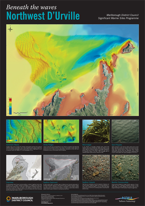
The Marlborough District Council recently identified a number of significant marine sites including 60 km2 of seafloor northwest of Rangitoto ki te Tonga/D’Urville Island and Stephens Island (Takapourewa). In May 2015 a high-resolution multibeam echosounder was used to reveal the shape and depth of the seafloor off D’Urville Island. These new data reveal large sefloor depressions, nearshore rocky reefs, fields of sediment waves, and emergent ridges that protrude above the seafloor. Published in 2015, the poster is approximately 60 cm x 85 cm. $30 (plus $5 for overseas orders).