The issue
Braided rivers naturally flood frequently, repeatedly mobilising their bed sediments and shifting their multiple channels.
The frequent adjustment of braided rivers results in a mosaic of physical habitats that supports high biodiversity, and their bare gravel islands provide vital habitat for a number of rare and threatened endemic bird species. River bed vegetation combats these adjustments with vegetation roots binding bed sediments, hindering erosion and reducing the supply of bed sediments. This vegetation encourages island growth and stability, changes the local topography and corrals flow hindering braiding.
The more strongly rooted the vegetation is the harder it is for floods to remove it and so the result in the river depends on the balance between the frequency of floods and the rates of vegetation growth. Water abstraction (for irrigation and hydropower development) typically reduces the average flood frequency in a river. This, along with the arrival of more and more fast growing invasive woody weeds (e.g., willow, gorse, broom, lupin, false tamarisk), means that in many cases vegetation has gained the upper hand and braided rivers are gradually becoming less braided.
The approach
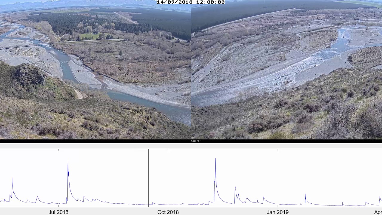
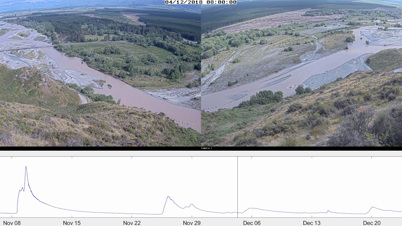
In 2018 NIWA installed two surveillance cameras overlooking a study reach in the Hurunui River (see videos below). The purpose of these cameras was to monitor the growth and removal of riverbed vegetation following floods. The cameras were installed at the Balmoral Fire Lookout, a public conservation area managed by the Department of Conservation (DOC). DOC approved NIWA installing these cameras so that they could also use them to monitor an island in our study reach that could provide ‘engineered’ (i.e., vegetation manually removed) bird habitat. The cameras will remain in their position overlooking the Hurunui River to view any geomorphic change occuring in that reach.
Next steps
NIWA research on river bed vegetation is continuing, focusing on developing remote sensing approaches and analysis techniques to efficiently identify nuisance species and quantify changes in cover over time