Fine sediment is NZ’s most widespread contaminant, degrading ecosystems and impairing recreational, cultural and aesthetic values in our rivers, estuaries, and coastal seas. NIWA’s Managing Mud research programme is focused on this issue. It is exploring the sources, characteristics, dynamics, and fate of fine sediment in NZ’s rivers and estuaries. The aim is to provide land and water managers with knowledge, methods, and tools to improve environmental and cultural values in waterways impacted by sediment.
River bank erosion is a key source of fine sediment in NZ’s rivers and estuaries. However, traditional methods of measuring bank erosion have struggled to accurately capture volumes of erosion at a reach scale, making it difficult to quantify the relative contribution of bank sediment to the system. Typically, bank erosion has been monitored using cross section surveys or erosion pins, but these methods miss bank changes between cross sections.
The recent development of Terrestrial Laser Scanners (TLS) has transformed our ability to capture high resolution and high precision measurements of bank erosion. However, TLS operate from a fixed location and the length of bank that can be scanned from a single set up is limited. Also, this method uses a single laser, which provides a single view of the bank. This means that the bank can often be obscured by vegetation. Recent advances in mobile laser scanners show potential to transform our ability to measure bank erosion.
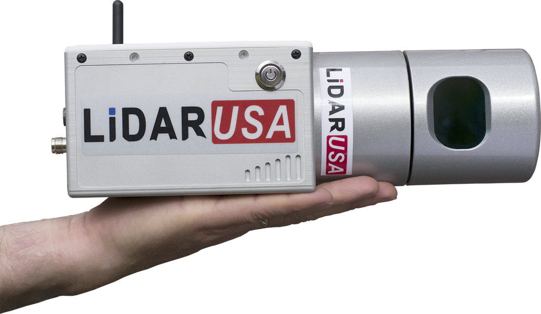
NIWA’s LiDAR USA Scanlook 2.0 mobile mapping system (Snoopy) is a miniaturised LiDAR scanner integrated with GPS and an inertial reference unit. This means that the scanner can collect high precision, high resolution data on the move. The scanner’s array of 32 lasers span a 40-degree field-of-view, which minimises shadowing effects caused by vegetation and other physical obstacles. It is ideally suited for rapidly surveying dry areas of river channels, and its small size and weight allow deployment on a range of platforms (e.g., 4WD vehicle, backpack, jet-boat, Unmanned Aerial Vehicle).
NIWA has recently used Snoopy to scan a 5.8 km study reach of the Oreti River in Southland. The Oreti study reach has widespread bank erosion and is being developed as a monitoring site with a range of instruments measuring flow, suspended sediment concentration and suspended sediment particle size distribution. The intention is to use the suspended sediment data along with measured volumes of bank erosion to develop a sediment budget for the reach, improving understanding of the dynamics and relative sources of fine sediment.
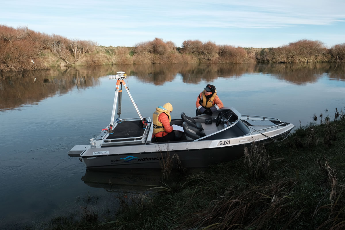
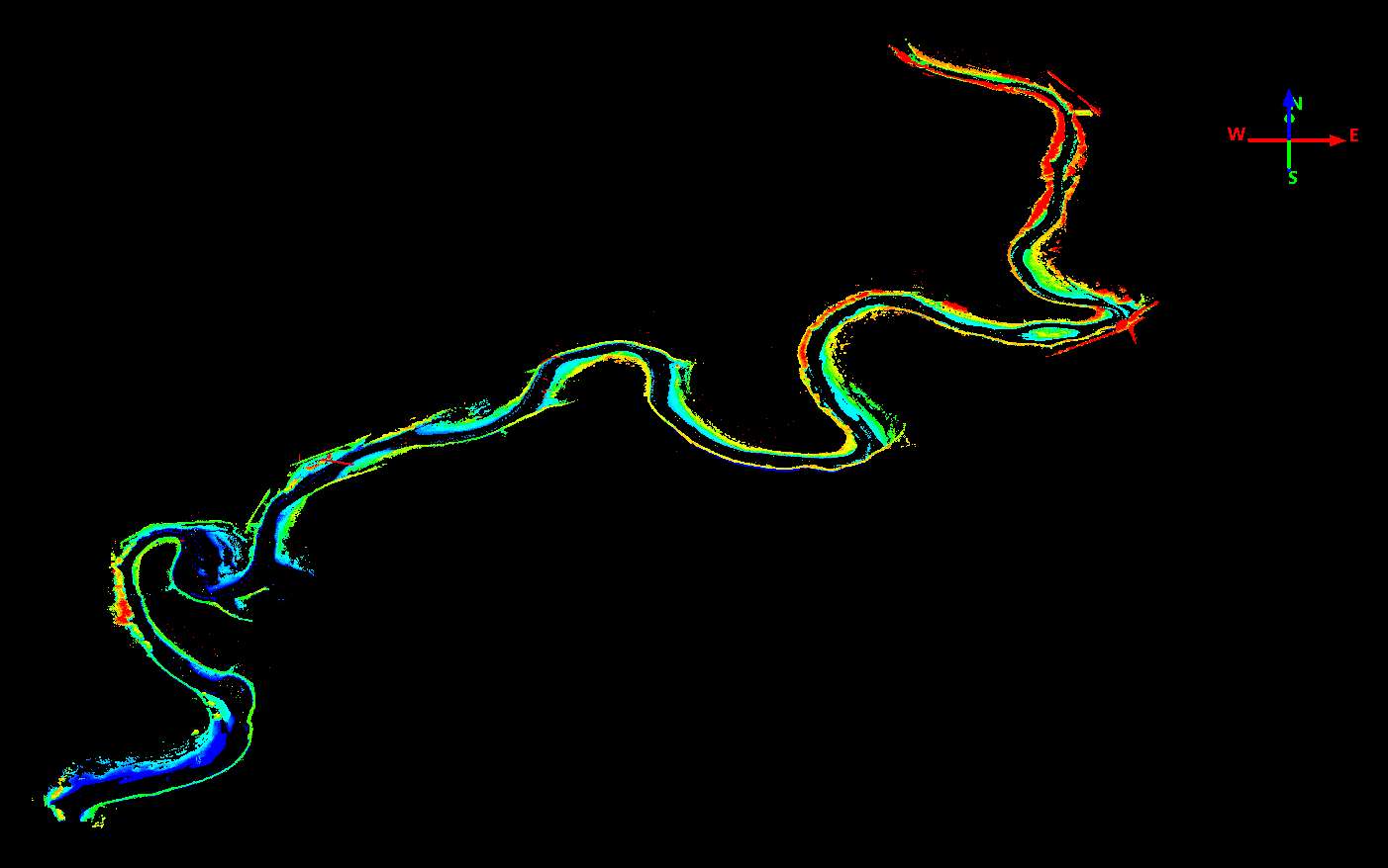
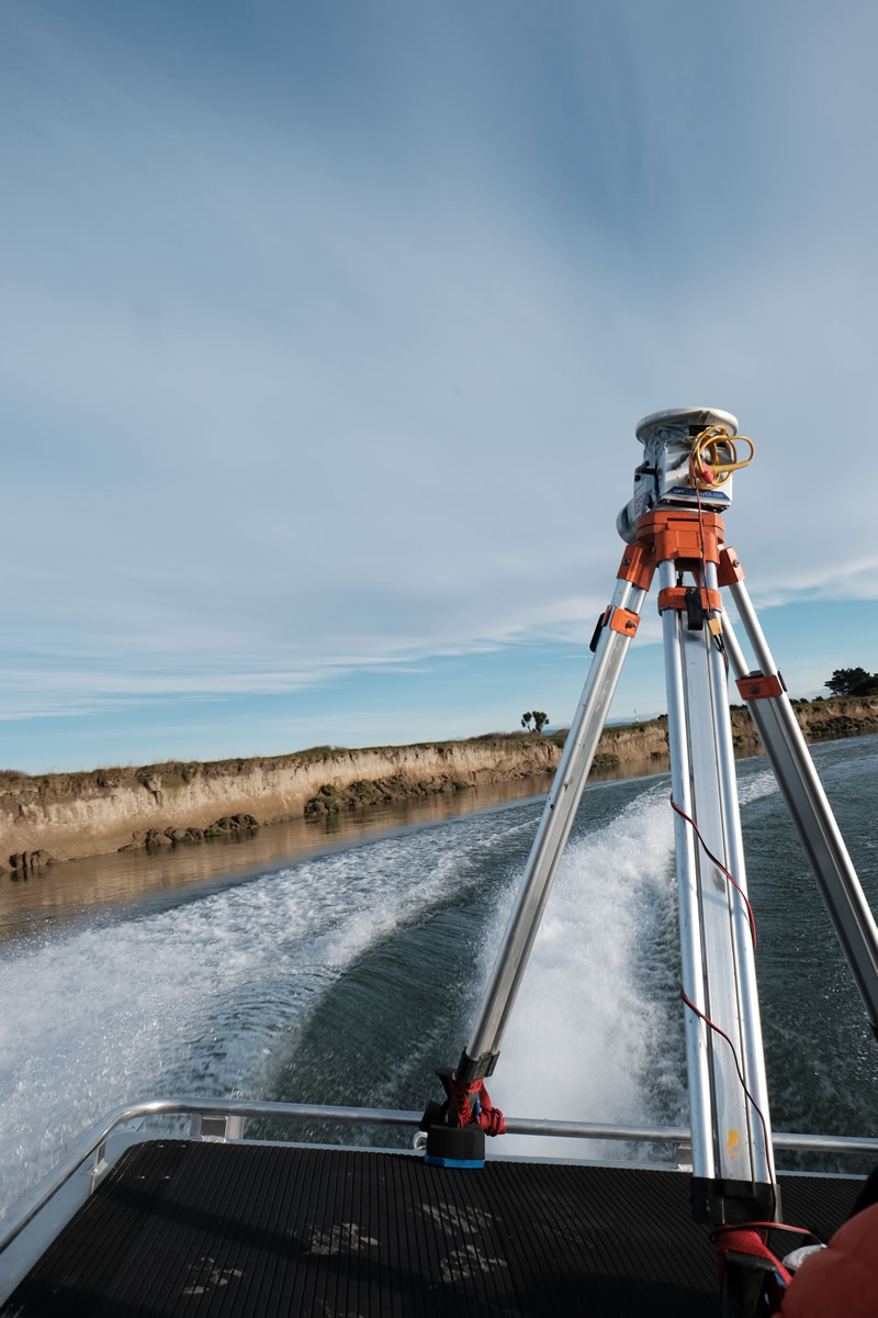
To quantify volumes of bank erosion in the Oreti study reach, Snoopy is being used to collect repeat surveys of the banks of the river. Differences between surveys will be used to calculate volumes of erosion. So far, Snoopy has been used to carry out the first scan. To do this, Snoopy was attached to the back of a jet boat, and the boat made two passes along the reach, scanning upstream and downstream – all in under 30 minutes. Making two passes of the study reach provides twice the data but, more importantly, also allows us to establish error models, enabling us to confidently assess what change is real during future repeat scans. The error between the upstream and downstream scans was found to be very low, fixing 3D location to within several cm - which is an excellent result.
The approach has provided very high resolution (300-3000 points per 1 m radius) and high precision data on the state of the banks, and the multiple views from the 32 lasers should enable us to relatively easily remove vegetation to establish a ‘bare earth’ bank surface for calculations of eroded volume. This work will improve understanding of contribution of bank erosion to fine-sediment dynamics at the hydrograph scale and will also inform modelling of bank erosion processes.