-
RiskScape software
Research ProjectRiskScape is a software application for analysing natural hazard consequences. -

Seabed 2030
Research ProjectNIWA is leading a New Zealand partnership to map the South and West Pacific Ocean's seabed as part of a worldwide initiative to map the entire globe’s seafloor. -

Tsunami generated by underwater volcanoes
Research ProjectMarsden-funded research investigating how erupting volcanoes can cause deadly and damaging tsunamis. -
PARTneR (Pacific Risk Tool for Resilience)
Research ProjectUnderstanding how hazards impact people and the environment provides the foundation for informed decision making for a resilient Pacific. -
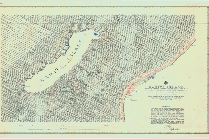
Revealing Kapiti Island's submarine landscape
Research ProjectWe are using modern techniques to map seafloor surrounding Kapiti Island, an area of significant cultural and environmental value to New Zealand. -
Oceans 20/20
Research ProjectThe Ocean Survey 20/20 (OS 20/20) programme aims to provide NZ with better knowledge of its ocean territory. -
Submarine faulting beneath Pegasus Bay
Research ProjectIn September 2010 and February 2011, two devastating earthquakes (M7.1 and M6.3 respectively) hit the Canterbury region