Understanding the relationship between hydrological processes and stream ecology is vital for the sustainable management of the water sources that support Lake Ellesmere.
The problem
Water resource management is a significant issue for regional authorities in Canterbury. The aquatic ecology of Lake Ellesmere in particular is under increasing pressure from agriculture on the Canterbury plains; lake levels are decreasing and water quality is worsening.
The health of the lake's ecosystem is related to the quality and volume of the water that sustains it. Excessive inflows of nutrients carried downstream from farms are intensifying algal growth, with dire effects on the lake’s ecosystem. Water pollution is impacting on the local food web and as a result some fish species such as eels are experiencing rapid decline.
In order to learn more about the link between water management and ecosystem response, NIWA is studying the streams in the lowlands surrounding Lake Ellesmere. The study is part of ongoing efforts by regional authorities including Environment Canterbury to reverse the deteriorating state of the lake.
Lake Ellesmere, New Zealand's fourth largest lake, supports a diverse range of fish and bird species but these are under threat from declining water levels and quality.
Our approach
Our research focuses on stream ecohydrology (the study of the interactions between water dynamics and ecosystems) in the catchment area. We want to measure the interactions between aquatic plants, water flow and sediment transport because these influence habitat quality, biodiversity, nutrient cycling and flood risk.
Many of Lake Ellesmere's tributaries contain dense beds of submerged and emergent aquatic plants (macrophytes). We know that plant coverage and density are controlled partly by water depth and velocity, along with light availability and nutrient supply. In turn, aquatic plants partly control water depth and turbulence plus the transport of sediment and nutrients.
Our project has two objectives:
- Determine how and to what extent aquatic plant coverage influences benthic (streambed) habitats and invertebrate communities
- Investigate how local dispersal and trapping of dissolved nutrients are affected by changes in aquatic plant coverage and species composition.
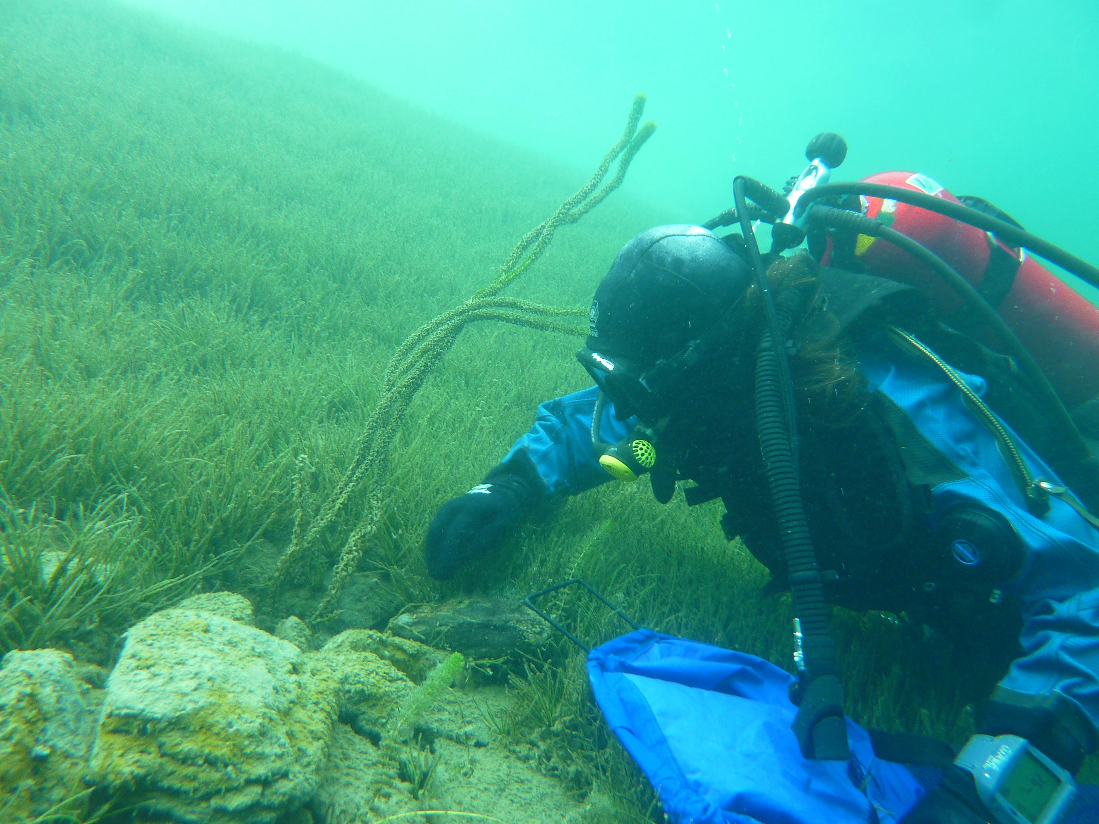
During the aquatic plant growing season (October 2009 to April 2010) we conducted field studies at four sites in three streams located in or near the lake catchment area. At each site, we selected a 30m section that formed our study zone.
The research involved:
- small tracer releases of salt to test the transport of dissolved substances (solutes)
- measuring rates of aquatic plant growth
- measuring stream flow and calculating hydraulic resistance
- calculating channel and hydraulic flow
- collecting samples of fine sediment and benthic macroinvertebrates (e.g. aquatic insects, worms and snails) from gravel filled boxes placed inside and outside plant beds
- hydraulic modelling to calculate how streamflow parameters such as plant coverage and bed roughness influence the transport and trapping of sediment and nutrients.
The result
Plant growth varied widely across our study area, with maximum summer plant coverage ranging from 25% to 100%. The streams we studied were primarily fed by groundwater. Over the study period water discharge slowly declined; however, over the same period water depth and width increased. We believe these changes are related to the rate of plant growth and coverage.
Key findings:
- Solutes are transported rapidly through streams with low plant coverage, and almost no trapping occurs
- As plants grow they impede streamflow, causing water pushing through them to decelerate and deposit fine sediment. Plant canopies trap solutes and release them slowly, resulting in greater mixing and dispersal. At high levels of plant coverage solutes move slowly and their dispersal is primarily controlled by diffusion
- Benthic habitats vary with plant coverage. Benthic habitats inside plant beds are composed mostly of fine sediment and organic matter, while habitats outside of plant beds are composed mostly of gravel
- Benthic macroinvertebrate communities, such as aquatic insects, worms and snails, vary with plant coverage. In habitat patches free of plants invertebrates tend to be more diverse and abundant, and they tend to be dominated by insect groups.
The next phase of research for this project is underway. We want to learn more about water allocation and groundwater/surface water interactions, and how we can improve the management of aquatic plants. Aerial footage will be used in conjunction with our research on the ground to give us a better idea of the distribution of aquatic plant growth across the catchment area.
Joanna Lessard, David Plew and Matt Enright 806 Sarah Hailes and Kelly May 607, 887, 811 749 730