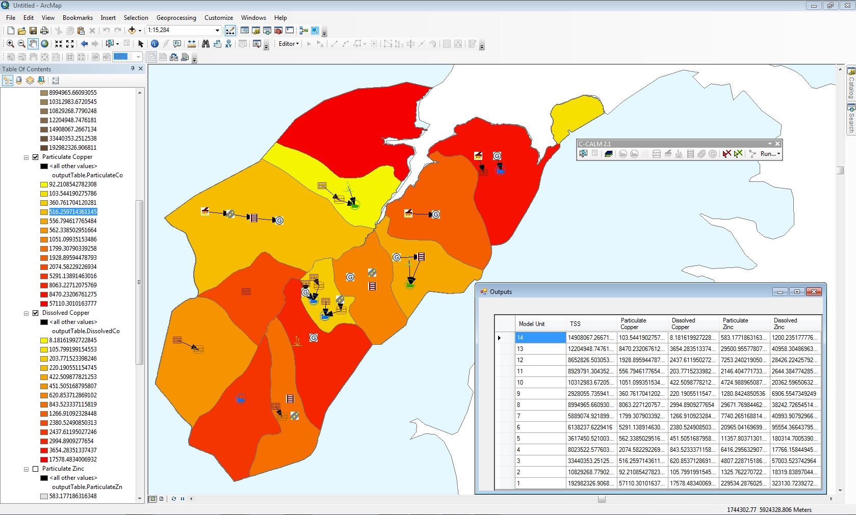
NIWA’s Catchment Contaminants Loads Model (C-CALM) is a spatial decision support system for planning applications. It estimates annual contaminant loads at the neighbourhood to stormwater management unit (sub-catchment) scale, from diffuse sources, for Total Suspended Solids (TSS) and particulate and dissolved zinc and copper. The estimated load is then adjusted for water treatment.
C-CALM has been developed as a toolbar for ArcGIS 10.1. The GIS interface allows geo-visualisation of contaminant sources and can aid communication between stakeholders. C-CALM can be used for preparation of integrated catchment management plans and consent applications. C-CALM is available free of charge for non-commercial use.
How does it work?
C-CALM is based on CLM, the Auckland Council Catchment Loads Model. Both models relate the annual contaminant load from a particular source to the source’s annual contaminant yield and the surface characteristics of the catchment area. The load is then reduced to account for the removal efficiency of treatment devices linked to that source.
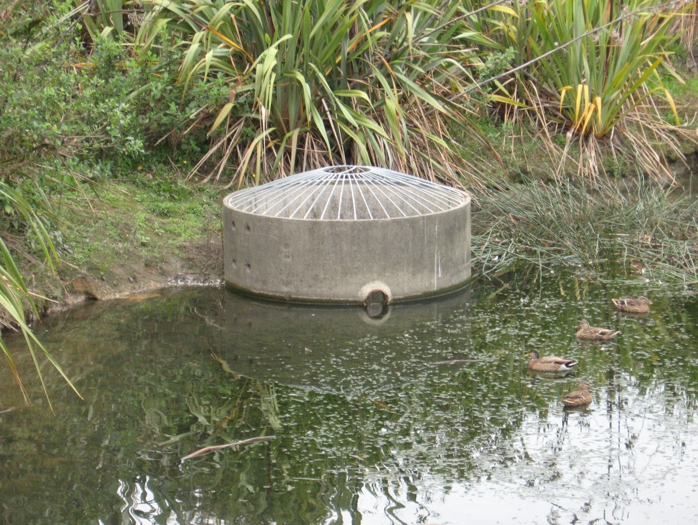
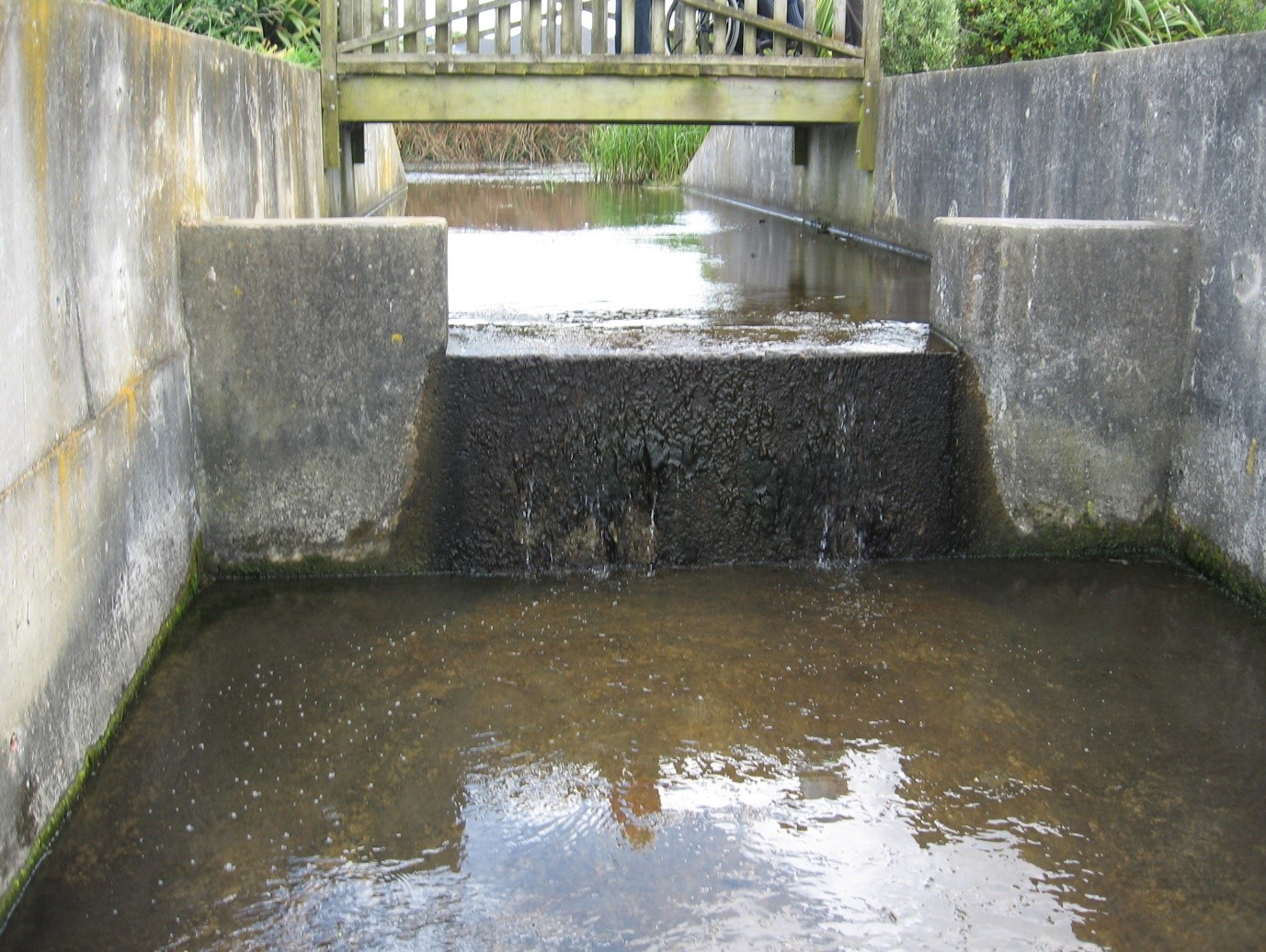
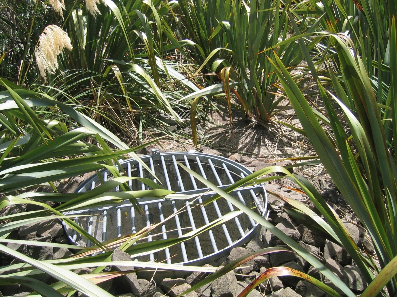
Treatment devices that can be simulated by C-CALM are:
- wet detention ponds
- wetlands
- filters
- raingardens (i.e., bio-retention)
- swales and infiltration surfaces (i.e., vegetated bio-filters)
- catch-pits (with and without inserts)
- street sweeping
- porous paving
- generic (user-specified) treatment.
C-CALM removal efficiencies are obtained by querying a treatment performance library, which contains values that are customised for each treatment option and catchment characteristics. This contains removal efficiencies within each treatment option.
C-CALM also:
- allows runoff from a specific source to be split between different treatment options
- allows complex treatment scenarios to be set up, which have no restrictions on train configuration or the number of treatment options
- partitions metals into particulate and dissolved forms, using a number of pre-set Particle Size Distributions (PSD) to simulate the range of particle grain sizes for sediments from different sources.
Land use in C-CALM is represented by differing proportions of roofing materials, roads, paving and impervious surfaces. The annual catchment load from a sub-catchment is the sum of the loads from each source. The results of the model can be used to indicate the relative contribution of different catchments to receiving environments impacted by the effects of urbanisation.
The performance library
The performance library consists of look-up tables of ‘rules’ for each of the treatment options stored in a relational database. Removal efficiency is related to a range of parameters including region, catchment characteristics, device size and design, and PSD.
The library gives C-CALM flexibility in assessing the effectiveness of different stormwater treatments. For sediment and particulate metals, the performance rules have been derived, where possible, from multiple runs of continuous simulation models of water treatment (i.e., ponds and raingardens). For catch-pits and street sweeping, sediment removal is related to the PSD. For all other treatment options, performance rules have been derived from evaluation of the range of removal efficiencies reported in the literature.
Results
For each sub-catchment, C-CALM calculates the total load of TSS, and particulate and dissolved zinc and copper. Results are supplied as a group layer in ArcMap and as a table which can be copied directly into reports or software for further processing. The GIS display can be customised using standard mapping tools.
Online Reports:
- C-CALM manual and licensing agreement
- Pond, Wetland and Raingardens modelling
- Performance rule library
Find out more
Please note that while this model is still available for use it is no longer supported.
For more information on C-CALM and/or to obtain a copy of C-CALM: