The Whatawhata Integrated Catchment Management (ICM) Project is the longest continuously monitored before-after-control-impact (BACI) catchment-scale study in New Zealand. NIWA scientists have played a leading role in the study for over 25 years. The Whatawhata ICM-related research is currently encompassed within a SSIF-funded project “Long-Term Stream Response to Sustainable Land Management”.
Background
From the 1980s, awareness increased of the severe environmental damage caused by livestock farming in steep hill-country in New Zealand. An inter-disciplinary catchment management group (CMG) was formed in 1996 to establish an ICM project at a farm in the North Island hill-country. The Whatawhata Research Station (WRS) farm in the Waikato Region was selected as the project location.
The CMG had representation from four broad groups: science (agricultural and environmental) policy (district and regional government, conservation), farming and Māori (Ngāti Māhanga). The overall goal of the ICM Project was to implement land use changes to demonstrate a well-managed rural hill country catchment that was both economically viable and environmentally sustainable.
The Whatawhata Research Station
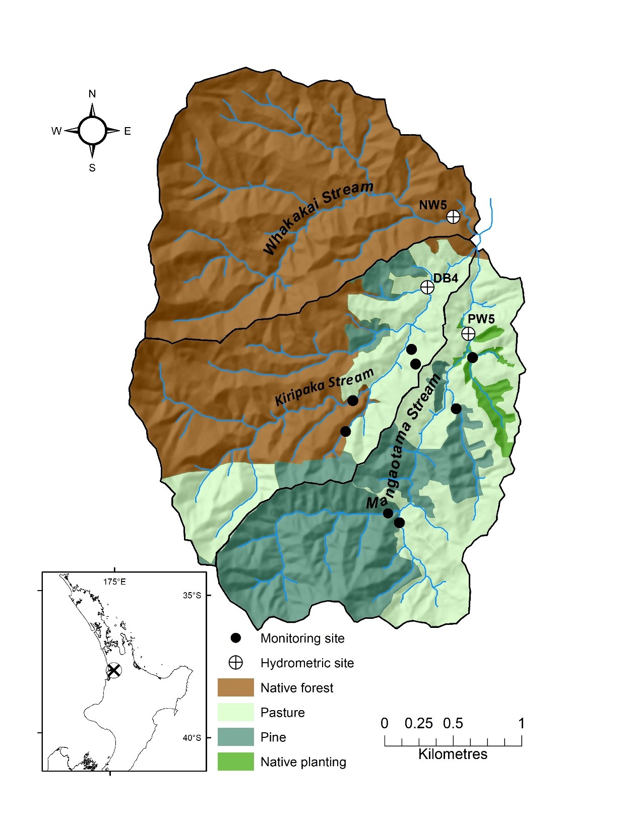
The WRS is located in the western Waikato (Figure 1). The site has been an important testbed for research on hill-land farming and environmental research in New Zealand since 1949.
Within the WRS there are two experimental sub-catchments, Mangaotama (268 ha) and Kiripaka (266 ha). A third monitored catchment, Whakakai (311 ha), is located in a forest reserve immediately adjacent to the WRS. Vegetation in the Whakakai catchment is minimally disturbed, > 90-year old indigenous forest. All three sub-catchments are dominated by steep, hilly terrain with strongly weathered Ultic soils underlain by Mesozoic greywacke and argillite.
The Approach
The Whatawhata ICM Project uses a BACI design to analyse the effects of land use changes on stream conditions. Multi-site monitoring within all three catchments commenced in in 1995. The ICM-related land use changes occurred in the Mangaotama catchment in 2000-2001. The Kiripaka and Whakakai catchments are used as control catchments. Ongoing monitoring includes:
- monthly water quality sampling at 11 sites, including three hydrometric sites (Figure 1)
- invertebrate surveys (6-monthly)
- macrophyte and periphyton abundance surveys (6-monthly)
- benthic sediment composition survey (6-monthly)
- stream channel width and stream/riparian lighting surveys (biennial)
- continuous stream flow at hydrometric sites located near each catchment outlet.
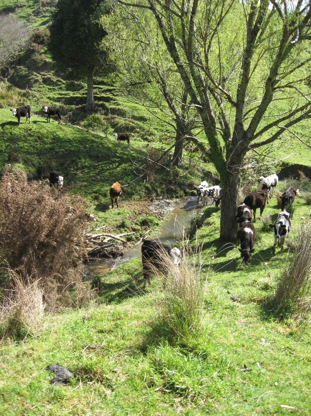
Prior to 2000, the Mangaotama catchment was almost entirely mixed sheep-beef cattle pasture, stocked at about 9 stock units per hectare (60% sheep, 40% cattle). The following land use changes were implemented in 2000-2001, based on the ICM plan:
- Pinus radiata was planted in around 60% of the catchment
- Indigenous tree species were planted across 7 ha of the existing pastoral land, surrounding and linking an existing 5 ha of native riparian forest patches
- Livestock was excluded from streams in areas converted to pine plantation and areas of native tree planting
- Cattle, but not sheep, were excluded from riparian areas within the remaining grazed areas
- Poplar trees were planted for erosion control in erosion prone pasture areas.
Key findings
The following outcomes were observed after the ICM plan was implemented.
- Stream shade has increased markedly with the growth of riparian tree plantings.
- Average stream temperature has decreased by 2.7°C, and peak summer temperatures have fallen markedly, greatly reducing thermal stress on stream-life.
- Stream invertebrate communities have shifted towards those of the reference native-forested catchment.
- Water quality response has been ‘nuanced’, with reductions in some contaminant concentrations (including faecal bacteria), but increases or minimage change or other contaminants (including sediment and nutrients).
- There has been no detectable trend in annual suspended sediment loads.
- There have been no significant changes in stream channel widths.
- Stream nitrate concentrations have increased in response to pine planting.
- Total stream flow has decreased by ~30%, and storm peak flow by ~50%.
An important conclusion from this study is that measures of stream ecosystem health and water quality do not always respond in a simple way to the implementation of sustainable land use interventions. Models currently applied in New Zealand catchments often make poorly informed assumptions about the response of catchments to management interventions. The information garnered at WRS can be used to better inform the potential impact of such changes and their response time at other locations.

Future research
NIWA scientists are currently applying the Soil and Water Assessment Tool (SWAT) model to the Whatawhata catchments. SWAT is a multi-scale catchment model used to simulate catchment water quality and quantity and predict the impact of land use changes . WRS provides an excellent testbed for SWAT under New Zealand conditions due to the comprehensive field-based datasets and the detailed information on ICM implementation over a long period.
With the first rotation of plantation forestry at Whatawhata nearing its end, opportunities exist to analyse the impact of harvest activities on stream water quality, stream flow and ecosystem health. Given the importance of tree planting as a sustainable land management approach, the lessons learnt at Whatawhata will help inform the impact of increased tree planting anticipated in the next decade in response to the implementation of the Government’s One Billion Tree Programme.
Other potential areas of investigation using the current long-term datasets include:
- long-term water quality and habitat trajectories in response to land use change
- analysis of stream water quality and habitat at sites with varying levels of human impact
- the impact of decomposing cattle on stream water quality
- sediment and nutrient pollutant attenuation by a natural seepage wetland.
- stream channel widening in response to riparian shading
Recent publications
Davies‐Colley, R. J. & A. O. Hughes, 2020. Sediment-related water quality of small hill-country streams near Whatawhata, New Zealand. Response to integrated catchment management (ICM). New Zealand Journal of Marine and Freshwater Research.
Graham, S. E. & J. Quinn, 2020. Community turnover results in variable invertebrate recovery between restored streams with different integrated catchment management plans. New Zealand Journal of Marine and Freshwater Research.
Hughes, A. O., R. J. Davies-Colley, M. A. Bellingham & G. B. Van Assema, 2020. The stream hydrology response of converting a pasture headwater catchment to Pinus radiata plantation. New Zealand Journal of Marine and Freshwater Research doi:10.1080/00288330.2020.1750434.
